George and Sandy's 2004 Camping Trip
Sandy and I have taken off to go on a trailer camping trip BY
OURSELVES. We couldn't leave before June 30 due to commitments at
my work. Katie had to leave to go back to school by mid August. This
left 6 weeks to fit in a 2-3 week trip. Zack and Katie didn't even want
to go. Charlie did. However, between an Anime convention that he wanted
to go to, summer school, band camp and school registration, there was
no time period that he could go either. So we had to go by ourselves.
We were heartbroken.
Katie is 18 so she is acting as the token adult. Richard has the van
at Santa Barbara so he could make it home in 2 or 3 hours if necessary.
This is an opportunity for the kids to learn something about taking
care of themselves. For us, we don't have to listen to "are we there
yet?"
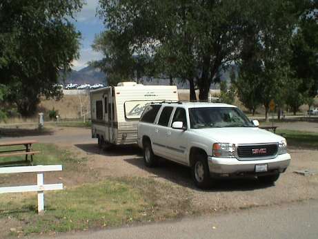
Wednesday, June 30, 2004, about 1930 MDT
It's been a long day. We ended up in a campground in Beaver UT. We
left the house at 0430 and headed up I-15. Since our first destination
is Glacier National Park, we'll take I-15 almost the whole way. It's
about a 1300 mile trip, we've budgeted 3 days to get there. Our
campground reservation starts on Saturday.
The trip was pretty uneventful except for a little
delay in Las Vegas. We stopped in North Las Vegas to make some
sandwiches for lunch. When I got out of the truck, I noticed that my
keyless remote didn't lock it. Neither did Sandy's. While messing with
them, I managed to set the alarm and couldn't reset it. I also couldn't
start the truck because the alarm had disabled the starter. We appeared
to be stuck.
We called the automobile club and they sent out a tow truck. The
driver managed to get the alarm reset by using the key in the door
lock. Since I had never used the key, I didn't know that you could
reset and bypass the alarm with just the key. The remotes still didn't
work though.
We drove back into Las Vegas to a GMC dealer and he managed to reset
the remotes. It seems that conventional wisdom holds that something
happening at Nellis AFB causes keyless remotes all over town to get
hosed. Normal resets don't work. The dealer had some sort of box that
he put in the car and then he held the remote right up to the dash and
managed to get them to resynchronize. We were on our way again. After
500+ miles, I got tired and we decided to call it a day at Beaver
UT.
I also had to mess with a brake light on the trailer that didn't
work. Since messing with the bulb in the socket appeared to fix it,
corrosion was probably to blame.
The campground is a standard fare RV park. At least it had fairly
flat spots and pull through spaces. We didn't get hookups, but it still
cost $15.
Sandy is ticked at me right now because I brought the bathroom scale
so I can keep track of my weight as I am on a diet. She considered that
a cardinal sin. I don't think that she is genuinely pissed, but she is
putting on a show anyway.
Thursday, July 1, 2004, about 1800 MDT
It's been another long day. No mechanical problems today, except
that at the end of the day, the Yukon was 2 quarts down on oil. I had
filled it just before we left so it is really sucking this stuff up. I
didn't have any with me (my bad) but a guy in the neighboring site gave
me a quart. That will hold us until we can buy some more.
After another 500+ miles of driving, I was pretty tired. We saw a
sign for a campground in Dubois Idaho, but it was just a grass patch
between a gas station and the freeway. We passed. 20 miles or so up the
road was a town called Spencer. There was a campground sign but no
obvious campground. The next town was 33 miles up the road.
 Just a mile up the road was a sign that
said "Campground." We followed a one lane road up the hill for a mile
to the Stoddard Creek Forest Service campground in the Targhee National
Forest in central Idaho. This is one of the nicer campgrounds that I
have been in and it is certainly worth the $6/night that the Forest
Service wants.
Just a mile up the road was a sign that
said "Campground." We followed a one lane road up the hill for a mile
to the Stoddard Creek Forest Service campground in the Targhee National
Forest in central Idaho. This is one of the nicer campgrounds that I
have been in and it is certainly worth the $6/night that the Forest
Service wants.
 Just after we got there, the
thunder boomers started up. Along with the cool breeze, it made for a
very relaxing evening. There is also a railroad line running nearby
because we can hear the horns.
Just after we got there, the
thunder boomers started up. Along with the cool breeze, it made for a
very relaxing evening. There is also a railroad line running nearby
because we can hear the horns.
Just about sundown, the thunder boomers got real close and it
started to rain and then it started to hail. It all came down pretty
hard for a short while but it let up in about 15 minutes.
We've got about 300 miles to go to get to Glacier. Our plan is to
camp just outside the park somewhere Friday night, then sleep in
Saturday morning and then and occupy or reserved campsite at St. Mary's
campground for at least 4 days, maybe longer if we want to. This would
be after the 4th of July weekend so that getting a site extension
should not be difficult.
Friday July 2, 2004, about 1845 MDT
Today was yet another long day of driving, nearly 500 miles again.
However, we've made it to the entrance of Glacier National Park. The
drive was uneventful, we got on the road about 8 AM and worked our way
through much of Montana to get here. Most of I-15 ran through pasture
and ranch land with some spots in river valleys or over forested
ridges. We got off I-15 just past Great Falls Montana and took highway
89 across featureless farmland and pasture for about 120 miles. This
was mostly a 2 lane rural highway but at least the road surface was
good and most of it was good for 60 mph. The last 31 miles was twisty
mountain driving to get to St. Mary.
Our reservation isn't for tomorrow morning so we are staying in the
St. Mary KOA which is about a mile from the park entrance, which is
where our campground is as well. The total milage from home is 1482
miles.
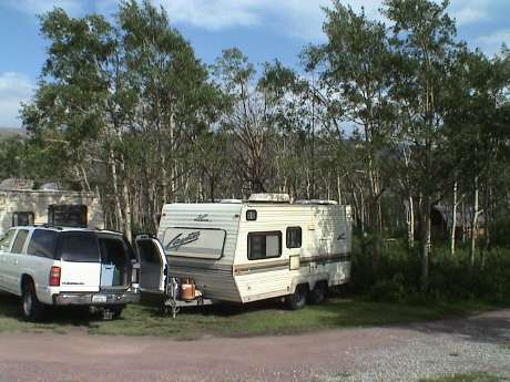 We got
one of the last campsites in the place. It may be a muddy corner, but
at least it has some trees which most of the others don't. This KOA is
pretty steep, $32 for a spot, electricity and water hookups. It doesn't
have WiFi but it does have hot tubs. We'll be sleeping in until late in
the morning, hitching up and then finding our site inside the park.
We got
one of the last campsites in the place. It may be a muddy corner, but
at least it has some trees which most of the others don't. This KOA is
pretty steep, $32 for a spot, electricity and water hookups. It doesn't
have WiFi but it does have hot tubs. We'll be sleeping in until late in
the morning, hitching up and then finding our site inside the park.
Saturday July 3, 2004, about 1330 MDT
We slept in late at the KOA and then moved just 2 miles to the St.
Mary campground in Glacier National Park. We didn't get in without
trouble though. In the parking lot of the visitor center, I sideswiped
another car with the trailer's awning mount and ripped it off the
trailer. I also damaged the other vehicle, although not badly. I
patched the awing mount back onto the trailer but it will require some
more work when we get home.
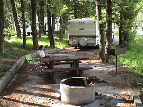
 The campsite is fairly nice this one is kind of
open, there are others that are more secluded. Sandy is napping now and
I am getting ready to eat some lunch. We have four days reserved at
this camp and we haven't set an agenda yet as to what we are going to
do except relax.
The campsite is fairly nice this one is kind of
open, there are others that are more secluded. Sandy is napping now and
I am getting ready to eat some lunch. We have four days reserved at
this camp and we haven't set an agenda yet as to what we are going to
do except relax.
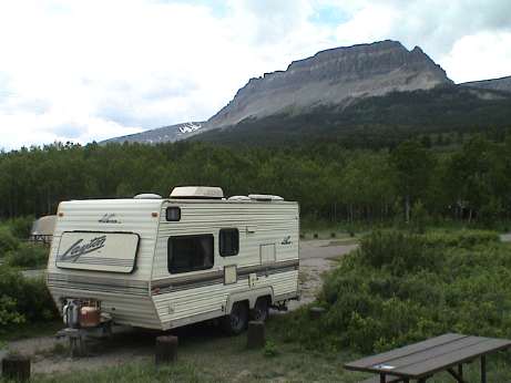
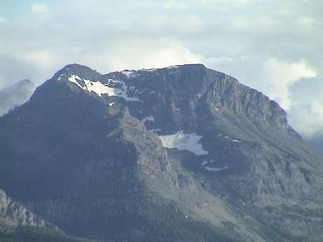 The campground has some pretty good views of small
glaciers on the surrounding mountaintops. This is one example. There
are about 50 glaciers in the park, from the map, most are small such as
these.
The campground has some pretty good views of small
glaciers on the surrounding mountaintops. This is one example. There
are about 50 glaciers in the park, from the map, most are small such as
these.
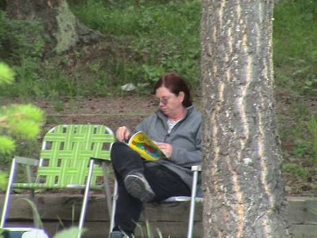
Saturday July 3, 2004, about 1800 MDT
We spent all day in the campground, Sandy was napping much of the
time, I spent some time exploring. The St. Mary river flows right by
the campground, eventually, it flows to the Hudson Bay. There is
another continental divide here. The part we are in is a wedge that
goes up into Canada.
Fishing in the river doesn't require a fishing license. I've seen
many people go down there, none come back with any fish. The campground
host gave me a handout with fishing regulations. It's pretty normal, 5
fish total per day with restrictions on some types of fish. Someday
this stay, I'll fish the river too.
Actually, I was thinking of fishing this afternoon. However, about
the time that I was going to gather up my gear, it got real windy and a
foggy veil drifted down from the mountains to the south heading this
way. I figured that it was getting ready to rain and I was right. In 5
minutes, it was raining hard. This kept up on and off for a few hours.
So I retreated to the trailer, hooked up the scanner to run from an
inverter and started scanning 10 year old photos. At least this kept me
out of trouble.
Sunday July 4, 2004, about 1340 MDT
Our plan for today was to drive the Going to the Sun road through
the park. The view from the highway and overlooks is supposed to be
spectacular. However, today, the view is nil. The whole park is socked
in and its been raining all day. Right now, it's raining hard.
We took a short excursion out to the boat tour dock on St. Mary Lake
but it isn't the right day to go boating. We also went into St. Mary to
go through the gift shops. Sandy was researching gifts. After that, it
was back to the trailer to wait out the storm. I'll spend part of the
afternoon scanning more photos, there are at least 1000 more to go.
Monday July 5, 2004, about 1930 MDT
We didn't expect to see any fireworks this year because we were in a
National Park. However, small scale stuff was going off quite a lot at
about sundown. After we went to bed, we started hearing some really big
stuff close by. Apparently, the KOA about half a mile away, was hosting
a really big show. Some of the mortars were huge, much bigger than the
stuff that gets shot off around LA. The balls on some were so large
that they intercepted the ground before going out. It must have been
exciting close up. I just watched out the trailer window.
Today, it dawned with a fairly clear blue sky so we elected to do
the "Going To The Sun" road trip today. However, after charging all
three computers and a cell phone from the truck battery the night
before, the truck battery was flat. I jumped the truck from the spare
RV battery that I bought for the trip and off we went.
It's about 50 miles one way to the other side of the park, crossing
over Logan pass and down the other side. It took us over 7 hours to
make the round trip considering the photo stops, the gift stores at
Apgar (the other side) and traffic delays (over 2 hours total, 90 min
of that at one time) due to road construction. What follows are
selected from the 200 or so photos that we both took during the trip,
ordered more or less in order from east to west.
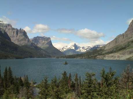 This is
a view looking more or less west over a part of St. Mary Lake. The lake
is nearly 10 miles long so this photo is only a small piece of it.
This is
a view looking more or less west over a part of St. Mary Lake. The lake
is nearly 10 miles long so this photo is only a small piece of it.
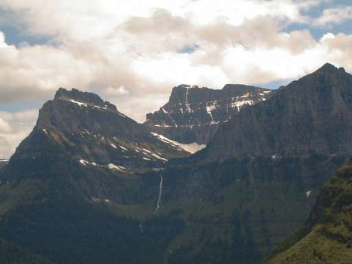
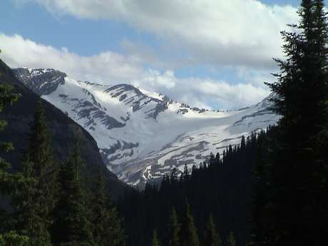 Jackson glacier has the most snow on it of any that
we saw, but it is only a shadow of its former self.
Jackson glacier has the most snow on it of any that
we saw, but it is only a shadow of its former self.
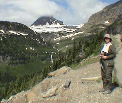
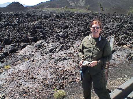
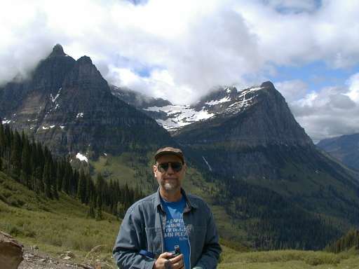 This is your's truly with some glacier on a
mountain in the background.
This is your's truly with some glacier on a
mountain in the background.
 My better half.
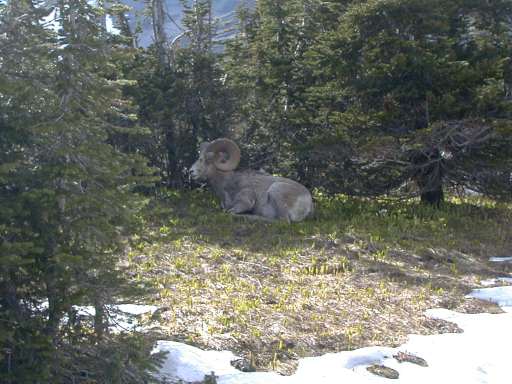 This
mountain goat was just resting right behind the Logan Pass Visitor
Center. Actually, there were three of them there about 10 feet from the
trail.
This
mountain goat was just resting right behind the Logan Pass Visitor
Center. Actually, there were three of them there about 10 feet from the
trail.
 Hanging valleys are formed by a glacier literally
falling over the edge and joining with another glacier below. This one
is just west of Logan Pass.
Hanging valleys are formed by a glacier literally
falling over the edge and joining with another glacier below. This one
is just west of Logan Pass.
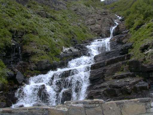 There were
hundreds of cascades like this one right next to the road. In one
place, there were so many together that they formed what is called
"Weeping Wall" because an entire road cut wall was seeping water over a
width more than a hundred feet.
There were
hundreds of cascades like this one right next to the road. In one
place, there were so many together that they formed what is called
"Weeping Wall" because an entire road cut wall was seeping water over a
width more than a hundred feet.
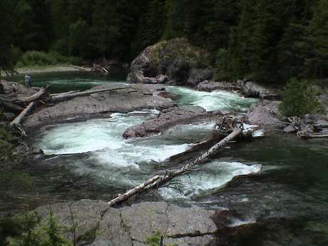 The river draining the valley west of Logan Pass
runs past these split rocks and makes a very nice rapid. If it weren't
for the tree fallen across the river, that would make a very exciting
raft ride.
The river draining the valley west of Logan Pass
runs past these split rocks and makes a very nice rapid. If it weren't
for the tree fallen across the river, that would make a very exciting
raft ride.
Tuesday July 6, 2004, about 1245 MDT
I had avoided recharging our computers and stuff from the trailer
domestic batteries because I didn't want to flatten them. However,
charging from the truck battery clearly wasn't a good plan either so I
devices a method to charge this stuff from the spare battery and to
allow the spare battery to recharge from the truck whenever we were
driving. See Camping
Power Management Tips for the gory details. This worked out really
well. Even if I flattened the spare battery, we would still have
domestic power AND be able to easily start the truck.
Our plan for today was to make a final pass at the gift shops in St.
Mary and then go on a boat tour of St. Mary Lake. We did the gift store
bit and finally bought a newspaper as we had been out of touch for
nearly a week. It seems that news radio is nearly non-existent in Utah,
Idaho and Montana. It's all talk, sports and music. It looks like from
the Great Falls Tribune that not much has happened since we left. No
news is good news.
Sandy cancelled the boat ride because of the wind. It is really
blowing hard with very hard gusts and it is probably worse out on that
big lake. So the alternate plan is to hang around the trailer, write,
scan photos and nap for the rest of the afternoon. We'll pack up and
leave in the morning headed south again, probably ending up in a KOA in
Dillon Montana. Dillon is a half day drive from Craters of the Moon
National Monument, our next probable stop.
Tuesday July 6, 2004, about 2100 MDT
The boat ride would have been a poor plan after all. At mid
afternoon, the wind came up with a vengeance and it rained off and on
all afternoon and evening so our plan held. I scanned about 200 photos,
Sandy read and actually did a little writing.
Wednesday July 7, 2004, about 1700 MDT
 We
did indeed leave early and we made it to Dillon Montana just a few
minutes ago. The drive down was uneventful except that it rained most
of the way. It is clear and pleasant here, probably about 75F, and just
a little breezy. This KOA is pretty nice as KOA's go although there are
mosquitos. We spotted a cyber cafe in town but it was closed when we
went back there.
We
did indeed leave early and we made it to Dillon Montana just a few
minutes ago. The drive down was uneventful except that it rained most
of the way. It is clear and pleasant here, probably about 75F, and just
a little breezy. This KOA is pretty nice as KOA's go although there are
mosquitos. We spotted a cyber cafe in town but it was closed when we
went back there.
Wednesday July 7, 2004, about 2130 MDT
While Sandy was doing our laundry, she noticed that there was an
open phone in the KOA laundry room which people were using to make
calling card calls. I was able to dial in to my ISP on a local number
and send an email to my kids. However that was about all I could do
because the connection to my ISP kept dropping and when it was there, I
didn't seem to be getting an IP address. We'll try again later.
The plan for tomorrow is to explore the ghost town of Bannack which
is about 20 miles west of here and then go another 20 miles or so north
on a gravel road to where Sandy can dig for minerals at a place called
Crystal Park.
Thursday July 8, 2004, about 1830 MDT
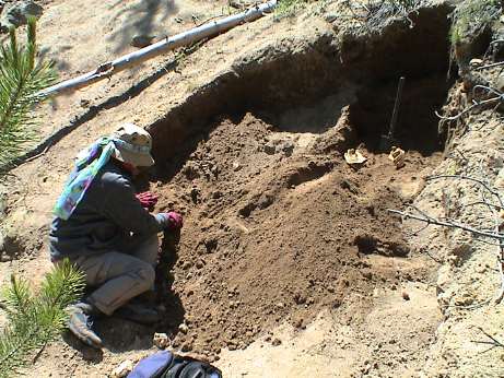 Today we went to Crystal Park first. This is a National
Forest rock hound reserve where they actually encourage visitor to dig
up the place in search of crystallized minerals. They charge $5 per car
per day but they allow you to dig pretty much anywhere except a few
places that are marked as unsafe. We found a hole that somebody else
had started and dug for about an hour while sorting through the
tailings. We collected about two pounds of small quartz crystals and a
little pyrite. We may go back there again later.
Today we went to Crystal Park first. This is a National
Forest rock hound reserve where they actually encourage visitor to dig
up the place in search of crystallized minerals. They charge $5 per car
per day but they allow you to dig pretty much anywhere except a few
places that are marked as unsafe. We found a hole that somebody else
had started and dug for about an hour while sorting through the
tailings. We collected about two pounds of small quartz crystals and a
little pyrite. We may go back there again later.
 On the way
back to town, we stopped by the Bannack State Park. This is a preserved
abandoned town. Bannack started in 1862 when some prospectors panned
Grasshopper Creek (which they named even though Lewis and Clark had
been there before and named it Willard Creek) because of the large
quantities of grasshoppers there. They found substantial gold in the
creek and the rest followed a standard story. A wild mining town sprang
up around the first mining claim made in the Montana Territory. Because
of the gold digs, Bannack became the first territorial capital of the
Montana Territory in 1864. By 1940, the place was washed up, stripped
of gold and everybody moved out. The town was preserved as a museum in
1954 when the mining property was put up for bankruptcy action and
purchased and donated to the State of Montana.
On the way
back to town, we stopped by the Bannack State Park. This is a preserved
abandoned town. Bannack started in 1862 when some prospectors panned
Grasshopper Creek (which they named even though Lewis and Clark had
been there before and named it Willard Creek) because of the large
quantities of grasshoppers there. They found substantial gold in the
creek and the rest followed a standard story. A wild mining town sprang
up around the first mining claim made in the Montana Territory. Because
of the gold digs, Bannack became the first territorial capital of the
Montana Territory in 1864. By 1940, the place was washed up, stripped
of gold and everybody moved out. The town was preserved as a museum in
1954 when the mining property was put up for bankruptcy action and
purchased and donated to the State of Montana.
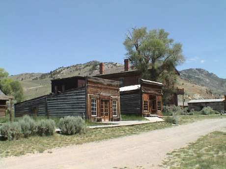
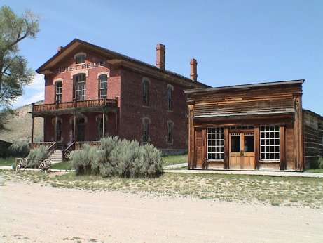 Today, Bannack is a preserved ghost town
operated by the State of Montana. For $3 a head, you can walk in and
around most of the buildings. This photo is of the Meade Hotel (the
courthouse in earlier times) and Skinner's Saloon (one of the meanest
places anywhere in the state).
Today, Bannack is a preserved ghost town
operated by the State of Montana. For $3 a head, you can walk in and
around most of the buildings. This photo is of the Meade Hotel (the
courthouse in earlier times) and Skinner's Saloon (one of the meanest
places anywhere in the state).
I'll be placing more pictures and stories from Bannack on another
web page when I get around to writing it.
After we returned to Dillon from Bannack, we stopped at the Internet
Cafe near the KOA. Actually, it provided internet access only, no cafe
services. However, a fast WiFi connection it did provide and both Sandy
and I got on line to get our email and read the news. I also uploaded
the first part of this web page.
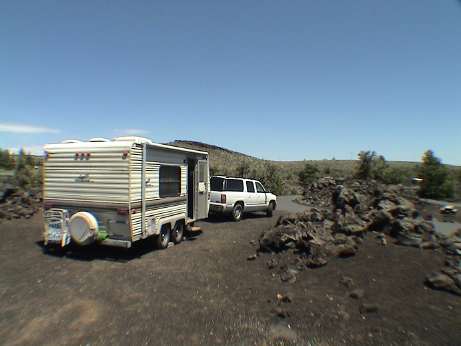
As we were coming down the mountain from Crystal Park, we spotted a
campground that wasn't very far up a good dirt road. The campground is
on a creek that feeds the Grasshopper Creek and is very nice. We
decided to move there for a couple of days starting tomorrow.
Friday July 9, 2004, about 1345 MDT
This morning, we ran around town on errands. We got materials to
make a sieve box to take back to Crystal Park, probably tomorrow. I
also got a Montana fishing license (2 days for $24) and we exchanged an
empty propane bottle with an old style valve for a new one. Then we
headed back up Grasshopper Valley to the Grasshopper Creek Forest
Service campground in the Beaverhead National Forest.
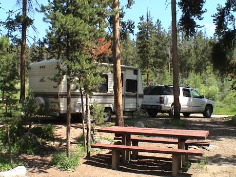 About noon, we arrived at the
campground, and a nice one it is. Most of the sites are long enough for
a trailer or RV, our site is especially long. Most are also in forest
as this one is. The elevation here is about 7500 feet and it is cool
but very nice during the day. I'll bet it'll be somewhat cooler
overnight.
About noon, we arrived at the
campground, and a nice one it is. Most of the sites are long enough for
a trailer or RV, our site is especially long. Most are also in forest
as this one is. The elevation here is about 7500 feet and it is cool
but very nice during the day. I'll bet it'll be somewhat cooler
overnight.
The one downside of the place is that there are real mosquitos here.
The ones in Dillon and Glacier weren't aggressive at all and when they
did bite, they would hardly raise a welt. The ones here are a different
breed. The attacked me as soon as I got out of truck and many of them
died for their sin. However, some of them got through my socks and my
ankles itch like crazy now.
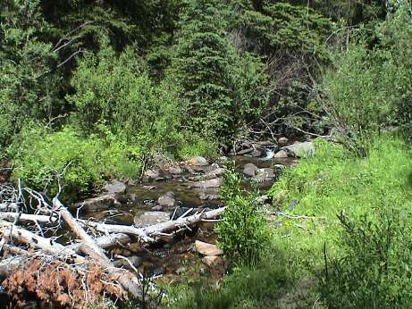 The campground is named for Grasshopper Creek which
runs right down one side. This is the same creek that works its way
down Grasshopper Valley to the gold strike at Bannack. The campground
host said that there are fish in the creek and they bite at almost
anything. I fished it for about an hour and got nada. I didn't even see
a hint of a fish. My fishing license is good for 2 days, I'll try again
later.
The campground is named for Grasshopper Creek which
runs right down one side. This is the same creek that works its way
down Grasshopper Valley to the gold strike at Bannack. The campground
host said that there are fish in the creek and they bite at almost
anything. I fished it for about an hour and got nada. I didn't even see
a hint of a fish. My fishing license is good for 2 days, I'll try again
later.
Friday July 9, 2004, about 1600 MDT
I started assembling the sieve box but I didn't finish because a
thunderstorm came up. It got dark very suddenly, then the thunder
started to roll, then a few drops fell. I put away the project just as
it started to rain pretty hard. So it was back to scanning old photos,
this time it was our trip to ride the Durango and Silverton Railway in
July of 1993. Inside half an hour, the rain had stopped and the sun
came back out. Such is life in the mountains. I went back outside and
finished the sieve.
Friday July 9, 2004, about 1930 MDT
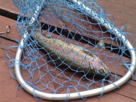 We had
just finished dinner and I was considering what to do with the rest of
the evening. I decided to go fishing. Earlier in the day I had tried
several hundreds of yards of the creek using Powerbait and got nothing.
The campground host had recommended cheese for bait but I used
powerbait instead. This time, I stuck on a wad of Baby Bon Bel and went
to the nearest part of the stream which I had spend quite a bit of time
at earlier. I let the bait trickle downstream and over small cascade
into a pool below where the bait would float to the undercut of the
bank. I wasn't there 2 minutes before I hooked this little guy.
We had
just finished dinner and I was considering what to do with the rest of
the evening. I decided to go fishing. Earlier in the day I had tried
several hundreds of yards of the creek using Powerbait and got nothing.
The campground host had recommended cheese for bait but I used
powerbait instead. This time, I stuck on a wad of Baby Bon Bel and went
to the nearest part of the stream which I had spend quite a bit of time
at earlier. I let the bait trickle downstream and over small cascade
into a pool below where the bait would float to the undercut of the
bank. I wasn't there 2 minutes before I hooked this little guy.
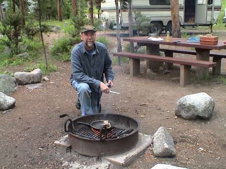 Even though I had just eaten, it was time for dinner
again. Since I didn't want to stink up the trailer frying a fish (Sandy
would be much less than pleased) I started a small fire in the fire pit
and fried him outside. He was small but he was sure good. This fish had
been eating bugs because his meat was pink and very tasty. Hatchery
fish usually have white meat and don't taste as good as fish that
haven't been eating corn meal.
Even though I had just eaten, it was time for dinner
again. Since I didn't want to stink up the trailer frying a fish (Sandy
would be much less than pleased) I started a small fire in the fire pit
and fried him outside. He was small but he was sure good. This fish had
been eating bugs because his meat was pink and very tasty. Hatchery
fish usually have white meat and don't taste as good as fish that
haven't been eating corn meal.
I was the evening and the mosquitos were out in force. However, this
was not enough to keep me away from my 2nd dinner.
Saturday July 10, 2004, about 1430 MDT
I did another round of fishing this morning but came up dry. I guess
that the fish just weren't hungry.
After lunch, we drove the 6 miles or so back to Crystal Park to dig
for more crystals. The sky was pretty dark when we got there and this
time the mosquitos were out in force and we didn't have any bug
repellant with us. Anyway, we dug for about an hour and found lots of
small crystals. Then I felt some raindrops. After a few more, we packed
up and headed back to the truck. By the time that we got there, it was
raining. We decided to wait the storm out in the truck to see if we
could dig some more, but it just rained harder and harder. We concluded
that our digs would be a mud hole by the time we got back so we elected
to return the 5 miles or so back to our campsite.
Sunday July 11, 2004, about 1740 MDT
Today we left Grasshopper (and the mosquitos) and headed south to
Craters of the Moon. The drive was uneventful except for a nagging
banging sound at certain times. It turned out to be no big deal, but
I'm surprised that it hasn't happened before. There is a rubber flap
inside each rear wheel wheel on the Yukon. When the wind blows sideways
under the truck just right, one or the other of them starts to
flap.
 As I write this at the campsite, the wind is blowing so hard
that its kicking the trailer around. It has not let up since we got
here. The still air temperature is about 80F, but with the wind, it
feels much cooler.
As I write this at the campsite, the wind is blowing so hard
that its kicking the trailer around. It has not let up since we got
here. The still air temperature is about 80F, but with the wind, it
feels much cooler.
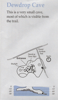
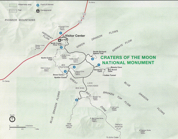 This
is the layout of Craters of the Moon. The Visitor Center and campground
are right next to highway 93 and there is a one-way loop road around
the interesting sites. We did the loop once and stopped at about half
of the sites. We'll do the rest tomorrow.
This
is the layout of Craters of the Moon. The Visitor Center and campground
are right next to highway 93 and there is a one-way loop road around
the interesting sites. We did the loop once and stopped at about half
of the sites. We'll do the rest tomorrow.
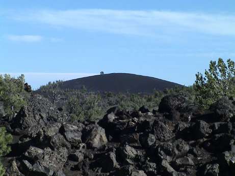 On our
drive around the place and I climbed this cone, the photo is from our
campsite. It's only about a 160 foot climb, but the average grade is
15% and parts of the trail are much steeper. Sandy made it only about
1/3 the way up. There, the wind was blowing so hard that I had to lean
into it. I estimate the wind speed at 50 to 60 mph.
On our
drive around the place and I climbed this cone, the photo is from our
campsite. It's only about a 160 foot climb, but the average grade is
15% and parts of the trail are much steeper. Sandy made it only about
1/3 the way up. There, the wind was blowing so hard that I had to lean
into it. I estimate the wind speed at 50 to 60 mph.
 The lava here is a mix of 'a'a (chunky and
sharp) and pahoehoe (rope lava) depending on the temperature that it
was ejected from the vent. The 'a'a kind is really treacherous to walk
on. It'll tear your shoes up in a hurry.
The lava here is a mix of 'a'a (chunky and
sharp) and pahoehoe (rope lava) depending on the temperature that it
was ejected from the vent. The 'a'a kind is really treacherous to walk
on. It'll tear your shoes up in a hurry.
 There
are several lava tubes that visitors can crawl through. Dewdrop cave is
the smallest one of the bunch. I had to climb over some really sharp
rocks and through a very low passage to get inside this small cave.
Since i didn't have a camera with a flash with me, I only got nightshot
video of the inside.
There
are several lava tubes that visitors can crawl through. Dewdrop cave is
the smallest one of the bunch. I had to climb over some really sharp
rocks and through a very low passage to get inside this small cave.
Since i didn't have a camera with a flash with me, I only got nightshot
video of the inside.
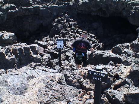 As you can see from this photo of the entrance, it is a
a short, but rough climb into the cave. Once inside, it's isn't too bad
but without good hiking boots, you could turn an ankle here is a short
second.
As you can see from this photo of the entrance, it is a
a short, but rough climb into the cave. Once inside, it's isn't too bad
but without good hiking boots, you could turn an ankle here is a short
second.
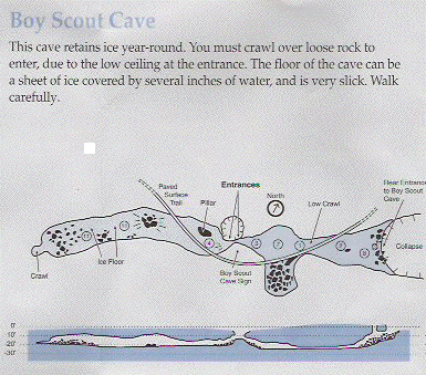 Boy
Scout cave is much bigger. The entrance is in the middle. The way to
the right (on the map) is so low (maybe 2 ft) that I didn't even thing
of trying it. The other way was generally tall enough to walk upright
in. The entrance was even more difficult that Dewdrop cave. At the end
of the cave, there is a pool that is usually frozen, but it was melted
today. However, there was a section of ice along the cave wall near the
end. The ice on the floor was melting and so that section was really
slippery. Sandy didn't go in and I didn't take her camera so I don't
have any photos of the inside, just some nightshot video.
Boy
Scout cave is much bigger. The entrance is in the middle. The way to
the right (on the map) is so low (maybe 2 ft) that I didn't even thing
of trying it. The other way was generally tall enough to walk upright
in. The entrance was even more difficult that Dewdrop cave. At the end
of the cave, there is a pool that is usually frozen, but it was melted
today. However, there was a section of ice along the cave wall near the
end. The ice on the floor was melting and so that section was really
slippery. Sandy didn't go in and I didn't take her camera so I don't
have any photos of the inside, just some nightshot video.
Monday July 12, 2004, about 1850 MDT
About sunset last night the wind died down to a breeze and it became
very pleasant. There had been no bugs around at all because the wind
just kept them hiding. However, some gnats (non-biting) came out and
gathered by the hundreds around each source of light. We stayed up late
(2300 or so) to watch the stars come out as the sky was clear and there
was a 360 degree view. We could see the Milky Way. Just after sundown,
I also spotted a satellite that traversed from overhead until it
vanished over the eastern horizon. It was really bright so it had to be
something big, maybe the International Space Station or some other
large low earth orbit satellite. Aircraft move at about the same
apparent rate, but the strobes and sometimes the colored navigation
lights give them away. Satellites are bright and steady.
We just got back from the rest of the cave "tour." I had climbed
into Boy Scout and Dewdrop Caves yesterday, Sandy stayed out. Today we
both went into Indian Tunnel and Beauty Cave.
Indian
Tunnel is the largest of the caves. Since there are several roof
collapses along the way, there is enough light to traverse the whole
cave without artificial light. However, the going is still rough. The
collapses are just big rock piles that must be clambered over and many
of the rocks are sharp and unsteady. One must go slowly and carefully
least one turn an ankle.
 The entrance to Indian Tunnel is typical of
all of the caves, it is a collapse.
The entrance to Indian Tunnel is typical of
all of the caves, it is a collapse.
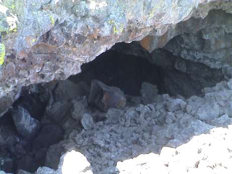
 For
the most part, the cave is very large, maybe 30 feet wide and 20 feet
high. However, near the end, it gets smaller. This is looking out to
the last collapse where the exit is.
For
the most part, the cave is very large, maybe 30 feet wide and 20 feet
high. However, near the end, it gets smaller. This is looking out to
the last collapse where the exit is.
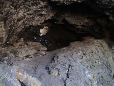
 The exit is a collapse of a very small
lava tube. Sandy is literally climbing out of a hole in the rock to the
surface.
The exit is a collapse of a very small
lava tube. Sandy is literally climbing out of a hole in the rock to the
surface.
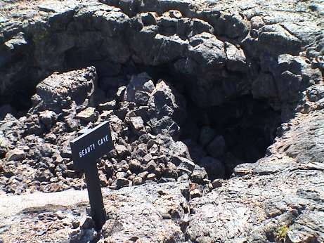
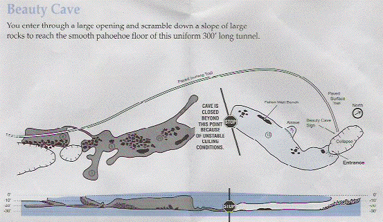 Beauty
Cave is the clearest of the lava tubes. Once down the rocky entrance,
the floor is nearly flat and the ceiling is at least 10 feet high. The
cave extends maybe 50 yards until it is roped off due to an unstable
ceiling. It was too dark in the cave to take stills. My video camera
doesn't have a flash and Sandy's still camera wouldn't even take a
flash picture because there wasn't enough light for it to
autofocus.
Beauty
Cave is the clearest of the lava tubes. Once down the rocky entrance,
the floor is nearly flat and the ceiling is at least 10 feet high. The
cave extends maybe 50 yards until it is roped off due to an unstable
ceiling. It was too dark in the cave to take stills. My video camera
doesn't have a flash and Sandy's still camera wouldn't even take a
flash picture because there wasn't enough light for it to
autofocus.
 Sandy originally didn't want to go
into Beauty Cave, but since the entrance was more open that the rest of
them, I talked here into going all the way down. After we returned to the trailer, we rested through the heat of the afternoon. By about 1630, we went out to finish the nature walks at Devil's Orchard and a nature walk loop trail. It is hotter than yesterday, it was still 91F by 1800 and there was only a little breeze. After we got back from the walks, Sandy walked across a lava field to the Visitor Center to buy a pin. Then it was dinner and relaxing for the rest of the evening.
Sandy originally didn't want to go
into Beauty Cave, but since the entrance was more open that the rest of
them, I talked here into going all the way down. After we returned to the trailer, we rested through the heat of the afternoon. By about 1630, we went out to finish the nature walks at Devil's Orchard and a nature walk loop trail. It is hotter than yesterday, it was still 91F by 1800 and there was only a little breeze. After we got back from the walks, Sandy walked across a lava field to the Visitor Center to buy a pin. Then it was dinner and relaxing for the rest of the evening.
Tomorrow, the plan is to travel to northern Utah to see the museum at Hill AFB and some other museum nearby. We'll find a place to stay around Ogden and then travel south Wednesday headed generally toward Cedar Breaks.
Tuesday July 13, 2004, about 2100 MDT
We did get to Ogden Utah today. The trip was uneventful (as all good travel days are).
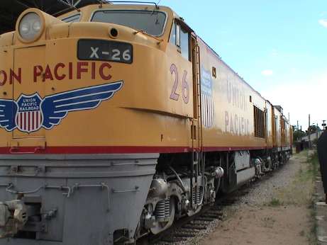 We stopped at the Ogden Railroad Museum which is located at the old depot in downtown Ogden. There were several indoor displays, a model railroad, and several outdoor displays, mostly of UP gear as this is UP country. This is a UP "Big Blow" gas turbine loco. Its a 3 unit set, the lead unit has most of the housekeeping equipment and a diesel engine for moving the thing around when the main turbine isn't running. The 2nd unit is the turbine power plant itself. The 3rd unit is the tender need to provide the enormous quantity of fuel that the turbine used. Even though it burned a lot of fuel, the stuff it burned was the cheapest kind so that the fuel cost wasn't too high. In the end, high maintenance and fuel costs did these beasts in.
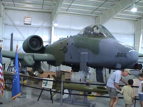 The next stop was at the Hill AFB museum. We got there about 1500 and just as we walked in, they announced that they were closing at 1530 due to a pending power outage. Apparently Utah Power and Light has these guys as a sheddable load. It was over 90F when we got there and the A/C units were running all over Ogden. I snapped as many pictures as I could before they turned out the lights. This is an A-10 Thunderbolt II (a.k.a. the Warthog). Most other kinds of AF fighters were there too plus a bunch of transport equipment outside.
 Since we didn't get to see all of it, we'll go back in the morning to catch the rest. In the meantime, we went back north 5 miles to the Century RV park at Exit 346 (the same one as for the Ogden Railroad Museum) to stay the night. This is a nice place. It has lots of trees, but it is also right next to the freeway. It also had a local dial up line so that we could get on the internet and check our email.
Wednesday July 14, 2004, about 2030 MDT
We executed our plan today with little difficulty. Sandy actually WANTED to stop at McDonald's for breakfast so we did. We both had sausage egg McMuffins.....talk about heartburn. We then went by an RV store at exit 341 (the same one as Hill AFB) and I bought some small stuff. Then I visited Hill AFB again to get photos of the stuff that I couldn't see yesterday. I shot a whole 64 Meg memory stick of megapixel stills, about 120 shots. We then drove down I-15 south to Draper Utah, the location of a Camping World store where we bought various other RV related stuff.
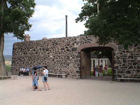 We headed south from there to Cove Fort. This is a restored fortification near the junction of I-15 and I-70. The Mormons built this fort in 1867 to provide protection for travelers and the telegraph line between Beaver and Fillmore. Cove Fort was about a one day stagecoach ride from either place. There wasn't enough water here to support a community, so one family essentially built and ran the place at the behest of the Mormon Church.
On the short drive from I-15 to the fort, there were literally thousands of large black bugs on the road. I must have squashed a goodly number of them. They are Mormon crickets, a normal to large cricket but black in color.
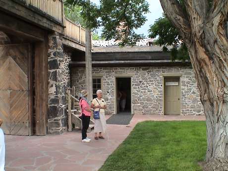 The lady on the right is our private tour guide, Sister Willis. She works here as a missionary for the Church of the Later Day Saints 6 months a year. Sandy did an excellent job of running interference for me so that I could take pictures instead of listing to the religious pitch. The fort consisted of 12 rooms, 6 along each of the north and south walls. The south rooms were "business" rooms consisting of the Stagecoach office, a telegraph office, a kitchen, a domestic room and the master bedroom for the Bryant's who ran the place. The north rooms were guest rooms for travelers or bedrooms for the children that lived there.
It was threating rain the whole time that we were there and just as the tour ended, it started to rain. As we drove about a mile south, it rained with a vengeance. The rain was so hard that I could hardly see AND it washed off the cow pies that had splattered all over the front of the trailer when we were in Montana. Just as we arrived in Beaver, the rain abruptly stopped and we pulled up for the evening at the same campground (an almost the same site) as we were in the first night out.
Thursday July 15, 2004, about 1330 MDT
 It's Sandy's 52nd birthday today and we made it to Cedar Breaks National Monument. This place is so named because of the "break" or cliff and the cedars that grow here. This is an erosion zone similar to Bryce Canyon, but it is higher, 10,350 feet in elevation.
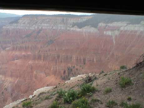
Just as we got to the campground at about 1145, it started to rain. By the time that we unhitched and drove back to the Visitor Center to pay or entrance fee of $6, it began to rain really hard. We walked out to the break to the Visitor Center and by that time it was hailing and the lightening and thunder were quite impressive. I had to take this picture through the rain and the window of the visitor center so it isn't really clear. When we got back to the campground, it was pouring rain and the place was covered in hail so this afternoon is a time for reading, scanning more photos and generally drying out.
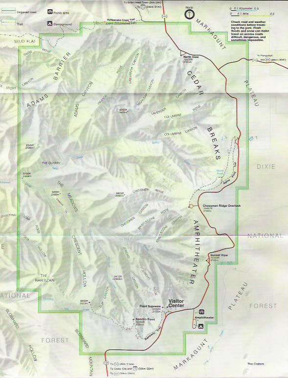 This is one of the nicest places that we've been yet. I've driven past Cedar Breaks on I-15 and never knew what was here. The road up from Parawan is the most direct route southbound, but it has 13.5% grades so we elected to take south entry from Cedar City. It was longer, but it had only 8.5% grades. Our plan is to stay here today and tomorrow and then head home Saturday morning.
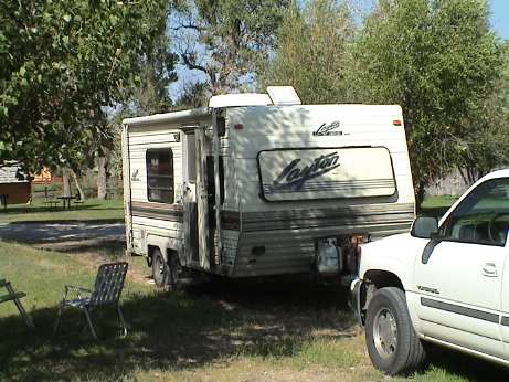
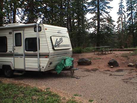 by 1400, the rain had let up enough so that I could go outside and take the obligatory campsite photo. Except for the rain, this place is really nice. Hopefully, the rain will let up enough to let us hike around tomorrow. Sandy has an altitude headache right now and she is sleeping it off.
Thursday July 15, 2004, about 2000 MDT
More than six hours have passed and it's finally stopped raining....almost. A ranger came by and knocked on our door to tell us that this evening's campfire is at the Visitor Center instead of the rained out campground ampitheatre. We've elected to go.
Sandy spent the afternoon sleeping and reading. I spent it scanning 35 mm prints into iPhoto and I'm about scanned out for today. I figure that I've scanned over a thousand photos already this trip, most of the ones that I brought with me. There are thousands more at home, all neatly filed in card files....
Friday July 16, 2004, about 1200 MDT
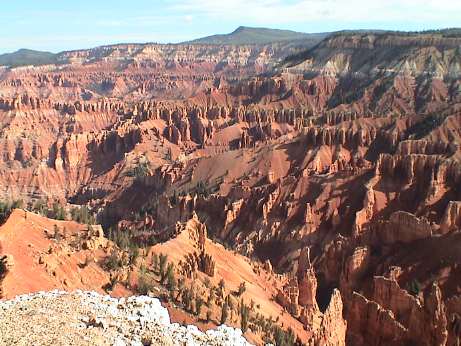 This morning it dawned bright and clear so we went out to see the sights. This is a clear picture of Cedar Breaks taken from Supreme Point, right next to the Visitor Center.
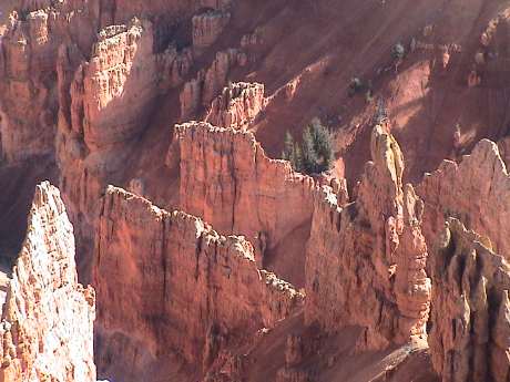 There is an unlimited amount of detail available if one cares to look for it. We also started to hike the Spectra Point trail (about a mile) along the rim, but it was so muddy from yesterday's rain that we turned back after the mud caked on our shoes and started squishing out to the side.
Instead we elected to drive the rim road and catch the views from the overlooks. About 1100, we returned to the trailer for lunch. Our trip out turned out to be really good timing because by 1145 it had started to rain and hail again. This at almost exactly the same time that it started to rain yesterday. Right now, it's raining hard but the hail accumulation is not nearly as much as yesterday.
Friday July 16, 2004, about 1600 MDT
The rain stopped about an hour ago so we drove back to the visitor center to see if we could find some cell phone coverage. Sandy's old phone worked so we called home. Her new GSM phone couldn't find service.
Directly east of the campground is a large meadow with thousands of dead spruce on the other side. The spruce bark beetle has done a real job here. The bugs aren't too bad either. I've run across a few mosquitos, but they aren't very aggressive nor very fast so that they are easy to nail. The other ordinary types of flies, gnats and moths are around, but not in great numbers. I figured that being next to a meadow would result in more bugs, but not in this case.
Friday July 16, 2004, about 2000 MDT
About 1500, another storm blew through, again with heavy rain and hail. We also had some VERY close lightening strikes, one close enough to set off the alarm in the Yukon. By sundown, the sky was fairly clear again.
This is our last night out. Tomorrow morning we set out for the 500 mile trip home.
Friday July 17, 2004, about 1730 MDT
Well, the trip is over. We are home, the trailer is parked and partially unloaded and Sandy is reading her mail. I still have to finish unloading the trailer and the truck, take a shower and read my mail.
The trip was uneventful, it got to 107F in the Mojave but the heat caused no problems. The overall trip distance was 3480 miles, quite a bit for 18 days. Glacier was a little further away that I thought but it was nice.
This page has been accessed  times since July 8, 2004
© 2004 George Schreyer
Created June 30, 2004
Last Updated July 17, 2004