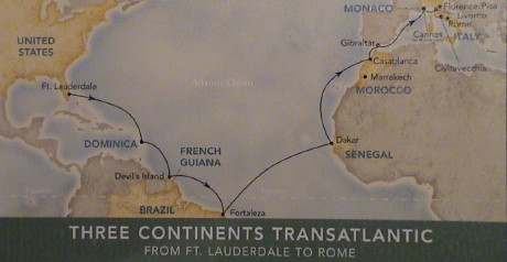
Trans Atlantic and Mediterranean Cruise 2008
Thursday, February 14, 2008
It's just two weeks since we got back from the last trip to
Antarctica and, again, another one is in the works. This time, we'll be
cruising across the Atlantic from Florida to the Mediterranean in the
springtime. We'll be leaving in just two months.
Some of our travel arrangements may look a little odd, but Sandy
worked around the airline's bizarre fare schedules to find some really
good fares. Our fare from LAX to Orlando is $105/head, the train fare
to Fort Lauderdale is $26/head and our flight back from Venice is
$650/head with taxes. If we wanted to travel back a day earlier, the
fare was over $2000/head.
The plan is to fly directly to Orlando and visit Disney World (never
been there) and the next day visit some other attraction in Orlando.
These are our travel margin days, if we are late getting there, one of
these days gets scrapped. Then we take a day to travel by train to Fort
Lauderdale, stay in a hotel that night and then get on the ship the
next day. After the cruise ends in Venice Italy, we'll spend
essentially two days kicking around and fly out late on the 2nd day.
We'll have an all night layover in Dublin (we pick up some hours due to
the time change) and then fly back to LAX the following day. Dublin is
nearly on a great circle route from Venice to Los Angeles so that it
doesn't even take us out of our way.
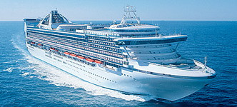
We'll yet again have an inside cabin, this time on the Grand
Princess, a nearly identical ship to the Star Princess on which we went
to Antarctica on. The cruise was booked through VacationsToGo.com for about
$100/day. This is really two cruises back to back. The part from Fort
Lauderdale to Rome is another repositioning cruise to get the ship back
to it's stomping grounds for the summer. The second part is a regular
Mediterranean cruise.
| Grand Princess |
Grand Princess Specifications
|
 |
| Decks |
18 |
| Passenger Elevators |
14 |
| Passengers |
2600 |
| Crew |
1150 |
| Gross Tonnage (based on volume) |
109,000 |
| Net Tonnage (displacement) |
71,763 |
| Length |
951 ft |
| Width |
118 ft |
| Draft |
27.7 ft |
|
| Built |
1998 |
| Bow Thrusters |
3 units, 2992 bhp |
| Stern Thrusters |
3 units, 2334 bhp |
| Props |
2 x 6 blades |
| Main Diesel Engines |
4 x 11.5 MW
(14,500 bhp)
2 x 8.6 MW
(11,300 bhp) |
| Cruising Speed |
22.5 knots |
|
Our itinerary is:
|
|
| Day |
Date |
Port of Call |
| Day 1 |
08 Apr 08 |
Fly to Orlando, Florida |
| Day 2 |
09 Apr 08 |
Orlando, Florida |
| Day 3 |
10 Apr 08 |
Orlando, Florida |
| Day 4 |
11 Apr 08 |
Train to Fort Lauderdale |
| Day 5 |
12 Apr 08 |
Depart Fort Lauderdale FL |
| Day 6 |
13 Apr 08 |
At Sea |
| Day 7 |
14 Apr 08 |
At Sea |
| Day 8 |
15 Apr 08 |
Dominica |
| Day 9 |
16 Apr 08 |
At Sea |
| Day 10 |
17 Apr 08 |
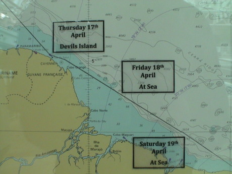
Devil's Island, French Guiana |
| Day 11 |
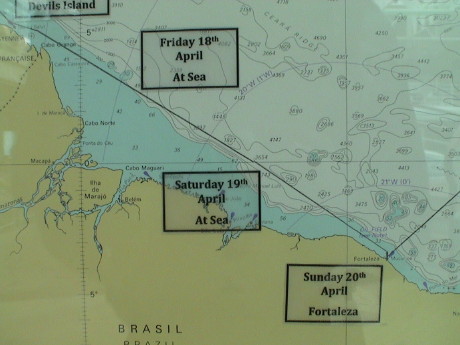
18 Apr 08 |
At Sea |
| Day 12 |
19 Apr 08 |
At Sea |
| Day 13 |
20 Apr 08 |
Fortaleza, Brazil |
| Day 14 |
21 Apr 08 |
At Sea |
| Day 15 |
22 Apr 08 |
At Sea |
| Day 16 |
23 Apr 08 |
At Sea |
| Day 17 |
24 Apr 08 |
Dakar, Senegal |
| Day 18 |
25 Apr 08 |
At Sea |
| Day 19 |
26 Apr 08 |
At Sea |
| Day 20 |
27 Apr 08 |
Casablanca, Morocco |
| Day 21 |
28 Apr 08 |
Gibraltar |
| Day 22 |
29 Apr 08 |
At Sea |
| Day 23 |
30 Apr 08 |
Cannes, France |
| Day 24 |
01 May 08 |
Florence/Pisa (Livorno), Italy |
| Day 25 |
02 May 08 |
Rome (Civitavecchia), Italy |
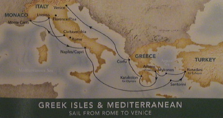
| Day 26 |
03 May 08 |
Monte Carlo, Monaco |
| Day 27 |
04 May 08 |
Florence/Pisa (Livorno), Italy |
| Day 28 |
05 May 08 |
Naples/Capri, Italy |
| Day 29 |
06 May 08 |
At Sea, Messina Straits |
| Day 30 |
07 May 08 |
Santorini, Greece |
| Day 31 |
08 May 08 |
Kusadasi (Ephesus), Turkey |
| Day 32 |
09 May 08 |
Myknons, Greece |
| Day 33 |
10 May 08 |
Athens (Piraeus), Greece |
| Day 34 |
11 May 08 |
Katakolon (Olympia), Greece |
| Day 35 |
12 May 08 |
Corfu, Greece |
| Day 36 |
13 May 08 |
At Sea |
| Day 37 |
14 May 08 |
Venice, Italy, Disembark |
| Day 38 |
15 May 08 |
Venice, Italy |
| Day 39 |
16 May 08 |
Depart Venice, Arrive Dublin late |
| Day 40 |
17 May 08 |
Depart Dublin, Arrive LAX |
|
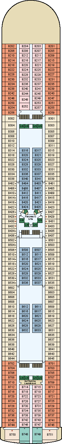
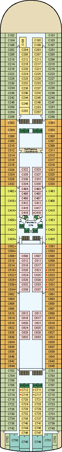
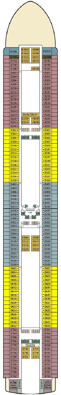
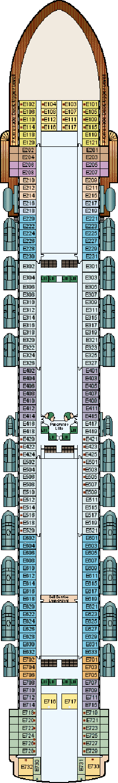
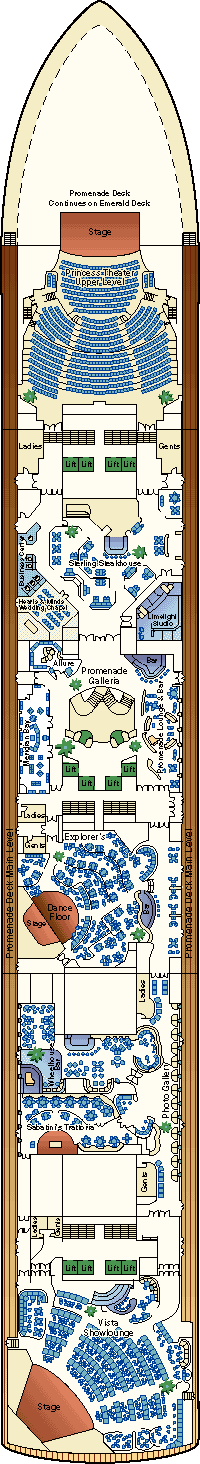
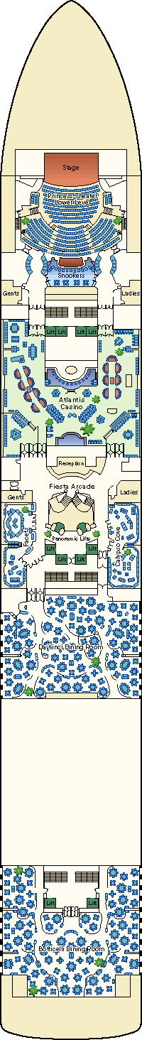
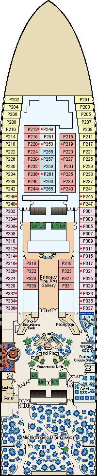
Grand Princess Deck Plans
| Sky Deck |
Sports Deck |
Sun Deck |
Lido Deck |
Aloha Deck |
|
|
|
|
|
|
| Baja Deck |
Caribe Deck |
Dolphin Deck |
Emerald Deck |
Promenade Deck |
|
|
|
|
|
|
| Fiesta Deck |
Plaza Deck |
Gala Deck |
|
|
|
|
|
|
|
|
Thursday, February 14, 2008
We have received our cabin assignment, Caribe 711. Our cabin is
immediately behind the aft elevators and there are laundry rooms
directly above and below. There could be just a little noise in this
room.
Friday, March 14, 2008
To accommodate the stop at Fortaleza, Brazil, we needed yellow fever
inoculations. Brazil requires this for for travelers coming from French
Guiana. Further, we need a Brazilian visas to enter Brazil. It took
several weeks to arrange the inoculation through Kaiser. Last week, we
drove to the Brazilian Consulate in West LA and paid them $260 for the
visas. We had to leave our passports at the consulate while the visas
were being processed. We still need to go back there next week to pick
up the visas and passports. Then we drove down to Kaiser to actually
get the inoculations. As it turns out, Sandy didn't need any but they
stuck me three times for stuff that I was missing and then said I
needed to come back the next day for the yellow fever shot. This is all
done, but this one stop has turned out to be a major pain in the
backside, and expensive too.
Tuesday, April 8, 2008, Orlando Florida, about 1830 EDT
Our flight from LAX to Orlando was uneventful if not a little bumpy
at the end. We took a local bus from the airport to the Rodeway Inn out
near the tourist area west of the airport. It was about an hour bus
ride but it cost on $1.75/head. Tomorrow is probably Disney World.
However right now it's time to go down to the lobby and make
arrangements.
We didn't find out until after we arrived in Orlando that American
Airlines had cancelled 500 flights today. Fortunately for us, our's
wasn't one of them.
Wednesday, April 9, 2008, Orlando Florida, about 2200 EDT
Today, we went to Disney World, specifically the Magic Kingdom part
of Disney World. Unlike Disneyland/California Adventure/Downtown Disney
which are all concentrated on a relatively small parcel of land in the
middle of Anaheim California, Disney World is spread out over 1000's of
acres of natural Florida forest with monorail and buses connecting the
various parks. The Magic Kingdom is very similar to Disneyland but
there is no Matterhorn and no submarine ride. I haven't been to
Disneyland in many years and I was a little surprised about the
admission price, one day is about $77.
Our hotel, the Rodeway Inn, is on International Drive which is where
virtually all of the attractions and resorts are except Disney World
which is it's own major complex in itself, a little southwest of the
rest of the stuff. International Drive is itself southwest of downtown
Orlando. We got to Disney World and back on public transportation with
one bus transfer. We arrived at about 1100 and left when were were both
used up at about 1900. The only downside of the trip is that when we
went back to ride Space Mountain one more time before we left, it had
just broken. I knew that there was a problem when people were streaming
OUT of the entrance.
Sandy's Canon S2IS digital camera died this morning also, but before
we actually left. It succumbed to a known failure for that model. The
imager died. When we got off the bus, we went into several camera shops
that were right near the hotel looking for a replacement. We may have
found a Canon S5IS, but the guy also tried to sell us a Fuji which
appeared to work a little better. So he blew the immediate sale because
Sandy now has to research the details of the two models on the
internet. She just left to go down to the lobby to do that. She'll
probably pick one to buy tomorrow night after we get back from a tour
to the Kennedy Space Center. That tour leaves early tomorrow morning
from a hotel a few blocks away.
Thursday, April 10, 2008, Orlando FL, about 2045 EDT
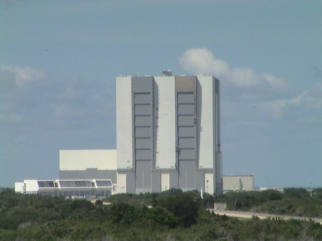 Today we took a bus trip to the Kennedy Space Center. KSC has
a very well developed and organized visitor facility. There are four
major regions which tourists can visit, a large visitor center, a
gantry about halfway between the Vehicle Assembly Building (picture)
and Pad 39B (next picture), a complex specifically developed to display
the moon program, and the facility that integrates the International
Space Station components. There are NASA provided tour busses that
shuttle visitors between these four locations.
Today we took a bus trip to the Kennedy Space Center. KSC has
a very well developed and organized visitor facility. There are four
major regions which tourists can visit, a large visitor center, a
gantry about halfway between the Vehicle Assembly Building (picture)
and Pad 39B (next picture), a complex specifically developed to display
the moon program, and the facility that integrates the International
Space Station components. There are NASA provided tour busses that
shuttle visitors between these four locations.
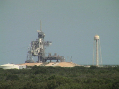 Both pads 39A and 39B were used for shuttle launches, but
since there are only about 10 shuttle launches to go before the program
ends, only pad 39B is now used for the shuttle. Pad 39A is being
rebuilt to serve the Constellation (return to the moon) program. Pad
39A will service the Aires rocket initially.
Both pads 39A and 39B were used for shuttle launches, but
since there are only about 10 shuttle launches to go before the program
ends, only pad 39B is now used for the shuttle. Pad 39A is being
rebuilt to serve the Constellation (return to the moon) program. Pad
39A will service the Aires rocket initially.
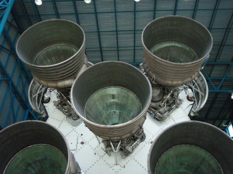 At the moon program facility there is an
ENTIRE Saturn V rocket on display INDOORS. This is one big rocket and
you an walk underneath it's whole length. There are also displays of
the moon rover and lunar lander. The whole facility was built with
revenue generated over 20+ years of "profits" made from food, gift and
entry fee concessions. The food was not cheap, but at least it was
good.
At the moon program facility there is an
ENTIRE Saturn V rocket on display INDOORS. This is one big rocket and
you an walk underneath it's whole length. There are also displays of
the moon rover and lunar lander. The whole facility was built with
revenue generated over 20+ years of "profits" made from food, gift and
entry fee concessions. The food was not cheap, but at least it was
good.
We had a little issue as we were leaving the hotel in the morning.
We went down one flight of stairs and Sandy fell on the last step and
injured her ankle. She was able to walk on it the whole day by being
careful but it is now quite swollen and very sore. However, it is not
black and blue so the likely sprain is apparently not too severe.
There are five camera shops within 3 blocks of our hotel. Last night
we went into several of them looking for new camera to replace the one
that died. Only one of the shops that we visited had a Canon S5IS
model. The sales guy there tried to switch us to another camera. It
turns out, via Sandy's research on the Internet, that the Fuji camera
was a discontinued model AND he claimed an initial price that was fully
twice MSRP. He then "discounted" the camera by over 50%. Right away, we
could smell a rat. It turns out that the camera he wanted $300 for is
currently selling at a closeout price at Amazon for $120. After
comparing specs, Sandy decided that she really wanted the S5IS. We went
to the other shops again this evening before they closed like last
night and nobody but that one shop had one. We went back in to that
shop and the manager of the place would not sell the camera at the
price offered last night ($279, Amazon's price was $299) if we wanted
to use a credit card. He wouldn't even take $300 on a credit card.
We're not giving a cameral shop cash. We could not come to a deal so we
walked.
Tomorrow, we take a cab to the Orlando Amtrak station for a ride on
Amtrak to Fort Lauderdale. We'll overnight in a hotel there and then
make our way to the ship.
Friday, April 11, 2008, Orlando Florida, about 0950 EDT
 We caught
a cab to the train station at 0900 and got here 15 minutes later. Our
train is scheduled to depart at 1031, but it's running nearly an hour
late.
We caught
a cab to the train station at 0900 and got here 15 minutes later. Our
train is scheduled to depart at 1031, but it's running nearly an hour
late.
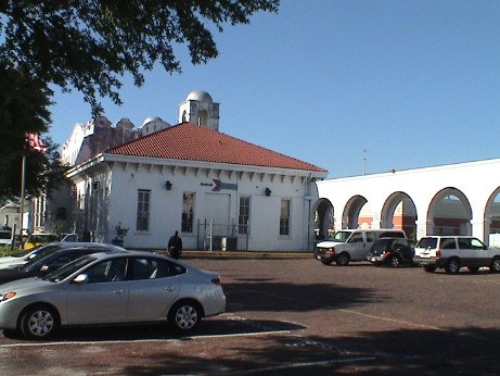
When we got here, I was surprised to find a mission style station in
Florida. I had just finished building a freelance
version of a mission style station for my backyard train layout
just before we left on this trip.
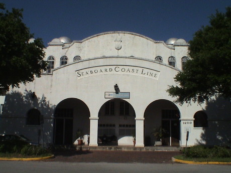 This station
was originally built by the Seaboard Coast Lines. It is now operated by
Amtrak. The Amtrack trains run on CSX owned track.
This station
was originally built by the Seaboard Coast Lines. It is now operated by
Amtrak. The Amtrack trains run on CSX owned track.
 Our train, number 91, the Silver Star, will
take over 5 hours to go between Orlando and Fort Lauderdale via Tampa.
We will actually cross over the state to hit Tampa and then come out
the same way to head southeast again to reach Fort Lauderdale. This
train originated yesterday in New York at 1052 and will reach Miami
today at 1805, a 31 hour ride.
Our train, number 91, the Silver Star, will
take over 5 hours to go between Orlando and Fort Lauderdale via Tampa.
We will actually cross over the state to hit Tampa and then come out
the same way to head southeast again to reach Fort Lauderdale. This
train originated yesterday in New York at 1052 and will reach Miami
today at 1805, a 31 hour ride.
Update, Friday, April 11, 2008, Orlando Florida, about 1140
EDT
We're on the train running south across Florida. It'll take about 6
hours to reach Fort Lauderdale, slower than if we flew but much less
expensive and the seats are MUCH better than airline coach. There is
also AC power at each seat so I can use my computer, weak batteries and
all.
The view of Florida from a train window isn't very spectacular
considering that pretty the whole state is dead flat and the rail lines
tend to go through less scenic areas. Nobody wants to build anything of
real value next to a noisy rail line.
This train is pretty long and it is being pulled by two Genesis
series locomotives. The ride is a little bumpy, but not any worse than
most trains I have been on.
Update, Friday, April 11, 2008, Fort Lauderdale, about 2030
EDT
We've made it to the Hampton Inn in Fort Lauderdale without
incident. Their airport shuttle also makes runs to the Amtrak station.
We got a gourmet dinner at the Wendy's on the next block and settled in
for the evening. Sandy's ankle is still swollen but she can walk on
it.
Tomorrow the hotel provides a shuttle to the ship at 1130 tomorrow
so we can sleep tomorrow morning.
Saturday, April 12, 2008, Port Everglades, about 1530 EDT
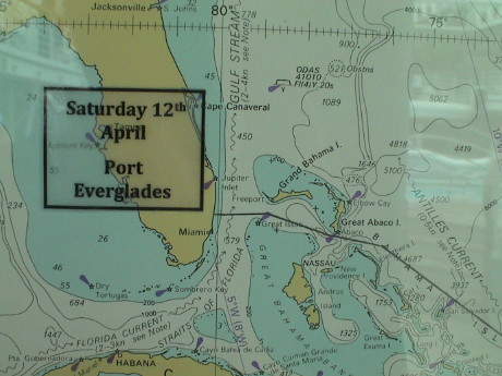 Our cruise leaves from Port Everglades at Fort Lauderdale.
This port can hold four large cruise ships and a couple of smaller ones
at the same time. These photos are from the navigator's map posted on
deck 14.
Our cruise leaves from Port Everglades at Fort Lauderdale.
This port can hold four large cruise ships and a couple of smaller ones
at the same time. These photos are from the navigator's map posted on
deck 14.
We caught our shuttle on time and made in the ship just after noon.
We dropped our stuff on in our cabin and went up to lunch. Our luggage
has arrived and I've partially unpacked. Sandy is sleeping. In about a
half hour, we will have the evacuation drill.
This ship is the original of the "Grand" class. It is very similar
to the Star Princess on which we traveled to Antarctica earlier this
year. Only a few things are in different places, 98% of the ship is
exactly the same. One difference is that this ship has in-room wireless
internet. However, the satellite link is currently down.
Sandy had unloaded her suitcase into a duffle and filled it with 2
liter bottles of diet Coke, 10 bottles worth, that we bought at the
Winn-Dixie market near the Fort Lauderdale hotel. Her suitcase weighed
in at over 90 lbs. We got some surprised looks from the shuttle driver,
the porter that unloaded the shuttle and the porter that delivered the
bags to our cabin. A "all you can drink" soda card is available on the
ship, but it costs about $4.25/day, the 2 liter bottles were $1
each.
Sunday, April 13, 2008, At Sea, about 1630 EDT
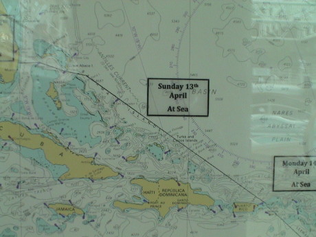 Our first whole day out is "at sea." Repositioning cruises
usually involve several stretches of several days at sea. This ship has
to get from it winter cruising grounds, the Caribbean, to it's summer
cruising grounds, the Mediterranean. The port stops on repositioning
cruises are usually the more out-of-the-way places as well. Our cruise
from Los Angeles to Auckland, New Zealand was also a repositioning
cruise.
Our first whole day out is "at sea." Repositioning cruises
usually involve several stretches of several days at sea. This ship has
to get from it winter cruising grounds, the Caribbean, to it's summer
cruising grounds, the Mediterranean. The port stops on repositioning
cruises are usually the more out-of-the-way places as well. Our cruise
from Los Angeles to Auckland, New Zealand was also a repositioning
cruise.
Obviously, the satellite link came up and the internet works as I
was able to upload this page. We have an inside cabin again and there
is no sunlight to wake us up so without an alarm, we slept past 0930.
We skipped breakfast and went to a lecture by a forensics expert about
the RFK assassination. Lunch is in about half an hour. I'll do my
typical video tour of the ship today, but it will be pretty quick
because this ship looks so much like the Star Princess that I know my
way around and I'll be documenting primarily the differences.
Our stateroom is right aft of the elevators so, based on some
experiences I've had in hotel rooms, I expected some considerable
noise. I can hear it rumble past, but the sound is not as loud as the
noise from the air conditioning and other ships noises. The are
laundromats directly above and below this cabin, but they are closed
after 2200 so that there is no noise from them either.
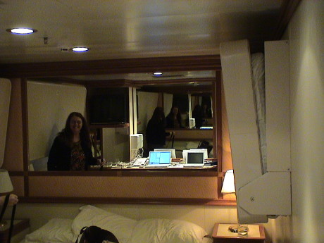 Our cabin is configured to accept four people, two in
twin beds and two more in the fold down beds. This is an inconvenient
configuration when the two twins are pushed together to make a queen
bed as the folded up beds restrict access along the sides of queen bed.
I've mashed either my head or shoulder against this bed several times
already and I am just now learning to avoid it. Sandy can be seen
reflected in the mirror above the bed and re-reflected in the mirror
above the desk. The computers can be seen, reversed, on the desk as
well.
Our cabin is configured to accept four people, two in
twin beds and two more in the fold down beds. This is an inconvenient
configuration when the two twins are pushed together to make a queen
bed as the folded up beds restrict access along the sides of queen bed.
I've mashed either my head or shoulder against this bed several times
already and I am just now learning to avoid it. Sandy can be seen
reflected in the mirror above the bed and re-reflected in the mirror
above the desk. The computers can be seen, reversed, on the desk as
well.
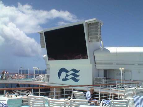 I walked the ship looking for differences between the
Grand Princess and the Star Princes on which we cruised in January. The
Grand Princess was the first ship in this class, now there are four.
The Star Princess was built to the same plan four years later, but
there were some changes made, mostly minor. On change is that the Star
Princess didn't have a really big screen TV outdoors. This ship runs
"Movies Under the Stars" in the evenings. The screen isn't bright
enough to be really useful during the day. It can be seen, but only
from almost straight on. At night, it would look pretty good. The other
changes were in the position of some of the less notable features.
There is no wedding chapel on the Star Princess. The Internet Cafe, and
some other offices were moved around. The kid's area on the Star
Princess is aft, on the Grand Princess it is forward. Overall, it's the
same ship.
I walked the ship looking for differences between the
Grand Princess and the Star Princes on which we cruised in January. The
Grand Princess was the first ship in this class, now there are four.
The Star Princess was built to the same plan four years later, but
there were some changes made, mostly minor. On change is that the Star
Princess didn't have a really big screen TV outdoors. This ship runs
"Movies Under the Stars" in the evenings. The screen isn't bright
enough to be really useful during the day. It can be seen, but only
from almost straight on. At night, it would look pretty good. The other
changes were in the position of some of the less notable features.
There is no wedding chapel on the Star Princess. The Internet Cafe, and
some other offices were moved around. The kid's area on the Star
Princess is aft, on the Grand Princess it is forward. Overall, it's the
same ship.
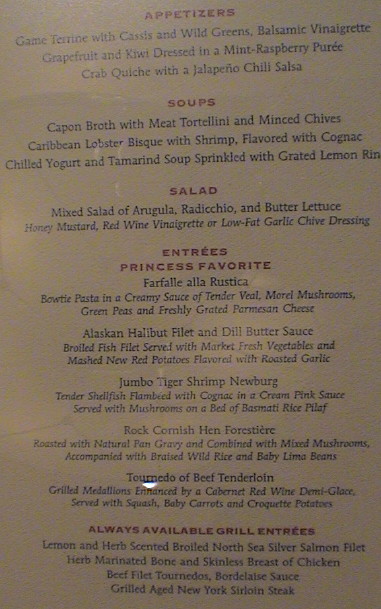 This is the menu for tonight, a formal dinner. We didn't
bring formal clothes so we will probably get dinner in the Horizon cafe
on Deck 14 instead. If you read the menu, you'll see that some of this
stuff is pretty rich. At least it is portion controlled.
This is the menu for tonight, a formal dinner. We didn't
bring formal clothes so we will probably get dinner in the Horizon cafe
on Deck 14 instead. If you read the menu, you'll see that some of this
stuff is pretty rich. At least it is portion controlled.
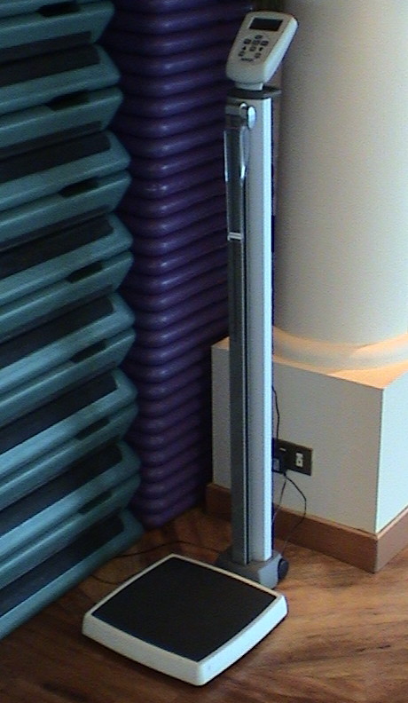 Due to the menu shown above, this device can be handy. If
one is not careful, one can put on a lot of weight on a cruise,
especially one that lasts for a month. The last cruise was about 16
days and I managed to hold my gain to 4 pounds. I hope to do the same
on this cruise by avoiding the stuff that really packs it on (sweets,
grains and the rich sauces) and sticking to my preferred diet anyway
(seafood, fruits and vegetables). When I left home I was 192 lbs
dripping wet after losing the weight I gained on the last cruise. I
weighed myself dressed when I got on the ship and I was 202, implying
10 lbs of clothing AND the weight that I might have gained since I left
home. I weighed myself today and it said 220! Then it said 184 then
216, then 190 and so on. The ship is rolling a little and the
accelerations due to the movement are pretty significant. It is clear
that to use the scale, we must be tied up in port.
Due to the menu shown above, this device can be handy. If
one is not careful, one can put on a lot of weight on a cruise,
especially one that lasts for a month. The last cruise was about 16
days and I managed to hold my gain to 4 pounds. I hope to do the same
on this cruise by avoiding the stuff that really packs it on (sweets,
grains and the rich sauces) and sticking to my preferred diet anyway
(seafood, fruits and vegetables). When I left home I was 192 lbs
dripping wet after losing the weight I gained on the last cruise. I
weighed myself dressed when I got on the ship and I was 202, implying
10 lbs of clothing AND the weight that I might have gained since I left
home. I weighed myself today and it said 220! Then it said 184 then
216, then 190 and so on. The ship is rolling a little and the
accelerations due to the movement are pretty significant. It is clear
that to use the scale, we must be tied up in port.
I spent the afternoon trying out the various hot tubs and swimming
pools. There are four swimming pools and at least 8 hot tubs scattered
around the ship. At any given location, one of the hot tubs is set to
"parboil" and the other is just hot.
Later, we went down to the tour desk to book some shore excursions,
two of the three that we wanted were already sold out. Sandy had
pre-booked the tours that she wanted most, a train to Marrakesh and a
tour of the WWII tunnels at Gibraltar so we have those. We also got a
trip to a "pink lake" at Dakar so we'll see some of the countryside
there as well. It looks like the stops at Dominica and Fortaleza will
be on our own. We learned a lesson on the Star Princess, but we didn't
follow the lesson here, big ship + small port = sold out tours. Book
early or there won't be anything left.
Monday, April 14, 2008, At Sea, about 1100 EDT
Last night, after dinner and a walk, we settled down on Deck 14 to
watch "The Bourne Ultimatum" on the big screen. The showing was
supposed to have been at 1900, but it was delayed until the Masters
golf tournament finished on ESPN. The ship provided blankets and
popcorn for the showing. Apparently, there are three films shown each
sea day.
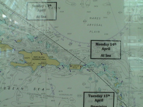 Today is another day at sea through the eastern Caribbean
on our way to our first port-of-call, Dominica. We attended the port
lecture for Dominica this morning. We don't have a tour set up for this
port so we're just going to walk the 10 minutes into the main town of
Rosseau and look around. The island is heavily forested and much of it
is inaccessible. The snorkel trip was booked up and I didn't feel like
doing a scuba trip. Dominica is a economically poor so we don't expect
a lot. A recent boost to the economy occurred when Pirates of the
Caribbean 2 and 3 were filmed on location in and around Dominica.
Today is another day at sea through the eastern Caribbean
on our way to our first port-of-call, Dominica. We attended the port
lecture for Dominica this morning. We don't have a tour set up for this
port so we're just going to walk the 10 minutes into the main town of
Rosseau and look around. The island is heavily forested and much of it
is inaccessible. The snorkel trip was booked up and I didn't feel like
doing a scuba trip. Dominica is a economically poor so we don't expect
a lot. A recent boost to the economy occurred when Pirates of the
Caribbean 2 and 3 were filmed on location in and around Dominica.
Before the port lecture, Sandy and I went for a walk on the
Promenade Deck. Unlike the ms Statendam, the walkway around the ship is
fairly narrow in spots and transitions between two decks. Most of the
walk is on deck 7 with the portion around the bow on deck 8. The wind
on the bow portion is fearsome. I had to lean forward and push hard
through the wind on while walking forward and hold myself back from the
tailwind while going aft around the other side. I figure that it is
about 3/8 mile around the whole loop and about a quarter mile if one
cuts through the ship on deck 7 to avoid the stairs to deck 8. Sandy is
still recovering from a foot injury and her ankle is not yet flexible
enough to deal with stairs although she can walk on flat surfaces
without pain.
There is a cell phone repeater on this ship so that we have phone
coverage, but at international roaming rates. This could run between $1
and $2.50 per minute, but I wouldn't be surprised if Princess hasn't
figured out a way to charge more. So I am carrying Sandy's cell
phone.
Tuesday, April 15, 2008, Dominica, about 1800 EDT
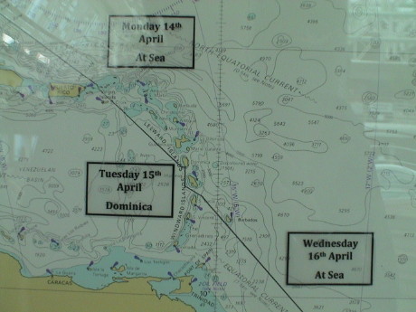 Dominica was the port of call for today. Until 23 years
ago, this island was part of the British Commonwealth. The next year,
Dominica got hammered by a serious hurricane, from which they are still
economically recovering.
Dominica was the port of call for today. Until 23 years
ago, this island was part of the British Commonwealth. The next year,
Dominica got hammered by a serious hurricane, from which they are still
economically recovering.
There are about 70,000 people on this island, about 17,000 in the
capital and largest city, Roseau. At various times, the island was
under British or French control. There is still the influence of both
here, especially in place names.
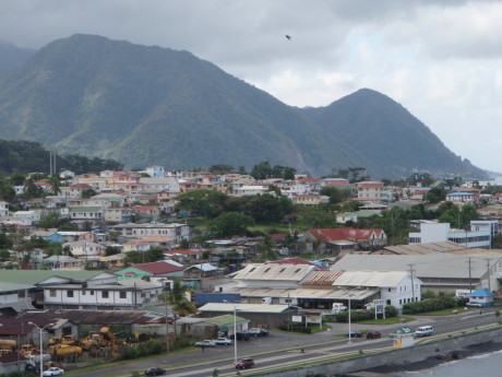 Roseau is a town of contrasts. Mostly, it is run down and
poor. Parts of it, especially down near the ocean, are in pretty good
condition. There are no major resorts here and cruise ships visit only
from October to May. The other months are hurricane season and the
cruise lines just stay away from this part of the world.
Roseau is a town of contrasts. Mostly, it is run down and
poor. Parts of it, especially down near the ocean, are in pretty good
condition. There are no major resorts here and cruise ships visit only
from October to May. The other months are hurricane season and the
cruise lines just stay away from this part of the world.
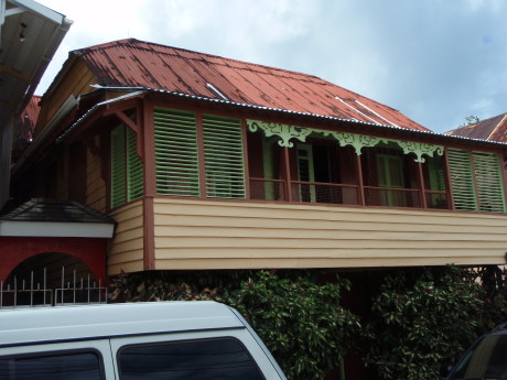 We walked the short distance into town and got a
pretty good look around. This is a typical Roseau house that is in
fairly good condition. There are fewer of these than those similar to
the next picture.
We walked the short distance into town and got a
pretty good look around. This is a typical Roseau house that is in
fairly good condition. There are fewer of these than those similar to
the next picture.
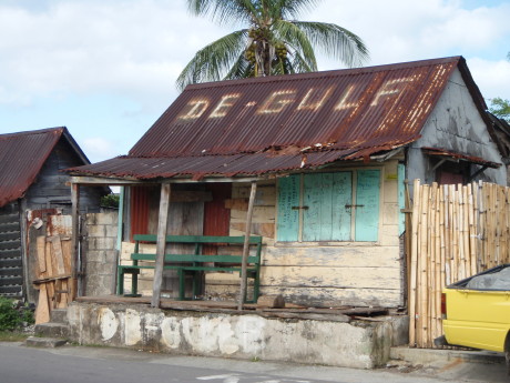 This shack is possibly boarded up, and in worse
condition that most, but still most of the buildings were closer to
this one than the other one.
This shack is possibly boarded up, and in worse
condition that most, but still most of the buildings were closer to
this one than the other one.
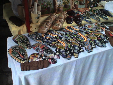 At one end of the town, there is a flea market, there
were lots of booths set up. This one seemed a little atypical in that
it had more carved masks than most, but it was all tourist
trinkets.
At one end of the town, there is a flea market, there
were lots of booths set up. This one seemed a little atypical in that
it had more carved masks than most, but it was all tourist
trinkets.
We spent only a couple of hours out and then took a $2 shuttle back
to the ship. Before we got on the ship, Sandy decided that she wanted
to see more of the outback, so we booked the last couple of spots in
the rainforest tour. We got lunch and went back out at noon to board
our tour minivan.
The minivan took us up some truly winding and pothole filled roads.
There were hairpin turns, steep drop off and no guardrails. Most of the
road was wide enough for one vehicle but the driver always seemed to
find a way around another vehicle on the narrow road. He said that he
had a "PhD" or a pot hole dodger.
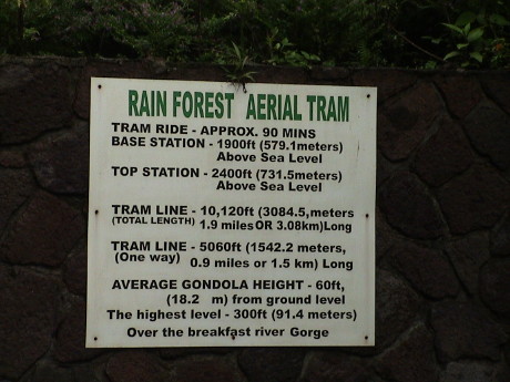
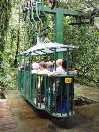 The tramway itself was a typical cable car type of thing.
There was a long line and we were sweating the schedule. I figured that
we had to get on by 1430 to get back to the ship on time and we
actually go on at 1430.
The tramway itself was a typical cable car type of thing.
There was a long line and we were sweating the schedule. I figured that
we had to get on by 1430 to get back to the ship on time and we
actually go on at 1430.
 This is some of the detail of the tram. There is
nothing at the top besides a turn around and a place to get off to walk
partially back down to a mid station. We were running late, it was
raining and Sandy's ankle wouldn't handle the uneven trail so we didn't
get off.
This is some of the detail of the tram. There is
nothing at the top besides a turn around and a place to get off to walk
partially back down to a mid station. We were running late, it was
raining and Sandy's ankle wouldn't handle the uneven trail so we didn't
get off.
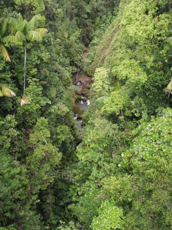 The forest was so close to the tram cars that we truly
could not see much of the forest for the trees. The river gorge, which
is about 300 ft below the tram opened things up enough to get an
overall photo. The tramway operators have to trim the path for the tram
cars every couple of weeks. There was lots of foliage that actually
intruded into the tram as we passed by.
The forest was so close to the tram cars that we truly
could not see much of the forest for the trees. The river gorge, which
is about 300 ft below the tram opened things up enough to get an
overall photo. The tramway operators have to trim the path for the tram
cars every couple of weeks. There was lots of foliage that actually
intruded into the tram as we passed by.
There was a guide on each tram. Ours was quite knowledgeable about
the local flora and fauna. We got to see a lot of it quite close
up.
We got off the tram at 1600, a half hour before we were due back on
the ship and there was a half hour drive to get back. However, the
people in our bus were scattered about and the bus wasn't ready to
leave. We actually got back to the ship at 1700, the time that the ship
was supposed to sail. However, there were still busses behind us so we
didn't pull away from the dock until an hour after the scheduled
time.
Wednesday, April 16, 2008, At Sea, about 1600 EDT
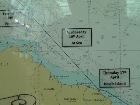 We went to the port talk this morning for Devil's Island,
our next stop. This "port" is unusual in there there are NO ship's
tours. It's a tender port so we have to fit in with 2600 other on 6
boats that carry only 100 each. On the island, made famous by the movie
"Papillon", our only option is to walk around and investigate the ruins
of the prison which was closed only 56 years ago. Most of the 80,000 or
so prisoners were never seen again. They died on Devil's Island of
overwork, starvation, yellow fever, poisonous snakes and insects and a
host of other tropical issues. Only 30,000 actually returned from
Devil's Island.
We went to the port talk this morning for Devil's Island,
our next stop. This "port" is unusual in there there are NO ship's
tours. It's a tender port so we have to fit in with 2600 other on 6
boats that carry only 100 each. On the island, made famous by the movie
"Papillon", our only option is to walk around and investigate the ruins
of the prison which was closed only 56 years ago. Most of the 80,000 or
so prisoners were never seen again. They died on Devil's Island of
overwork, starvation, yellow fever, poisonous snakes and insects and a
host of other tropical issues. Only 30,000 actually returned from
Devil's Island.
We've been on this ship for a few days now and during the whole
time, I've seen exactly one child, a little girl, perhaps four years
old. The passengers on this ship are also among the older crowd.
Everyone that we've talked to is retired at least. Many are quite old.
Again, we are probably in the youngest 5% of the passenger
compliment.
I've had a chance to fully scope out the walking tracks on the ship.
I need to walk to burn off at least some of the excess calories that I
have been consuming. On deck 16 forward, there is a nice jogging track
with a composite rubber surface. It is 1/10 of a mile per lap. The
Promenade deck is split between two decks. If one takes a shortcut at
the forward elevators, it is very close to 1/4 mile per lap. This is
important to us right now as Sandy still has difficulties with stairs
although she is getting materially better. The swelling in her ankle is
down by quite a bit. The whole loop around the bow stretches a lap to
1/3 of a mile. I wear a pedometer now so that I can see how much I am
walking. We have been averaging about 7000 steps a day, with some days
over 10,000. I get 2200 steps to the mile. I calibrated the pedometer
by many walks near home where I evaluate the distance with the Google
Distance Measurement Tool to get the distance.
 Today is another sea day, although the sea is not very
"sea-like", it's more "lake-like." This is as rough as it has been up
to this point.
Today is another sea day, although the sea is not very
"sea-like", it's more "lake-like." This is as rough as it has been up
to this point.
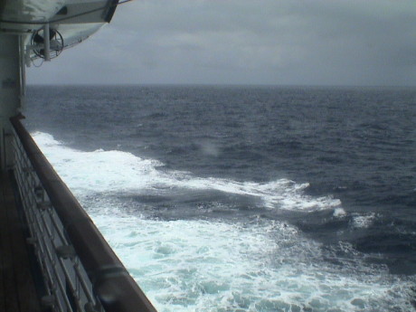
The sea has actually been kind to us so far on this trip. This is
about the worst we've seen so far, which is actually pretty typical for
the vast majority of the cruising days that we have experienced. There
have been only a few days with large swell. We had some really high
winds (and cold too) in Antarctica but not much swell.
Thursday, April 17, 2008, Devil's Island, about 1400 GFT
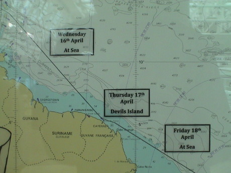 French Guiana is a small French colony on the northeast
coast of South America. The capital is Cayenne. The other two notable
places are Devil's Island (actually 3 islands) and the Kourou rocket
center used by Ariaespace as its major satellite launching
facility.
French Guiana is a small French colony on the northeast
coast of South America. The capital is Cayenne. The other two notable
places are Devil's Island (actually 3 islands) and the Kourou rocket
center used by Ariaespace as its major satellite launching
facility.
The three islands of are actually called the Salvation Islands.
Prior to 1850, part of the population of the mainland found "salvation"
on these islands from the harsher conditions on the mainland. Since
Devil's Island is not particularly known as a tropical paradise, it is
fairly easy to see why the mainland of French Guiana is not heavily
populated. The interior is mostly uninhabited, flat jungle. In 1852 the
prison was established by the French to deal with their prison
overpopulation problem and an shortage of hard laborers in French
Guiana.
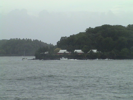 However, this
is as close as we got. The swell and wind were too high to allow a safe
tender operation. There were 6 tenders in the water, but the conditions
were just too poor to allow us off the ship. The swell was
inconsistent, but it was up to six feet with a 40 kt wind and rain.
However, this
is as close as we got. The swell and wind were too high to allow a safe
tender operation. There were 6 tenders in the water, but the conditions
were just too poor to allow us off the ship. The swell was
inconsistent, but it was up to six feet with a 40 kt wind and rain.
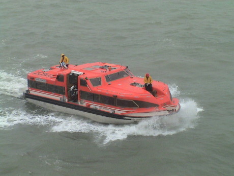 The tenders were milling
about waiting for a chance to be hauled up. This one was moving into
the swell. When the tenders came under to hooks to be lifted, they were
bouncing around by about 4 feet. The cable operator would lower the
latching mechanism and the poor guy on the boat had to wrestle with
this thing that probably weighed over 100 lbs and try to get it into
the latch and still not fall off the top of a wet and slippery boat. It
took two guys each time to manhandle the hook into the latch.
The tenders were milling
about waiting for a chance to be hauled up. This one was moving into
the swell. When the tenders came under to hooks to be lifted, they were
bouncing around by about 4 feet. The cable operator would lower the
latching mechanism and the poor guy on the boat had to wrestle with
this thing that probably weighed over 100 lbs and try to get it into
the latch and still not fall off the top of a wet and slippery boat. It
took two guys each time to manhandle the hook into the latch.
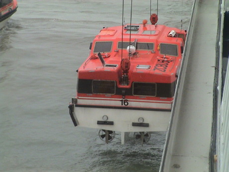 This tender has just been
lifted from the water, the last crew member has just ducked into the
open hatch. The tender is then hauled up to the deck level and the crew
exits the tender. The tender is then hauled up one more deck and them
pulled into its berth and tied down.
This tender has just been
lifted from the water, the last crew member has just ducked into the
open hatch. The tender is then hauled up to the deck level and the crew
exits the tender. The tender is then hauled up one more deck and them
pulled into its berth and tied down.
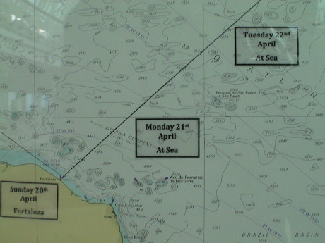
The Grand Princess, having aborted the Devil's Island stop, is
proceeding to our next stop, Fortaleza. We'll have two days at sea to
get there.
There are a few more children on this ship, but not many. Last
night, we saw a boy, about 10, in the pool. Today I saw a young lady,
maybe 12 or so, out on deck. We've also seen a small child in a
stroller. Long cruises, like this one, tend to attract those with time
on their hands, such as retirees. Families with children don't usually
travel away from home for weeks during the school year and many working
people don't get enough vacation time to be able to go on a 3 week
cruise.
Friday, April 18, 2008, At Sea, 1100 time GFT
 Counting yesterday as a sea day, because we didn't get off
at Devil's Island, we've been at sea for three days and will have one
more before we get to Fortaleza Brazil. The sea has become fairly rough
and choppy. It's raining and gray.
Counting yesterday as a sea day, because we didn't get off
at Devil's Island, we've been at sea for three days and will have one
more before we get to Fortaleza Brazil. The sea has become fairly rough
and choppy. It's raining and gray.
We went to a talk on the loss of the S.S. Brother Jonathan, a side
wheel steamer that struck an uncharted rock and went down in 1865 off
Crescent City CA with 200+ people and quite a bit of gold. A small
portion of the gold has been recovered but legal hassles with the state
of California is halting further recovery.
The rest of today and tomorrow will be just kicking around the ship
and relaxing except we might take in some shows or movies. Several are
offered.
Saturday, April 19, 2008, At Sea, about 1600 GFT
 Last night, we crossed the Equator and we will spend a
couple of days in the southern hemisphere. The weather is warm and very
humid. At noon, the sun is almost directly overhead. It is pretty
intense and even a few minutes direct exposure can lead to a sensation
of sunburn even before sunburn becomes obvious.
Last night, we crossed the Equator and we will spend a
couple of days in the southern hemisphere. The weather is warm and very
humid. At noon, the sun is almost directly overhead. It is pretty
intense and even a few minutes direct exposure can lead to a sensation
of sunburn even before sunburn becomes obvious.
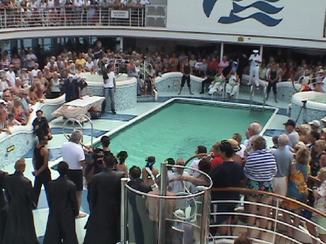 At 1300
today, the typical ceremony was held at the behest of King Neptune.
Slimy pollywogs (those that have not crossed the equator on a ship
before) are charged with heinous crimes and punished. Then the
pollywogs graduate into Shellbacks and are granted permission to enter
Neptune's kingdom forevermore.
At 1300
today, the typical ceremony was held at the behest of King Neptune.
Slimy pollywogs (those that have not crossed the equator on a ship
before) are charged with heinous crimes and punished. Then the
pollywogs graduate into Shellbacks and are granted permission to enter
Neptune's kingdom forevermore.
 A sailor,
usually the most senior shellback, is selected to be King Neptune.
Along with his queen, the captain welcomes them aboard the ship. The
pollywogs are brought out one by one and trumped up charges are read.
The verdict is consistently guilty.
A sailor,
usually the most senior shellback, is selected to be King Neptune.
Along with his queen, the captain welcomes them aboard the ship. The
pollywogs are brought out one by one and trumped up charges are read.
The verdict is consistently guilty.
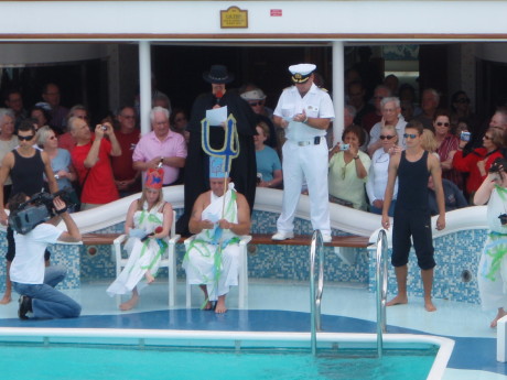
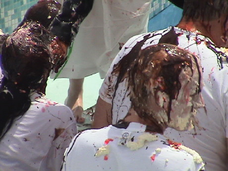 The guilty
parties are sentenced to "kiss the fish" and then they are slathered
with whipped cream, chocolate, jello and other goopy stuff. Then
everybody goes in the pool to wash off. In this ceremony, both
passengers and crew members are involved in the ceremony.
The guilty
parties are sentenced to "kiss the fish" and then they are slathered
with whipped cream, chocolate, jello and other goopy stuff. Then
everybody goes in the pool to wash off. In this ceremony, both
passengers and crew members are involved in the ceremony.
After the ceremony, I went for a swim in a freezing cold pool and
then spent some time is a hot tub. After that, it was time for a nap.
Such is the hard life on the high seas.
Sunday, April 20, 2008, Fortaleza, Brazil, about 2300 GST
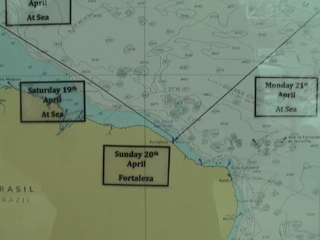 Fortaleza is the capital of the Ceara province of Brazil.
It is very near the equator and therefore very tropical. Today was a
pretty normal day here, hot and humid. For the last couple of days as
we paralleled the northeast coast of South America, the weather report
on the ship's TV has been consistently reporting humidity levels of
100%.
Fortaleza is the capital of the Ceara province of Brazil.
It is very near the equator and therefore very tropical. Today was a
pretty normal day here, hot and humid. For the last couple of days as
we paralleled the northeast coast of South America, the weather report
on the ship's TV has been consistently reporting humidity levels of
100%.
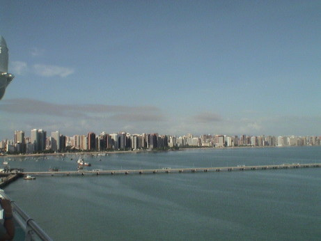 There are about 3.6 million people living
here. Many of these buildings are apartments, some are hotels. Spaced
in among and behind the tall buildings, there is are many small run
down structures as well.
There are about 3.6 million people living
here. Many of these buildings are apartments, some are hotels. Spaced
in among and behind the tall buildings, there is are many small run
down structures as well.
We didn't have a tour booked, but the ship arranged for free shuttle
busses to the central district which is just to the right of the end of
the row of tall structures, it was quite a distance and would not be
practical or safe on foot. They were very nice busses and the trip was
equivalent to what one might expect from the less expensive paid
tours.
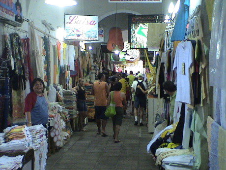 The one shuttle bus stop was the craft market.
This is a bunch of vendor stalls set up in an old prison. Fabrics, lace
and woman's clothing seemed to be the most common items. The prices
were not at all bad.
The one shuttle bus stop was the craft market.
This is a bunch of vendor stalls set up in an old prison. Fabrics, lace
and woman's clothing seemed to be the most common items. The prices
were not at all bad.
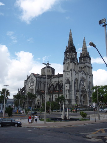 About three
blocks away is the main cathedral. This structure took 40 years to
build and seats 5,000.
About three
blocks away is the main cathedral. This structure took 40 years to
build and seats 5,000.
We were warned several times about petty crime. On the way to the
cathedral, we saw several police officers watching over the scene. A
little further down the road, we ran into some military police. When we
passed the last building, it became clear why. It was a regimental army
headquarters.
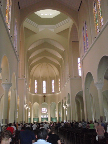 We arrived on Sunday morning and mass
was being held. It was all in Portuguese but the building had good
acoustics and when the congregation started singing, it sounded quite
good, especially because these people could really sing well.
We arrived on Sunday morning and mass
was being held. It was all in Portuguese but the building had good
acoustics and when the congregation started singing, it sounded quite
good, especially because these people could really sing well.
 Immediately next to the cathedral was the
Mercado Central, or central market. This is a purpose built building.
We were told that this was the place to go to buy just about anything.
Well over half of the shoppers in the market were locals.
Immediately next to the cathedral was the
Mercado Central, or central market. This is a purpose built building.
We were told that this was the place to go to buy just about anything.
Well over half of the shoppers in the market were locals.
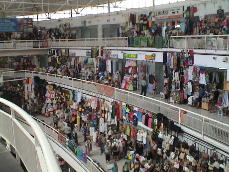 The place was literally filled with vendor
stalls around the outside on four levels with large sweeping walkways
wandering through the central part of the building. The amount of stuff
for sale almost amounted to a sensual assault. The vendors were not
overly pushy and the prices were good, but all we came away with was a
handmade refrigerator magnet. There was a set of hand carved and
painted masks that Sandy liked but she could not come to an agreement
on the price so she passed.
The place was literally filled with vendor
stalls around the outside on four levels with large sweeping walkways
wandering through the central part of the building. The amount of stuff
for sale almost amounted to a sensual assault. The vendors were not
overly pushy and the prices were good, but all we came away with was a
handmade refrigerator magnet. There was a set of hand carved and
painted masks that Sandy liked but she could not come to an agreement
on the price so she passed.
By the time we made it through the market, we were both wilting from
the heat and I was soaked in sweat. We made our way back to the old
prison and found the shuttle back to the ship. After a shower, some
clean clothes, lunch and a healthy dose of air conditioning, I felt
much better.
The ship departed for Dakar, Senegal at about 1750, somewhat late.
To get to Dakar, we have about 3 days at sea to cross the shortest span
across the Atlantic.
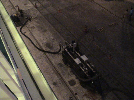 While I was out on deck watching the departure
activity, there was an engineering officer there on his break. The ship
had bunkered (taken on fuel) here via a pump on a trailer. There was a
fuel port on the dock and the fuel was pumped into the ship. Princess
buys the very cheapest fuel that they can get. In this form, it can't
be burned in the diesel engines because there is too much crud in it.
The ship has a complete fuel processing plant that removes the tar and
asphalt via mechanical and centrifugal separation. The sludge is stored
for delivery ashore or incineration at sea. The remaining fuel is
heated to 130°C to be injected into the low speed diesel engines.
The officer said that the engines could burn #2 diesel for awhile, but
it burns too quickly and generates too much explosive force. The
engines are not designed to deal with such a fast burning fuel for
long.
While I was out on deck watching the departure
activity, there was an engineering officer there on his break. The ship
had bunkered (taken on fuel) here via a pump on a trailer. There was a
fuel port on the dock and the fuel was pumped into the ship. Princess
buys the very cheapest fuel that they can get. In this form, it can't
be burned in the diesel engines because there is too much crud in it.
The ship has a complete fuel processing plant that removes the tar and
asphalt via mechanical and centrifugal separation. The sludge is stored
for delivery ashore or incineration at sea. The remaining fuel is
heated to 130°C to be injected into the low speed diesel engines.
The officer said that the engines could burn #2 diesel for awhile, but
it burns too quickly and generates too much explosive force. The
engines are not designed to deal with such a fast burning fuel for
long.
In the tropics, it gets dark really fast. When I went outside, it
was twilight and I was still able to take some pictures. 10 minutes
later, it was nearly completely dark. This is in stark contrast to the
Antarctic where sundown and sunrise took hours.
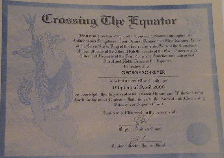 With our mail tonight, we
received our certificates, again, for our Equator crossing. We got one
on the New Zealand cruise as well.
With our mail tonight, we
received our certificates, again, for our Equator crossing. We got one
on the New Zealand cruise as well.
Monday, April 21, 2008, At Sea, at 1222 GST (GMT-2)
 Today is the first of three days at sea before we get to
Dakar. We recross the equator today pretty soon. The navigation display
on the TV at 1215 said that we were 0.01 degrees south. We should cross
over the equator right about now. The outside weather is clear,
80°F and 100% humidity.
Today is the first of three days at sea before we get to
Dakar. We recross the equator today pretty soon. The navigation display
on the TV at 1215 said that we were 0.01 degrees south. We should cross
over the equator right about now. The outside weather is clear,
80°F and 100% humidity.
We slept in today and then attended another lecture given by Robert
Schirn, a semi-retired deputy DA from Los Angeles county. Today's talk
was on the Patty Hearst case. Previous talks have been about the Robert
Kennedy assassination, OJ Simpson, the Hillside Stranglers and the
Charles Manson case. Robert was an unofficial office historian so he
has kept good records of these high profile cases.
This afternoon we will do our laundry as we sweated through most of
our remaining clean clothes yesterday in Fortaleza.
Tuesday, April 22, 2008, At Sea, about 1300 AZOST (GMT-1)
 We are somewhere in the mid Atlantic on our way to Dakar
the day after tomorrow. The sea has a 4 to 8 foot swell and the wind is
a gentle breeze. The sky is cloudy, the temperature is 80°F and the
humidity is still high at 100%.
We are somewhere in the mid Atlantic on our way to Dakar
the day after tomorrow. The sea has a 4 to 8 foot swell and the wind is
a gentle breeze. The sky is cloudy, the temperature is 80°F and the
humidity is still high at 100%.
The DA's lecture today was about the Ennis Cosby murder, a robbery
gone bad where Bill Cosby's son was shot dead while trying to fix a
flat tire in the Sepulveda Pass in LA County.
We also attended a port lecture concerning Dakar. They were pretty
blunt about the port. It is a bustling and "in-your-face" city of about
3 million with many more in the surrounding area. We have a ship's tour
to a local landmark, the Pink Lake of Retba, a brine lake that is
actually colored pink. We took the tour because it gets us out of the
city into the country side.
Dakar was the primary shipment point for slaves from Africa to all
over the new world. Most of the slaves were captured by rival tribes
and sold to the slave traders who packed them tightly on slave ships
and shipped them for a profit. The slave trader's fort was on an island
nearby, other tours go there.
Wednesday, April 23, 2008, At Sea, about 1230 GMT
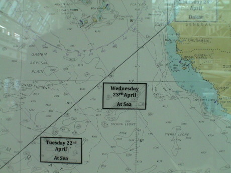 We've been turning the clocks ahead an hour a day for
several days now, somewhat like jet lag in the slow lane. We have
finally caught up with GMT. The weather has been pretty consistent, it
is still 80°F and 100% humidity, although last night we saw a
report from the bridge where the humidity had dropped to 97%.
We've been turning the clocks ahead an hour a day for
several days now, somewhat like jet lag in the slow lane. We have
finally caught up with GMT. The weather has been pretty consistent, it
is still 80°F and 100% humidity, although last night we saw a
report from the bridge where the humidity had dropped to 97%.
One of this morning's talks was by a former U-2 pilot about the U-2,
it's descendants, and the operational issues of U-2 flights. From past
reading, I was already familiar with most of the information that he
provided, but it was interesting nonetheless. The other talk was by
Robert Schirn again, this time about the Phil Spector case. The first
trial ended in a hung jury (10-2 to convict). The second trial is
pending, but from the presentation, it is pretty clear where this
prosecutor's's sentiments are. I should thank him for the information
as I live in LA county and I could be called for the jury pool.
Thursday, April 24, 2008, Dakar, about 1700 GMT
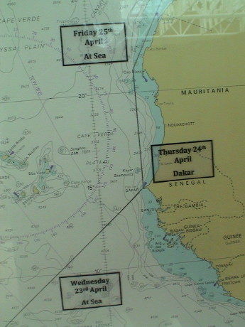 Today, we stopped at Dakar, Senegal. Senegal is a former
French colony that gained independence in about 1958. It is one of the
more prosperous western African countries, but it is still very poor.
Dakar is at the westernmost tip of Africa and it has a good harbor,
therefore it has advantages as a seaport.
Today, we stopped at Dakar, Senegal. Senegal is a former
French colony that gained independence in about 1958. It is one of the
more prosperous western African countries, but it is still very poor.
Dakar is at the westernmost tip of Africa and it has a good harbor,
therefore it has advantages as a seaport.
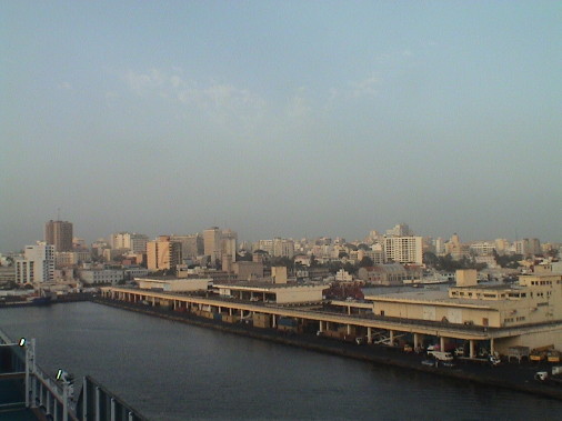 From a distance, Dakar looks like a fairly modern city.
However, closer up it fits the description that the port lecturer
provided. It is a raw, dirty, bustling and in-your-face place.
From a distance, Dakar looks like a fairly modern city.
However, closer up it fits the description that the port lecturer
provided. It is a raw, dirty, bustling and in-your-face place.
Our tour was to the Pink Lake of Retba, a brine lake somewhat north
of Dakar, near the Atlantic coastline. We picked this tour because it
took us out of town so that we could at least get a look at the
countryside. We were loaded on a tour bus and headed out of town. I
kept hearing sirens all the time and only later did I figure out
why.
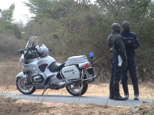 We had a police
escort of two motorcycle officers, riding BMWs, who were running
interference for us, Code 3 (lights and siren). This was to allow the
busses to get out of town and back in without getting stuck in traffic.
This turned out to be a good deal because we actually made it back 10
minutes after the ship was scheduled to sail. More on the trip back
later.
We had a police
escort of two motorcycle officers, riding BMWs, who were running
interference for us, Code 3 (lights and siren). This was to allow the
busses to get out of town and back in without getting stuck in traffic.
This turned out to be a good deal because we actually made it back 10
minutes after the ship was scheduled to sail. More on the trip back
later.
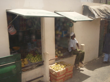 Trying to catch the flavor of a city from a tour bus
is a dicey proposition but we saw a lot. Much it was not very
attractive. This local market was an example of some of the best. It
was clean and organized, if not a little small.
Trying to catch the flavor of a city from a tour bus
is a dicey proposition but we saw a lot. Much it was not very
attractive. This local market was an example of some of the best. It
was clean and organized, if not a little small.
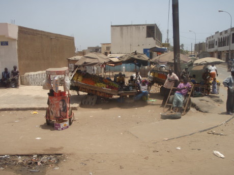 There were
street vendors everywhere. Most were selling to the locals, but
everything from streetlamp posts, steel plates, suitcases, and food was
available from the side of the road.
There were
street vendors everywhere. Most were selling to the locals, but
everything from streetlamp posts, steel plates, suitcases, and food was
available from the side of the road.
 Dakar seems
to be a place where old cars go to die. There were literally thousands
of obviously dead vehicles of all kinds littered the roadsides,
otherwise empty lots and businesses. Some had been dissected and their
parts were stacked up as in this photo. Others were merely hulks,
usually missing a motor or other rather significant part.
Dakar seems
to be a place where old cars go to die. There were literally thousands
of obviously dead vehicles of all kinds littered the roadsides,
otherwise empty lots and businesses. Some had been dissected and their
parts were stacked up as in this photo. Others were merely hulks,
usually missing a motor or other rather significant part.
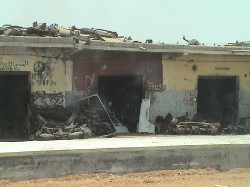
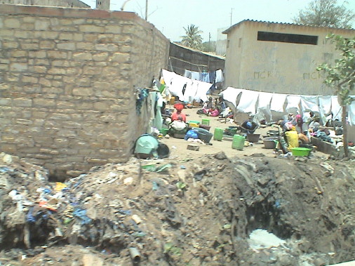 Some of Dakar looks like this. There is trash
EVERYWHERE. It would seem that littering is a national pastime. There
were also what appeared to be open sewers in many locations, the smell
sort of gave them away besides their positively evil appearance.
Some of Dakar looks like this. There is trash
EVERYWHERE. It would seem that littering is a national pastime. There
were also what appeared to be open sewers in many locations, the smell
sort of gave them away besides their positively evil appearance.
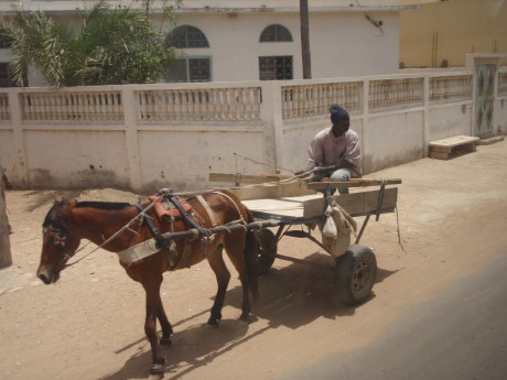 There are many regular trucks and heavy
vehicles on the roads, but there are also lots of these. It would seem
that horses, donkeys and mules are still an important transportation
resource.
There are many regular trucks and heavy
vehicles on the roads, but there are also lots of these. It would seem
that horses, donkeys and mules are still an important transportation
resource.
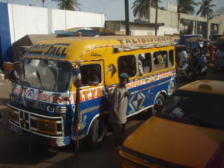 Public transportation is heavily dependent on busses
like this one. Some were larger, some smaller, but there were lots of
them. There was also an operating railroad paralleling much of our
route inland from Dakar.
Public transportation is heavily dependent on busses
like this one. Some were larger, some smaller, but there were lots of
them. There was also an operating railroad paralleling much of our
route inland from Dakar.
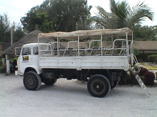 When we got to our destination, another form of
transportation awaited us, these 4x4 trucks. There were maybe a dozen
of them waiting for our group. This was the truck that we rode. I was
wondering where they were taking us that would require such a vehicle,
we found out soon enough.
When we got to our destination, another form of
transportation awaited us, these 4x4 trucks. There were maybe a dozen
of them waiting for our group. This was the truck that we rode. I was
wondering where they were taking us that would require such a vehicle,
we found out soon enough.
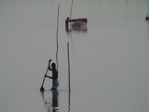 The first
part of the trip was around the Pink Lake of Retba. It wasn't anything
like pink in color today. Apparently the color only comes out under
certain weather conditions. The lake is a brine lake with about 6 times
the salt concentration as the oceans. The locals scrape up crystallized
salt from the bottom and load it into small boats. There is so much
salt that it cannot stay in suspension in the water so it collects on
the bottom of the lake.
The first
part of the trip was around the Pink Lake of Retba. It wasn't anything
like pink in color today. Apparently the color only comes out under
certain weather conditions. The lake is a brine lake with about 6 times
the salt concentration as the oceans. The locals scrape up crystallized
salt from the bottom and load it into small boats. There is so much
salt that it cannot stay in suspension in the water so it collects on
the bottom of the lake.
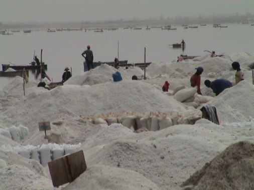 The salt is
then hauled ashore and piled up, bagged and shipped out. The piles of
salt apparently belonged to individuals because most were tagged with a
sign. The salt was packed into either 18 or 50 kilogram bags, and
loaded onto trucks to be hauled away. This has got to be hard work for
little return as salt is not a particularly scarce commodity.
The salt is
then hauled ashore and piled up, bagged and shipped out. The piles of
salt apparently belonged to individuals because most were tagged with a
sign. The salt was packed into either 18 or 50 kilogram bags, and
loaded onto trucks to be hauled away. This has got to be hard work for
little return as salt is not a particularly scarce commodity.
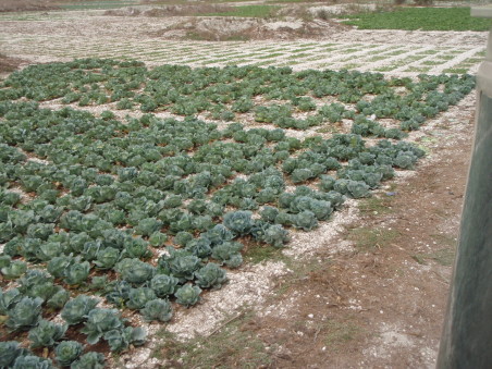 After traveling around the east side of the lake
(going northward), the trucks entered an area that was being farmed in
obviously poor soil. There were large pits dug into the rocky ground
that were wells, one can be seen in the background. Each had a foot
trail leading out of it so that the farmers could carry water by the
bucket to water their little plots. This one was one of the nicest of
the bunch, the rest were considerably more meager.
After traveling around the east side of the lake
(going northward), the trucks entered an area that was being farmed in
obviously poor soil. There were large pits dug into the rocky ground
that were wells, one can be seen in the background. Each had a foot
trail leading out of it so that the farmers could carry water by the
bucket to water their little plots. This one was one of the nicest of
the bunch, the rest were considerably more meager.
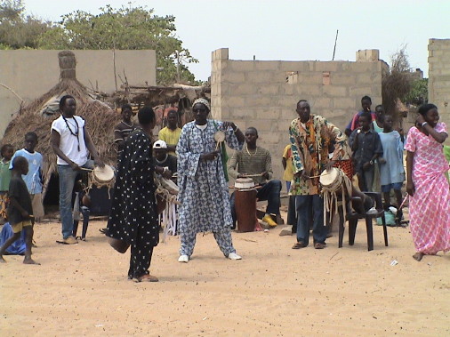 Then we passed through some dunes and
the driver leaned out of the cab and yelled "papa" and pointed to some
huts nearby. This was apparently his father's home. Then we drove
through more sand into a "semi-nomadic" village. There was a group of
drummers and dancers there providing some entertainment.
Then we passed through some dunes and
the driver leaned out of the cab and yelled "papa" and pointed to some
huts nearby. This was apparently his father's home. Then we drove
through more sand into a "semi-nomadic" village. There was a group of
drummers and dancers there providing some entertainment.
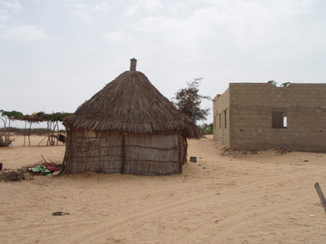 There were two primary kinds of structures in this
village, straw huts and concrete block building ruins. The huts were in
use. The block buildings were mostly just walls. Many had clearly been
roughly constructed but never finished. All were abandoned. The block
building in this photo was one of the best, most were in much worse
shape.
There were two primary kinds of structures in this
village, straw huts and concrete block building ruins. The huts were in
use. The block buildings were mostly just walls. Many had clearly been
roughly constructed but never finished. All were abandoned. The block
building in this photo was one of the best, most were in much worse
shape.
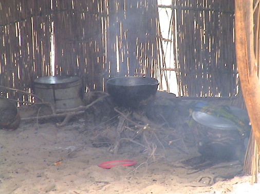 This
lean-to was in current use as a kitchen. There was a cooking fire
going, hence all the smoke. Outside, various pots and buckets were
scattered about.
This
lean-to was in current use as a kitchen. There was a cooking fire
going, hence all the smoke. Outside, various pots and buckets were
scattered about.
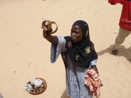 Everywhere we stopped, there were vendors selling
trinkets. They were REALLY pushy and as the trucks or busses were
getting ready to leave, they got pushier but also tended to accept
deals that they had previous refused outright.
Everywhere we stopped, there were vendors selling
trinkets. They were REALLY pushy and as the trucks or busses were
getting ready to leave, they got pushier but also tended to accept
deals that they had previous refused outright.
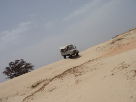 At the village, all of the drivers were letting air
out of their tires. This gave me a clue as to what was to come. The
truck convoy headed out into some pretty serious sand dunes and bounced
around for awhile. Over the last dune, we came to pounding surf, the
shoreline of the Atlantic Ocean. We stopped on the beach for awhile,
then proceeded south along the shore. Then the convoy abruptly turned
inland over some more dunes and descended to the "resort" where we
started out. There were more vendors there, even more pushy than
before.
At the village, all of the drivers were letting air
out of their tires. This gave me a clue as to what was to come. The
truck convoy headed out into some pretty serious sand dunes and bounced
around for awhile. Over the last dune, we came to pounding surf, the
shoreline of the Atlantic Ocean. We stopped on the beach for awhile,
then proceeded south along the shore. Then the convoy abruptly turned
inland over some more dunes and descended to the "resort" where we
started out. There were more vendors there, even more pushy than
before.
The resort gave us some sodas for refreshment and we loaded back
onto the tour busses. All was well until we entered the traffic of
Dakar again. The police escort then became frustrated with the
situation and herded the bus convoy to the WRONG side of the highway
and forced a path for us. When we finally became stuck, they led us
down some truly narrow back streets and back out onto the highway, in
the wrong direction again. The bus drivers bounced the busses over
curbs, medians and across the centers of traffic circles instead of
trying to go around. This kind of driving would have landed the bus
drivers in jail in the US.
We got back to the ship about 10 minutes after it was scheduled to
sail, but the ship won't leave if a ship scheduled tour hasn't
returned. Passengers that have made their own arrangements and are late
getting back aren't given such consideration. The ship leaves without
them.
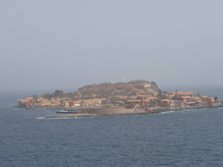 As the ship left
port, we passed by one of the more famous landmarks of Dakar. This is
Goree Island, the former slave trade prison/port. Millions of African
were sold into slavery here and shipped to the Americas. Other tours
were there today.
As the ship left
port, we passed by one of the more famous landmarks of Dakar. This is
Goree Island, the former slave trade prison/port. Millions of African
were sold into slavery here and shipped to the Americas. Other tours
were there today.
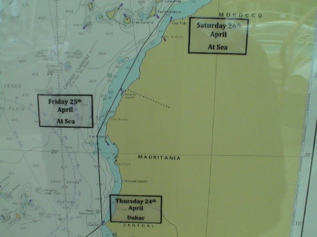
Friday, April 25, 2008, At Sea, about 1115 GMT
 We have another of two sea days between Dakar and Morocco.
The weather has become noticeably cooler, it down to 62°F but the
humidity is still 100%. The sky is very cloudy and we have a more
pronounced swell that we have experienced yet on this trip. We noticed
the cooling as we approached the coast of Africa. It was forecast to be
95°F in Dakar, but I doubt that the temperature even exceeded
80°F.
We have another of two sea days between Dakar and Morocco.
The weather has become noticeably cooler, it down to 62°F but the
humidity is still 100%. The sky is very cloudy and we have a more
pronounced swell that we have experienced yet on this trip. We noticed
the cooling as we approached the coast of Africa. It was forecast to be
95°F in Dakar, but I doubt that the temperature even exceeded
80°F.
We had a bit of minor excitement last night, but not the good kind.
We were in the cabin and I was trying to stream video from the tape
that I filled in Dakar. I was having troubles with data dropouts and
corrupted video clips. Then I heard a pop and then a buzz that sounded
like an AC power problem. Nothing appeared to die immediately but the
video streaming failed and iMovie hung and then quit. Then I smelled
something electronic burning. I shut everything down and then located
the problem. The wall wart (power supply) for the powered USB hub that
I use to power two external USB disks had simply failed and burned up
internally. The video streaming failed because with the loss of power
to the hub, the computer could not supply enough USB power to the disks
to keep them running and they dropped off line. I don't have a
replacement for that wall wart here so I have had to change operating
modes. Sandy has a two-headed USB cable that fits these drives. It
derives power from two USB ports on the computer to come up with enough
total power to drive a disk. However, it consumes all the USB ports on
the computer so that I can run only one drive at a time or a mouse.
Sandy and I are sharing the cable so that each of us can let Time
Machine (automatic backup software for the Macintosh) a couple of times
a day or I can run the other external drive to store streamed
video.
Everything else seems to have survived the abrupt failure of this
wall wart and we have workarounds so that no serious damage has been
done. I'll see about getting the thing replaced when we get home.
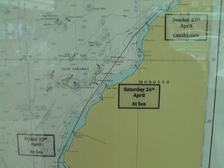
Saturday, April 26, 2008, At Sea, about 1100 CET (GMT+1)
 This is the last of the multiple sea days on this cruise.
There are only two more single sea days left. After we enter the
Mediterranean Sea, ports are close enough together to allow a stop
nearly every day.
This is the last of the multiple sea days on this cruise.
There are only two more single sea days left. After we enter the
Mediterranean Sea, ports are close enough together to allow a stop
nearly every day.
Even though Casablanca is on GMT, we are one hour ahead of GMT. We
have been instructed to use ship's time, not local time. There will be
one more time change to get us onto the time zone that most of the
western Mediterranean uses. Further we are scheduled to enter
Casablanca one hour later than originally scheduled and our speed has
been 22+ knots for quite a while. Since the ship is rated for 21.5
knots, the captain pretty obviously has the pedal to the metal to try
to make up some time. We are not sure of the reasons for all of
this.
Tomorrow, after we dock at Casablanca we are supposed to ride the
Marrakech Express to Marrakech. It'll take all day so we won't actually
see much of Casablanca. Then it is a short sail overnight to Gibraltar
where we have a tour of the WWII caves scheduled.
The weather has become much cooler and drier, about 70°F and 40%
humidity, much more like southern California. I expect the temperature
in the Med to warm up a little but we'll see.
In honor of our stop at Casablanca tomorrow, the ship is showing the
movie "Casablanca" in the theater this afternoon. The folks that will
tour Casablanca have been warned that there is no "Rick's Cafe
Americain" (aka Rick's place) there so don't bother looking for it.
Sunday, April 27, 2008, Casablanca, about 2245 CET (GMT+1)
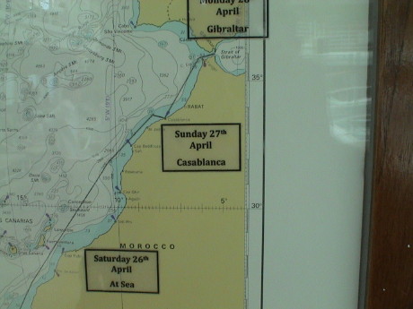 It's very late and we have an early day tomorrow so I
don't have time now to go through the photos and write some narrative.
That'll probably happen late tomorrow night after our visit to
Gibraltar or the next day while we're at sea.
It's very late and we have an early day tomorrow so I
don't have time now to go through the photos and write some narrative.
That'll probably happen late tomorrow night after our visit to
Gibraltar or the next day while we're at sea.
Monday, April 28, 2008, Gibraltar, about 1530 CEST (GMT+2)
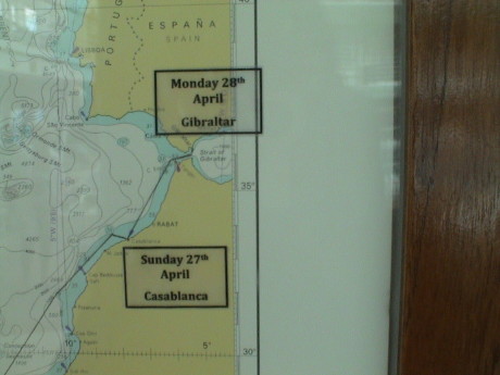 We've made it to Gibraltar and done our tour, but that
story will have to wait until I get caught up on Morocco.
We've made it to Gibraltar and done our tour, but that
story will have to wait until I get caught up on Morocco.
We had a tour scheduled to Marrakech, a city inland from Casablanca.
This was a tour that Sandy particularly wanted because she thought it
would be by train. However, the train turned out to be a tour bus, and
one with a broken air conditioner at that.
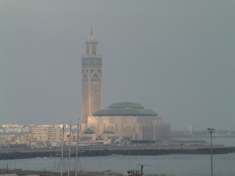 King Hussein II built this huge mosque
right on the shoreline of Casablanca. This was as close as we got to
the mosque as we saw it from the ship as it pulled in to port.
King Hussein II built this huge mosque
right on the shoreline of Casablanca. This was as close as we got to
the mosque as we saw it from the ship as it pulled in to port.
The tour got off to a late start, primarily due to the massive
numbers of people trying to get off the ship all at once and the
congestion of tour busses on the dock. It was cool then and we didn't
realize that the A/C on the bus was not functioning, but I did notice
that two sliding windows at the center of the bus were open. I thought
that that was a little odd but it didn't click then.
Casablanca is the largest and busiest city in Morocco. We didn't get
to see much of it but what did see indicated prosperity on a whole
different level from Dakar.
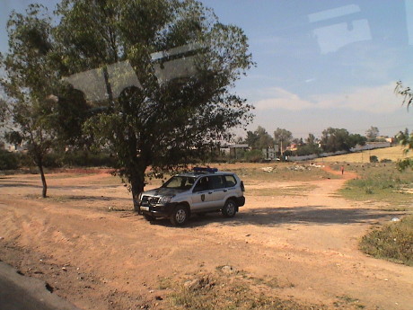 As we traveled
on the bus out of Casablanca, we saw lots of police including this
speed trap. The city itself was clean and organized and the roads were
generally quite good. We soon got onto a tollway that lead us to
Marrakech, a three plus hour drive each way.
As we traveled
on the bus out of Casablanca, we saw lots of police including this
speed trap. The city itself was clean and organized and the roads were
generally quite good. We soon got onto a tollway that lead us to
Marrakech, a three plus hour drive each way.
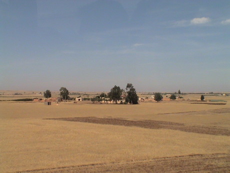 Much of the
Moroccan countryside outside of Casablanca is coastal plains that are
planted mostly in grains. The countryside was like this for nearly 100
miles.
Much of the
Moroccan countryside outside of Casablanca is coastal plains that are
planted mostly in grains. The countryside was like this for nearly 100
miles.
There were occasionally small herds of cattle and goats, but the
cash livestock is sheep. Moroccans eat lots of lamb and wool production
figures heavily into the economy, however not nearly as much as New
Zealand.
The population of Morocco is a mix of several cultures. Jews have
been here for thousands of years. The Berbers are of mixed European
ancestry. African natives are here as well as the dominant Arabs. Islam
is the primary religion of the country, although it is a liberal form
that tolerates other cultures well.
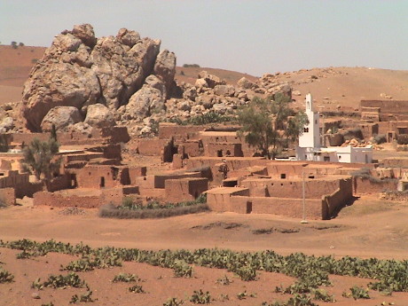 About halfway to Marrakech, we entered Berber
lands. The Berbers are a tribe that has inhabited this area for a very
long time. They build their houses, usually single story, around a
central walled courtyard. The Berber lands are usually pasture land,
and not very good land at that as they were pushed out of the better
lands by the Arabs that arrived in the 700's and conquered the whole of
north Africa.
About halfway to Marrakech, we entered Berber
lands. The Berbers are a tribe that has inhabited this area for a very
long time. They build their houses, usually single story, around a
central walled courtyard. The Berber lands are usually pasture land,
and not very good land at that as they were pushed out of the better
lands by the Arabs that arrived in the 700's and conquered the whole of
north Africa.
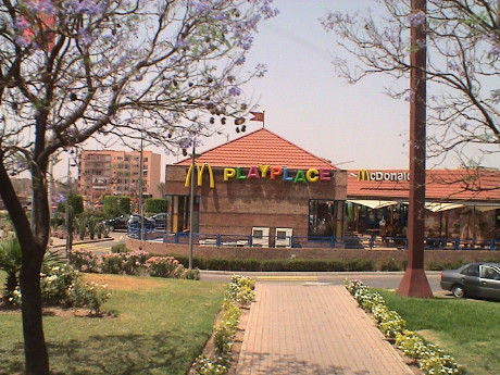 As we rolled into
Marrakech, we realized that we just couldn't get away from all American
influences.
As we rolled into
Marrakech, we realized that we just couldn't get away from all American
influences.
The color of all of the buildings is regulated to be this natural
earth color. Further, the height of the buildings cannot exceed that of
the tower of the central mosque which is 69 meters.
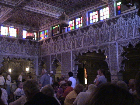 We were late getting into Marrakech so after
driving around a bit, we were taken to this restaurant in the Jewish
section of town although it served traditional Moroccan fare. Jews have
lived here for a couple of thousand years and are accepted by the more
liberal flavor of Islam practiced here.
We were late getting into Marrakech so after
driving around a bit, we were taken to this restaurant in the Jewish
section of town although it served traditional Moroccan fare. Jews have
lived here for a couple of thousand years and are accepted by the more
liberal flavor of Islam practiced here.
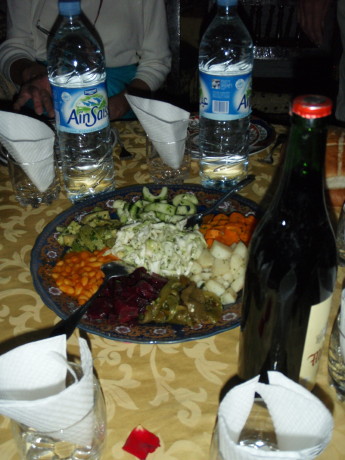 This
was our appetizer. It is a variety of marinated vegetables. The main
course was a well prepared chicken dish, then a course of vegetables
was served over couscous. There was one part that I thought was
particularly good but nobody else seemed to like it. I thought that it
may have been a mild green pepper, but somebody else said that it was
cactus. There were extensive stands of prickly-pear cactus growing
along the roads in the area of Marrakech. The Berbers were apparently
using it as fencing.
This
was our appetizer. It is a variety of marinated vegetables. The main
course was a well prepared chicken dish, then a course of vegetables
was served over couscous. There was one part that I thought was
particularly good but nobody else seemed to like it. I thought that it
may have been a mild green pepper, but somebody else said that it was
cactus. There were extensive stands of prickly-pear cactus growing
along the roads in the area of Marrakech. The Berbers were apparently
using it as fencing.
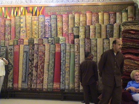 Then the tour started to go south. We were
supposed to be allowed some free shopping time in the bazaar but
instead, we were lead through a maze of twisting back alleys to a rug
dealer's shop where we were given a pitch for some very highly priced
woolen rugs. For only $3000, we could have had one shipped to our
door.
Then the tour started to go south. We were
supposed to be allowed some free shopping time in the bazaar but
instead, we were lead through a maze of twisting back alleys to a rug
dealer's shop where we were given a pitch for some very highly priced
woolen rugs. For only $3000, we could have had one shipped to our
door.
They then took us through another maze to a shop that sold perfumes
and other scents. The odor was so strong I could not even go in the
place. Then they walked us quickly through another maze of shops that
we would have liked to go through to a shop that sold highly priced,
but nice looking, Moroccan artifacts.
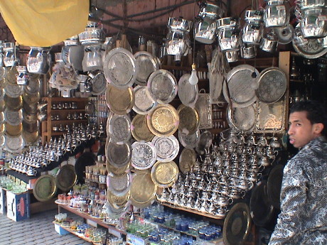 After
most of the people on the tour bitched loudly, they gave us 15 minutes
in the main bazaar, but we were so tired and hot at that point that we
didn't feel like shopping. Further, several people in the group didn't
show up at the meeting spot at the appointed time. Eventually, they did
arrive but the tour was running seriously late.
After
most of the people on the tour bitched loudly, they gave us 15 minutes
in the main bazaar, but we were so tired and hot at that point that we
didn't feel like shopping. Further, several people in the group didn't
show up at the meeting spot at the appointed time. Eventually, they did
arrive but the tour was running seriously late.
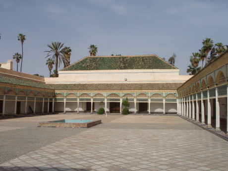 The tour included a visit to the Bahia Palace, a
residence of some of the kings and prime ministers. The whole place was
finely decorated with tile patterns, plaster carvings and painted cedar
ceilings. This is a courtyard where celebrations were held after
successful negotiations with visiting heads of state and tribal
leaders.
The tour included a visit to the Bahia Palace, a
residence of some of the kings and prime ministers. The whole place was
finely decorated with tile patterns, plaster carvings and painted cedar
ceilings. This is a courtyard where celebrations were held after
successful negotiations with visiting heads of state and tribal
leaders.
The tour was running progressively later and later through the day,
and it was getting hotter and hotter. The bus was a furnace unless it
was going fast enough to circulate some air through those two little
windows. It was pretty uncomfortable. By the time that we eventually
left Marrakech, it was pretty clear that we weren't going to get back
even close to on time. The ship was due to sail at 2030 and the tour
was originally scheduled to return at that time, all six busses worth,
so there was no margin in the schedule. We didn't know the status of
the other busses when we left Marrakech, but we did see one on the way
back. They were leaving a rest stop when we pulled in.
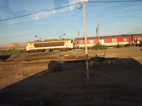 On the way back, nearing sunset, we drove
by a train station with a train waiting. This is a close as we got to
the Marrakesh Express.
On the way back, nearing sunset, we drove
by a train station with a train waiting. This is a close as we got to
the Marrakesh Express.
We saw some pretty extensive rail lines on this bus trip. The
Moroccan railways are modern. The sections that we saw were completely
electrified, used concrete ties and welded rail. Since this was a
French colony for awhile, it is not surprising to see a French
locomotive at the head of this train.
We passed through a fairly large town just after sunset and things
had cooled off considerably. The town was packed with people out and
about, doing their business. The guide explained that this was the time
that the locals got down to business as it was often too hot earlier in
the day to be out.
We got stuck in traffic on the way back and by the time that we got
back to the ship, we were fully an hour and a half late. All the other
busses were in, we were the last one. This is the third tour that we
had taken on this cruise where the ship had to wait for our tour to
return. The ship was fully ready to leave. As soon as we were on board,
the gangway was pulled in, the ship was buttoned up and then it
departed in the span of less than 5 minutes.
Leaving Casablanca late also made us late getting into Gibraltar by
about an hour. We got up early to go outside and see what the Strait of
Gibraltar looked like at sunrise. It was misty but we could see land on
both sides. It was also cold and windy so we didn't stay outside very
long. We got breakfast and waited for our tour in Gibraltar of the WWII
fortifications.
Gibraltar is an independently governed part of the British Empire.
Their governor is appointed by the British Crown and defense and
foreign policy is handled by Britain, but all local matters are handled
locally. This key chunk of rock guards the entrance to the
Mediterranean Sea and has been fought over many times. It was occupied
by the Moors, the Spanish and eventually the British. Both the French
(Napoleon) and the Nazis attempted to invade. Napoleon put the rock
under siege for nearly 4 years but the rock held. The Germans had plans
to invade for years and came up with detailed plans to do it, which
probably would not have worked before giving up due to the resource
demands of the Russian front made an invasion impractical. The British
presence on the rock probably eventually thwarted the Nazi plans for
domination of the Mediterranean. The rock was a key jumping off point
for Operation Torch, the Allied invasion of North Africa.
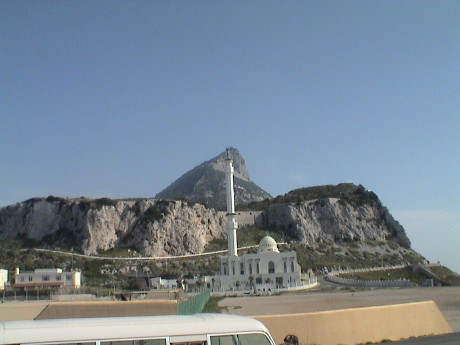 The tour bus first took us to the very
southern tip of Gibraltar. This is a view looking north from near the
lighthouse at the southern tip back at the highest part of the
rock.
The tour bus first took us to the very
southern tip of Gibraltar. This is a view looking north from near the
lighthouse at the southern tip back at the highest part of the
rock.
That is indeed a mosque in the foreground. It was built in 1997 for
the benefit of the Moroccans that live and work on Gibraltar. Funding
was provided by King Faad of Saudi Arabia. It is a odd place for a
mosque, nobody lives near it and it is not easy to get to, but land is
scarce here so things get built in some odd spots.
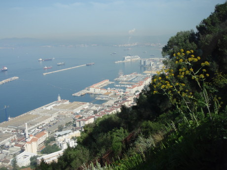 We drove up
twisty and narrow roads to a spot on the west face of the rock
overlooking the city of Gibraltar. This view is pretty much the whole
town. This is also the spot where some of the Barbary Apes live.
We drove up
twisty and narrow roads to a spot on the west face of the rock
overlooking the city of Gibraltar. This view is pretty much the whole
town. This is also the spot where some of the Barbary Apes live.
There were no full sized tour busses that we saw on Gibraltar. I can
understand why because the small bus in which we rode (22 passengers)
could barely make some of the turns and tunnels. Anything bigger could
not be driven here at all.
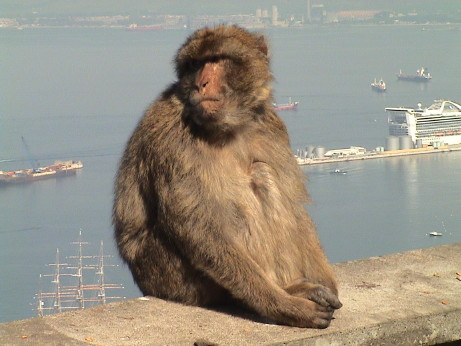 These
Macaques, the Barbary Apes, live all over the rock. Nobody is really
sure how they got here, but they are now a fixture. They are quite bold
and will climb on visitors that they thing might have some food. It is
illegal to feed them though. We were advised not to touch them
ourselves as they do bite. However the apes didn't seem to mind
touching the people. The population of apes is thought to be about 250
individuals which is deemed to be too many. There is some considerable
controversy about an upcoming cull of the ape population.
These
Macaques, the Barbary Apes, live all over the rock. Nobody is really
sure how they got here, but they are now a fixture. They are quite bold
and will climb on visitors that they thing might have some food. It is
illegal to feed them though. We were advised not to touch them
ourselves as they do bite. However the apes didn't seem to mind
touching the people. The population of apes is thought to be about 250
individuals which is deemed to be too many. There is some considerable
controversy about an upcoming cull of the ape population.
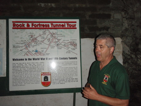 The tunnels that
we came to see were mostly dug during WWII as defensive measures for
the "rock" however some were dug in the 18th century for the same
purpose. There are about 30 miles of tunnels in the rock. There aren't
30 miles of roads. We toured less than 1% of the complex much of which
is still in use by the military.
The tunnels that
we came to see were mostly dug during WWII as defensive measures for
the "rock" however some were dug in the 18th century for the same
purpose. There are about 30 miles of tunnels in the rock. There aren't
30 miles of roads. We toured less than 1% of the complex much of which
is still in use by the military.
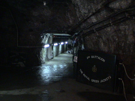 The
tunnels were drilled and blasted out of the limestone of the rock. The
floor of the tunnels is paved in concrete, the passages are often wide
and tall enough for motor vehicles. In places were there the rock tends
to be loose, the walls and ceiling are protected with cyclone fence
bolted to the rock face. Most of the cave is wet and dripping as
limestone caves tend to be.
The
tunnels were drilled and blasted out of the limestone of the rock. The
floor of the tunnels is paved in concrete, the passages are often wide
and tall enough for motor vehicles. In places were there the rock tends
to be loose, the walls and ceiling are protected with cyclone fence
bolted to the rock face. Most of the cave is wet and dripping as
limestone caves tend to be.
It was a complete city inside with all the services needed to
support up to 17,000 military inhabitants. The civilian population was
evacuated and settled all over the British world for the duration of
the war.
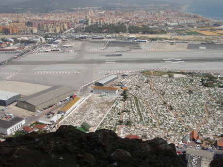 The debris that was taken out of the
tunnels as they were dug was dragged just north of the rock and used to
make an runway on reclaimed land. This view is from a tunnel opening
called "Jock's Balcony" on the sheer north face of the rock. This
runway is unique in that it has a road crossing the runway at grade,
the only such crossing in the world. Where land is scarce, one has to
make do. The runway is twice as long as the peninsula is wide so that
without some additional tunneling or this grade crossing, the runway
would divide the peninsula. The airport is right up against the Spanish
fence. All the buildings beyond the airport are on Spanish soil. At the
lower part of the photo is a cemetery which is also getting a bit
crowded.
The debris that was taken out of the
tunnels as they were dug was dragged just north of the rock and used to
make an runway on reclaimed land. This view is from a tunnel opening
called "Jock's Balcony" on the sheer north face of the rock. This
runway is unique in that it has a road crossing the runway at grade,
the only such crossing in the world. Where land is scarce, one has to
make do. The runway is twice as long as the peninsula is wide so that
without some additional tunneling or this grade crossing, the runway
would divide the peninsula. The airport is right up against the Spanish
fence. All the buildings beyond the airport are on Spanish soil. At the
lower part of the photo is a cemetery which is also getting a bit
crowded.
After the tour, we shopped around a bit for the camera that Sandy
wanted. We found one, but at almost twice the price we wanted so we
returned to the ship after a little more shopping.
Tuesday, April 29, 2008, At Sea, about 1215 CEST (GMT+2)
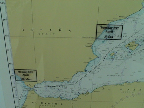 The navigator posted a new navigational chart yesterday.
The old one was auctioned off last night. We are currently between the
island of Mallorca and the coast of Spain.
The navigator posted a new navigational chart yesterday.
The old one was auctioned off last night. We are currently between the
island of Mallorca and the coast of Spain.
The satellite internet connection was down the whole time that we
were in Gibraltar, I thought that it might have been due to blockage by
the rock but that apparently wasn't the case as it didn't come back up
until this morning. It is more likely that the satellite antenna
patterns don't cover the Strait of Gibraltar very well as when the
internet did come up, it was really slow as it had been when we left
Morocco. I didn't try to upload the page updates for Morocco or
Gibraltar until the coverage got better. We may have actually switched
satellites with the coverage area at the Strait not being very good for
either of them.
We booked a tour out of Cannes for tomorrow morning, it'll take 3 to
4 hours round trip to drive into the mountains to a medieval fortress.
We'll be back to Monaco on the next leg of the cruise so we'll have an
opportunity to tour the French Riviera then. After we get back from the
tour sometime around noon, we'll have an opportunity to walk around
downtown Cannes.
The 2nd leg of the cruise will be a busy one, we have only one more
sea day. I've come to enjoy the days at sea, they are very
relaxing.
We got a letter last night that explained the procedure for the
switchover to the next cruise. We will retain the same cabin and only
have to get a new cruise card (combination room key, charge card and
boarding pass). We will be taking a tour of Rome that day so that we
will be off the ship most of the day. We've been told by an Italian
crew member than Civitavecchia is a pit, there is no point in actually
going there except to actually disembark or embark the ship.
Wednesday, April 30, 2008, Cannes, France, about 1500 CEST
(GMT+2)
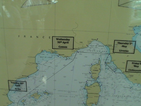 Today, the port of call was Cannes on the French Riviera.
We had a tour booked but we didn't take it due to a small problem.
Today, the port of call was Cannes on the French Riviera.
We had a tour booked but we didn't take it due to a small problem.
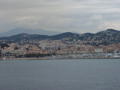 This is as close as we got to Cannes. We didn't go
ashore because I contracted a case of Montezuma's Revenge yesterday
afternoon. I was laid low for about 24 hours. We just got back from
lunch, the first real food, besides a single apple, that I had been
able to eat since yesterday. I am sufficiently improved such that we
probably will be able to make our tour tomorrow afternoon to Pisa in
Italy.
This is as close as we got to Cannes. We didn't go
ashore because I contracted a case of Montezuma's Revenge yesterday
afternoon. I was laid low for about 24 hours. We just got back from
lunch, the first real food, besides a single apple, that I had been
able to eat since yesterday. I am sufficiently improved such that we
probably will be able to make our tour tomorrow afternoon to Pisa in
Italy.
Thursday, May 1, 2008, Livorno, Italy, about 1900 CEST (GMT+2)
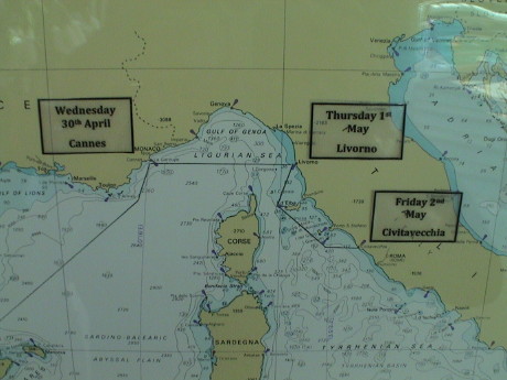 We pulled into Livorno this morning. I went to see the
ship's doctor this morning, and predictably, he quarantined me to my
room for 24 hours. This blows our shore excursion to Pisa today, but at
least, we can get a refund. A couple of crew members are here in the
room now sanitizing it. However, my condition has materially improved
and by tomorrow I should be fully recovered.
We pulled into Livorno this morning. I went to see the
ship's doctor this morning, and predictably, he quarantined me to my
room for 24 hours. This blows our shore excursion to Pisa today, but at
least, we can get a refund. A couple of crew members are here in the
room now sanitizing it. However, my condition has materially improved
and by tomorrow I should be fully recovered.
Tomorrow is the end of the first segment of our cruise. Most of the
passengers are getting off and a new crop will come on. However, we
will remain. We cancelled our tour of Rome and got a refund because
that one hadn't passed its cutoff time for a refund. With the Doctor's
stamp, we can get a refund on the other two that we paid for as
well.
Sandy reports that the weather was fabulous in Livorno but I didn't
even see the sun because I'm stuck in the room until tomorrow about
noon.
Livorno is a gateway port to Pisa and Florence, there is not much
else to do here. Since we'll be back in Livorno in about three days,
we'll rebook the same tour that we'd planned to take today.
Due to my "condition" our regular room steward is not allowed to
service our room. They sent in the Hazmat team instead.
Friday, May 2, 2008, Civitavecchia, Italy, about 1730 CEST
(GMT+2)
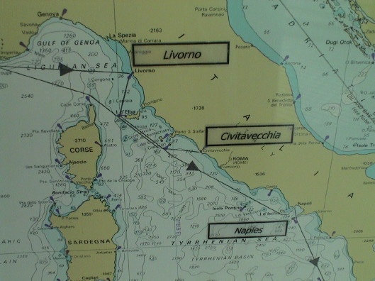 Civitavecchia is the port of entry for Rome which is a
€200 cab ride away. Taxis aren't cheap here.
Civitavecchia is the port of entry for Rome which is a
€200 cab ride away. Taxis aren't cheap here.
I didn't see the light of day until after 1300. We were supposed to
get a call about noon for a formal release, but the call never came.
Sandy went down to the Purser's desk to inquire and they issued a
release so I'm out.
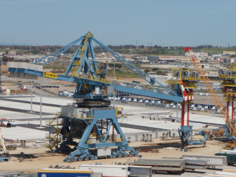 After I was sprung, I went immediately
outside to soak up some sun and air and to look around, even it was
just a cargo port. Near the ship were two of these huge machines. I
never did figure out exactly what they were, but since we were in a
port and the machines seemed to have some sort of conveyer mechanism at
what appeared to be the business end, they must be loader/unloader
machines for bulk cargo such as grain. However, they were sitting on
short track sections where they couldn't get near a ship. I eventually
concluded that they were in storage on the dock and would be eventually
moved to a new section of dock adjacent to where they were stored.
After I was sprung, I went immediately
outside to soak up some sun and air and to look around, even it was
just a cargo port. Near the ship were two of these huge machines. I
never did figure out exactly what they were, but since we were in a
port and the machines seemed to have some sort of conveyer mechanism at
what appeared to be the business end, they must be loader/unloader
machines for bulk cargo such as grain. However, they were sitting on
short track sections where they couldn't get near a ship. I eventually
concluded that they were in storage on the dock and would be eventually
moved to a new section of dock adjacent to where they were stored.
Our access to our email and web site hadn't worked for more than a
day but the rest of the web did. I therefore couldn't upload any
updates or get my email. Since today is a turnaround day (one cruise
ending, another beginning), I figured that they might have switched
over to the new cruise by now, but when I logged in, it accepted my old
password. My domain at girr.org was working again, at least the email
part was. Sandy had burned off all but one minute of our time last
night and apparently, I used the other minute before it logged me
off.
After most passengers were on board, the internet service came back
on again after being entirely non-functional for the whole afternoon.
This time, we got a promotion to the "platinum" level of our status in
the "Princess Captain's Circle" so that we get an internet credit of
$100, which is only 280 minutes worth. However, for 11 actual days,
this gives us about 25 minutes per day. We survived on 15 minutes per
day on the first part of the cruise.
I've added better overall cruise maps to the upper part of this page
as we'll be winding all around the Mediterranean, often retracing a
previous course.
day, May xx, 2008, place, about time CEST (GMT+2)
 This cruise took us back to the French Riviera but this
time to Monaco instead of Cannes. As far as I can tell, Monaco and
Monte Carlo are essentially the same thing. Monaco is the country,
Monte Carlo is the city that occupies the whole country.
This cruise took us back to the French Riviera but this
time to Monaco instead of Cannes. As far as I can tell, Monaco and
Monte Carlo are essentially the same thing. Monaco is the country,
Monte Carlo is the city that occupies the whole country.
We went on a bus tour right out of Monte Carlo and back into France
to visit the medieval village of St. Paul de Vence and a perfume
factory. The perfume factory was, as expected, a sales stop for
Fragonard perfume. The factory itself was over 100 years old and more
of a museum than a working factory although they could produce perfume
there still.
However, the tour took over hither and yon and we got a good look
around.
 A good piece of Monte Carlo can be seen in this
photo. The castle and old town are on the hill to the right. To the
left of the harbor is the rest of the town including the famous casino.
The whole place is about the size of Hermosa Beach, CA, about a mile
wide and half a mile deep. There doesn't seem to be a square inch of
unused land and much of it has been tunneled under as well.
A good piece of Monte Carlo can be seen in this
photo. The castle and old town are on the hill to the right. To the
left of the harbor is the rest of the town including the famous casino.
The whole place is about the size of Hermosa Beach, CA, about a mile
wide and half a mile deep. There doesn't seem to be a square inch of
unused land and much of it has been tunneled under as well.
At the end of the month, the place is going to get crazy because of
the Formula 1 race to be held there. They were setting up for it and
the bus drove on part of the race course.
The "frontier" between Monaco and France turned out to be a stop
sign and a speed bump. If you didn't know it was there, you would miss
it.
 We saw no large cars anywhere, many were really small
and there were lots of motor scooters. This is the reason. The price
may look good until you find that it by liter AND the price is in Euro.
Figured in $US at today's exchange rate, the French are paying about
$9/gal.
We saw no large cars anywhere, many were really small
and there were lots of motor scooters. This is the reason. The price
may look good until you find that it by liter AND the price is in Euro.
Figured in $US at today's exchange rate, the French are paying about
$9/gal.
Housing is also pretty expensive. Figure on paying €3M for a
reasonable house, more in Monaco itself.
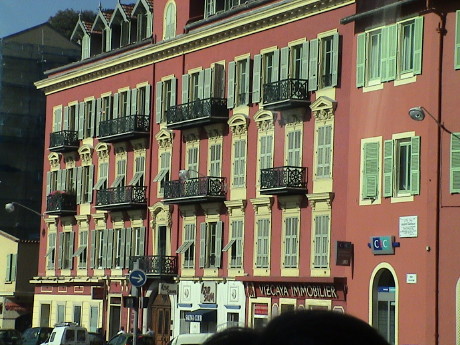 Our tour wandered along the coast through Nice. This is
a pretty town with wider streets than Monte Carlo. Most of them were
equipped with shutters like these, this building was pretty typical.
Air conditioning is not common here, the shutters tend to let in the
breeze but block the southern sun and we were told that they are pretty
effective.
Our tour wandered along the coast through Nice. This is
a pretty town with wider streets than Monte Carlo. Most of them were
equipped with shutters like these, this building was pretty typical.
Air conditioning is not common here, the shutters tend to let in the
breeze but block the southern sun and we were told that they are pretty
effective.
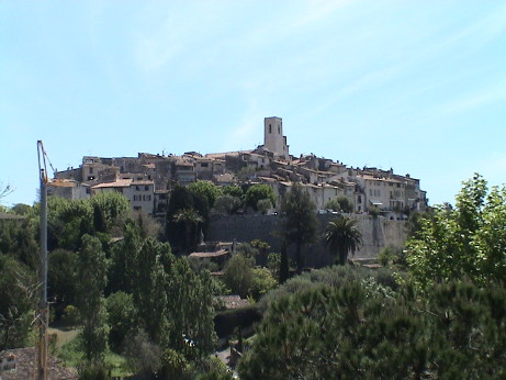 St. Paul de Vence is a walled village built
on a hilltop a few miles inland. During the 1300's, the coast was not
inhabited because of recurring pirate raids. The raiders rarely came
inland far enough to reach these hilltop towns and the fortified ones
were just too much bother to deal with.
St. Paul de Vence is a walled village built
on a hilltop a few miles inland. During the 1300's, the coast was not
inhabited because of recurring pirate raids. The raiders rarely came
inland far enough to reach these hilltop towns and the fortified ones
were just too much bother to deal with.
 The town is built almost entirely from limestone, the
streets are cobbled and are wide enough to ride a horse. This is a side
street away from the action. Except for the utilities tacked on the
outsides of the buildings, it probably doesn't look a lot different
that it did 600 years ago.
The town is built almost entirely from limestone, the
streets are cobbled and are wide enough to ride a horse. This is a side
street away from the action. Except for the utilities tacked on the
outsides of the buildings, it probably doesn't look a lot different
that it did 600 years ago.
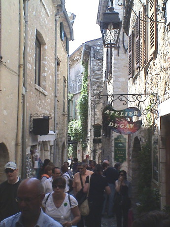 The town is roughly oval shaped and the main street
runs pretty much down the long axis of the oval. There are shops all
along it selling art of all kinds, trinkets, a little food and
clothing. There were many hundreds of tourists in the town, from two
cruise ships and obviously from all over Europe. It got pretty
crowded.
The town is roughly oval shaped and the main street
runs pretty much down the long axis of the oval. There are shops all
along it selling art of all kinds, trinkets, a little food and
clothing. There were many hundreds of tourists in the town, from two
cruise ships and obviously from all over Europe. It got pretty
crowded.
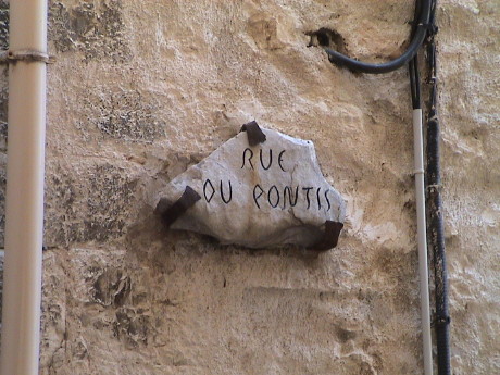 They even made their street signs from stone.
Utilities for buildings not designed for them are usually tacked on
the outside. Most older structures, which is most of them, have water,
sewer, electric, phone, CATV or any other service run into the building
from the outside. At least they are easy to work on and they are so
common that they become part of the background.
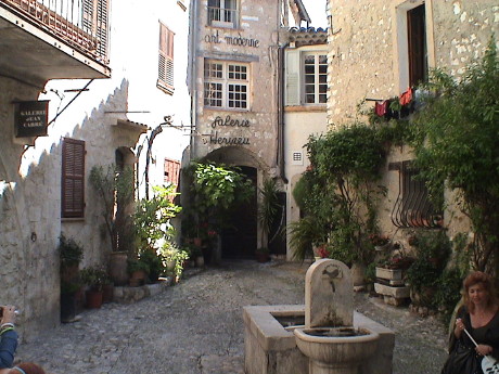 In older times,
the various kings that ruled over this area imposed a variety of taxes.
There were takes on windows and doors, but the most significant tax was
just on a property's frontage. This used to be a house with just about
the smallest frontage that could be arranged. It is now a hotel, it
expands quite a bit back from the facade.
In older times,
the various kings that ruled over this area imposed a variety of taxes.
There were takes on windows and doors, but the most significant tax was
just on a property's frontage. This used to be a house with just about
the smallest frontage that could be arranged. It is now a hotel, it
expands quite a bit back from the facade.
The fountain in the foreground is potable water that runs
continuously. Our tour guide, who did an excellent job, is in the lower
left. Her "wand" is a sign that she can hold up so that her group can
see her from a distance.
Sunday, May 4, 2008, Livorno, Italy, about 1800 CEST (GMT+2)
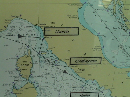 Today was our second stop at Livorno. Due to my condition
the last time, I didn't even see the port. Sandy reports that it was
also raining during part of the day. Today, however, the sky is clear
and the temperature is in the mid 70's, a perfect day for a tour.
Today was our second stop at Livorno. Due to my condition
the last time, I didn't even see the port. Sandy reports that it was
also raining during part of the day. Today, however, the sky is clear
and the temperature is in the mid 70's, a perfect day for a tour.
The ship is just leaving Livorno now, bound for Naples. An urgent
call just went out for three couples that maybe didn't get back on the
ship. They could be catching the overnight train to Naples.
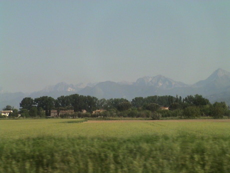 We got on a
typical tour bus for a half hour ride north from Livorno to Pisa to see
the famous leaning tower. Pisa is also a well preserved medieval town
and the tour was supposed to encompass both. From the bus window, I
caught this shot looking north toward the Alps. This is a pretty
typical view of the countryside of this region of Italy, Tuscany, home
to the ancient Etruscans who lived here before being overtaken by the
Romans.
We got on a
typical tour bus for a half hour ride north from Livorno to Pisa to see
the famous leaning tower. Pisa is also a well preserved medieval town
and the tour was supposed to encompass both. From the bus window, I
caught this shot looking north toward the Alps. This is a pretty
typical view of the countryside of this region of Italy, Tuscany, home
to the ancient Etruscans who lived here before being overtaken by the
Romans.
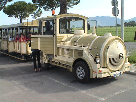 Our tour was billed as the "EZ" tour, which means little
walking. The bus transferred us to this tram which is really a Toyota.
The suspension was stiff and we were in the 2nd car so we caught the
coupler snatch of the whole rig. The ride was less than perfect.
Our tour was billed as the "EZ" tour, which means little
walking. The bus transferred us to this tram which is really a Toyota.
The suspension was stiff and we were in the 2nd car so we caught the
coupler snatch of the whole rig. The ride was less than perfect.
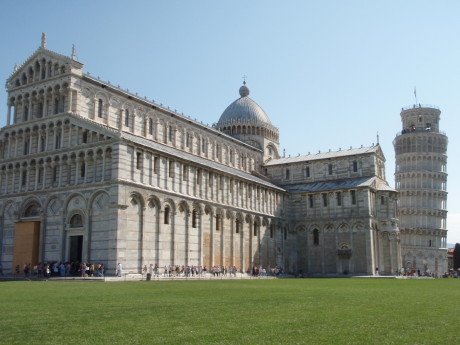 The
leaning tower was supposed to be a bell tower in La Piazza del Duomo,
or the plaza of the cathedral. It is also known as the field of
miracles, although that is just a marketing slogan. The cathedral is
settling too, it just has a much bigger foundation so that it's weight
is spread better over the sand that the whole place is built on. It is
clear from looking at the nearest end of the cathedral that it isn't
completely square either.
The
leaning tower was supposed to be a bell tower in La Piazza del Duomo,
or the plaza of the cathedral. It is also known as the field of
miracles, although that is just a marketing slogan. The cathedral is
settling too, it just has a much bigger foundation so that it's weight
is spread better over the sand that the whole place is built on. It is
clear from looking at the nearest end of the cathedral that it isn't
completely square either.
We were not allowed to take photographs inside, but it was very
impressive, as nice as many of the other very large cathedrals that we
have visited.
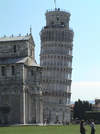 The tower started to lean even as it was being built.
Some interim architect elected to try to "correct" the problem by
making some of the upper levels thinner on the high side to try to bend
the top of the tower back. Now the thing has a permanent bend in
it.
The tower started to lean even as it was being built.
Some interim architect elected to try to "correct" the problem by
making some of the upper levels thinner on the high side to try to bend
the top of the tower back. Now the thing has a permanent bend in
it.
In years past, there were several attempts to straighten the tower
or even just to arrest the increasing lean. Several attempts to
reinforce or pump up the low side did not work very well. A restoration
project ended in 2001 which simply pumped out silt from the high side
of the tower to allow it to lean back by redistributing the silt under
it's foundation by itself, but at an overall lower elevation than it
had. This worked. The tower did lean back and stabilized.
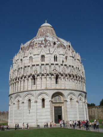 The
other major part of La Piazza del Duomo is the baptismal. The entire
function of this structure is baptisms.
The
other major part of La Piazza del Duomo is the baptismal. The entire
function of this structure is baptisms.
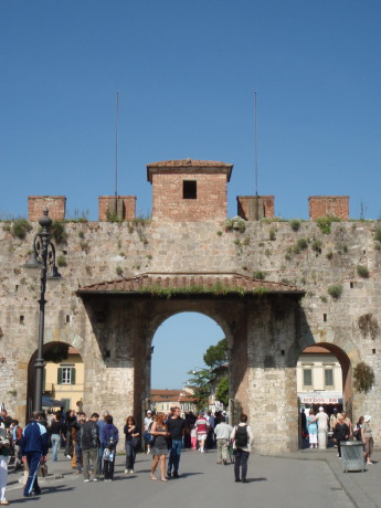 La
Piazza del Duomo is partially surrounded by the original medieval town
walls built in the 1200's. This is called the "new" gate because it was
punched through the wall in the 1500's.
La
Piazza del Duomo is partially surrounded by the original medieval town
walls built in the 1200's. This is called the "new" gate because it was
punched through the wall in the 1500's.
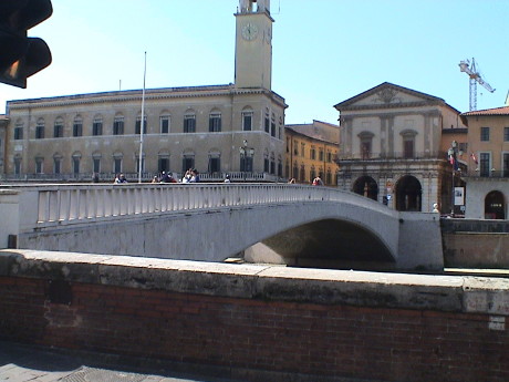 We did go on a tour through the town. This is the last
remaining medieval bridge across the Arno river. It still supports
vehicle traffic so it must have been built pretty well.
We did go on a tour through the town. This is the last
remaining medieval bridge across the Arno river. It still supports
vehicle traffic so it must have been built pretty well.
Monday, May 5, 2008, Naples, Italy, about 0930 CEST (GMT+2)
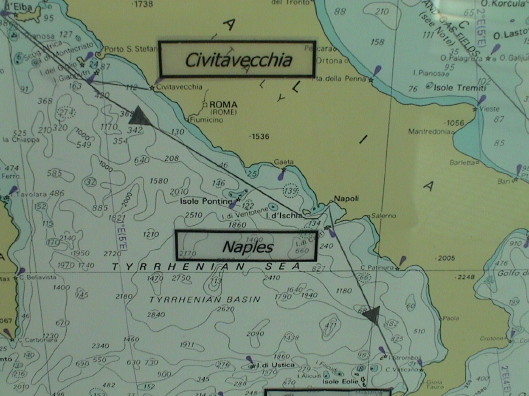 We pulled into Naples, Italy, at about 0800 after the all
night run from Livorno. Naples (Napoli to the locals) is the commercial
center and main port for most of southern Italy. There are about 1
million people living in the city proper and another 2 or 3 million in
the immediately surrounding area.
We pulled into Naples, Italy, at about 0800 after the all
night run from Livorno. Naples (Napoli to the locals) is the commercial
center and main port for most of southern Italy. There are about 1
million people living in the city proper and another 2 or 3 million in
the immediately surrounding area.
The weather today is predicted to be clear, sunny and about
71°F, pretty good weather for our tour this afternoon.
We were pretty sternly warned about "petty" crime in this area so we
are staying on the ship until our organized tour starts after
lunch.
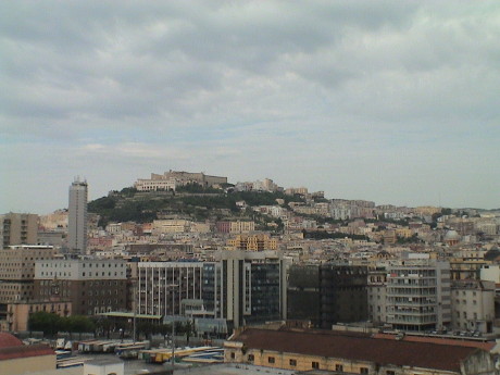 Naples, like many cities in Italy, is an old town. It was
initially settled by the Greeks so something has been here for maybe
3000 years. It got heavily bombed in WWII but the damage has been
repaired. This makes for a mix between very old and fairly new
structures. This castle on the hill obviously substantially survived
the bombing.
Naples, like many cities in Italy, is an old town. It was
initially settled by the Greeks so something has been here for maybe
3000 years. It got heavily bombed in WWII but the damage has been
repaired. This makes for a mix between very old and fairly new
structures. This castle on the hill obviously substantially survived
the bombing.
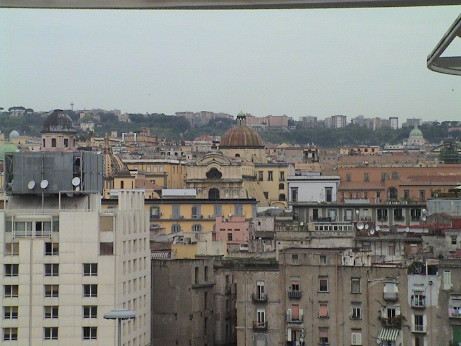 There are five domes in this photo, each probably
associated with a church. I counted 27 domes that are within about a
half mile of the ship. These include only the ones that I could see,
there are probably many more.
There are five domes in this photo, each probably
associated with a church. I counted 27 domes that are within about a
half mile of the ship. These include only the ones that I could see,
there are probably many more.
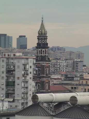 This one stood out like a sore thumb. When
I first saw it, it said Russian all over it, then I realized that the
Russian style is actually derived from Greek Orthodox which is what
this probably is.
This one stood out like a sore thumb. When
I first saw it, it said Russian all over it, then I realized that the
Russian style is actually derived from Greek Orthodox which is what
this probably is.
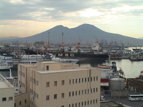 This is where we are going this afternoon. We
have been to Pompeii, so this time we are going to the other village
that was destroyed by Vesuvius in 79 AD, Herculaneum. Pompeii is on the
far right flank of the volcano. It was primarily covered in deep
volcanic ash. Pompeii was destroyed first, but over a period of hours
of ashfall. Herculaneum is located nearer to Naples. It survived the
initial ashfall but succumbed quickly to a pyroclastic flow that swept
over the whole town in just seconds killing everybody pretty much
instantly.
This is where we are going this afternoon. We
have been to Pompeii, so this time we are going to the other village
that was destroyed by Vesuvius in 79 AD, Herculaneum. Pompeii is on the
far right flank of the volcano. It was primarily covered in deep
volcanic ash. Pompeii was destroyed first, but over a period of hours
of ashfall. Herculaneum is located nearer to Naples. It survived the
initial ashfall but succumbed quickly to a pyroclastic flow that swept
over the whole town in just seconds killing everybody pretty much
instantly.
The tour doesn't leave until about 1430. In the meantime we are
taking it easy. This leg of the cruise is pretty hectic with stops
nearly every day. We have some kind of tour at most of them.
Update, Monday, May 5, 2008, Naples, Italy, about 1930 CEST
(GMT+2)
 The first stop on the tour was pretty predictable. We
stopped at a cameo "factory." In fact, there was one old guy whacking
away at some shell fragments and a large showroom of cameos. Many of
these tours seem to waste some our time be taking us through places
like these.
The first stop on the tour was pretty predictable. We
stopped at a cameo "factory." In fact, there was one old guy whacking
away at some shell fragments and a large showroom of cameos. Many of
these tours seem to waste some our time be taking us through places
like these.
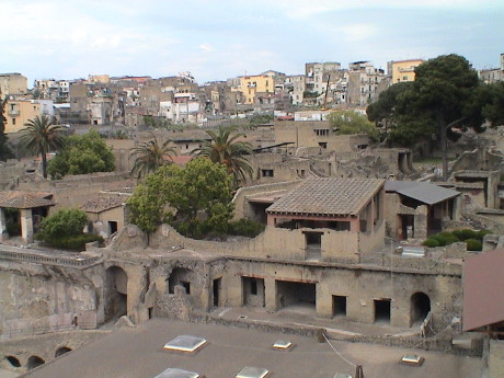 This is what we came to see. Herculaneum is both the
ancient town with the modern town built around it. From the look at
some of the modern buildings in the background, they don't look a lot
different from the ruins. The photo was taken from the current ground
level.
This is what we came to see. Herculaneum is both the
ancient town with the modern town built around it. From the look at
some of the modern buildings in the background, they don't look a lot
different from the ruins. The photo was taken from the current ground
level.
The ancient town had the sea lapping at it's wall. However, it got
buried by 21 meters of tufa and the whole area sank by 15 meters during
the eruption. This left the ancient town below sea level but deeply
buried. The area around the excavation requires continuous pumping to
keep it clear of seawater seepage. Discovery and excavation started in
the 1770's before there was much of the newer town.
 This is the puppy that did Herculaneum in, Vesuvius. It
erupted again in the 1600's and killed a bunch of people but it has
been quiet since. However, it is not dormant. The mountain produces
explosive eruptions and there is still plenty of pressure underground.
It could blow in a big way again. Without some kind of warning, many
more people could die in a new eruption.
This is the puppy that did Herculaneum in, Vesuvius. It
erupted again in the 1600's and killed a bunch of people but it has
been quiet since. However, it is not dormant. The mountain produces
explosive eruptions and there is still plenty of pressure underground.
It could blow in a big way again. Without some kind of warning, many
more people could die in a new eruption.
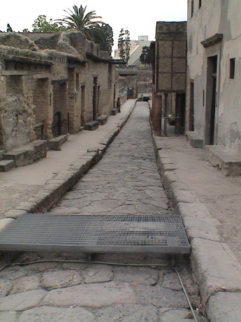 The place was full of people and getting photos
without tourists in them was not easy. However, we managed. The streets
are made of large cobblestones wide enough for a chariot or wagon. The
curbs are generally high. Unlike Pompeii, Herculaneum had real sewers
under the streets so that there are no stepping stones in the street
like in Pompeii. The town is laid out so that shops are on east west
streets and the entrances to homes are on north south streets.
The place was full of people and getting photos
without tourists in them was not easy. However, we managed. The streets
are made of large cobblestones wide enough for a chariot or wagon. The
curbs are generally high. Unlike Pompeii, Herculaneum had real sewers
under the streets so that there are no stepping stones in the street
like in Pompeii. The town is laid out so that shops are on east west
streets and the entrances to homes are on north south streets.
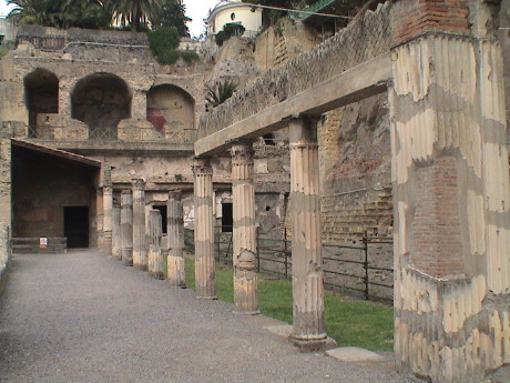 There is only one place in the town with columns. This is
the "center" of the city which is actually at the edge of the
excavation. The unexcavated area is underneath the parking lot and
visitor center for the site.
There is only one place in the town with columns. This is
the "center" of the city which is actually at the edge of the
excavation. The unexcavated area is underneath the parking lot and
visitor center for the site.
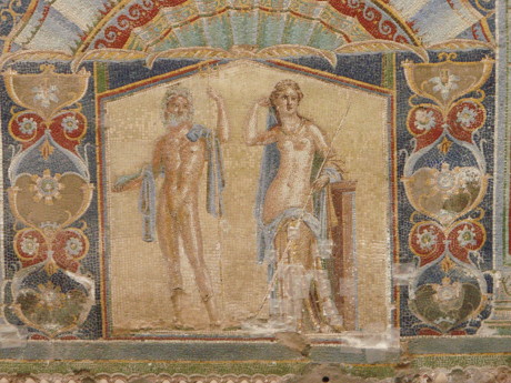 There are lots of frescos (scenes painted on wet plaster)
left in Herculaneum, but there was one house in particular that had a
stunning mosaic of colored tiles set into the wall. The typical house
was plain on the outside, but entered into a central room with small
rooms off to the side. This was in one of the side rooms.
There are lots of frescos (scenes painted on wet plaster)
left in Herculaneum, but there was one house in particular that had a
stunning mosaic of colored tiles set into the wall. The typical house
was plain on the outside, but entered into a central room with small
rooms off to the side. This was in one of the side rooms.
Our ride both out and back was kind of like Mr. Toads Wild Ride.
Napoli drivers are uniformly crazy. There are STOP signs all over,
nobody pays the slightest attention to them. Most of the signals were
not functioning so that those intersections were not controlled any
better than those with stop signs. Drivers in the smallest cars have no
trouble playing chicken with a tour bus, but at one point we came down
a street that was supposed to be two lanes with parking on only one
side. Cars were parked on both sides and we came head up against a
trash truck. It's driver was clearly unimpressed by the bus and we had
to back up, but there were cars behind us. It was a mess. We eventually
go through that one and some other similar situations. I would NOT
recommend renting a car in Naples.
Tuesday, May 6, 2008, At Sea, about 1100 (GMT+3)
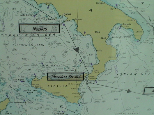 About 0500, we passed through the Messina Strait. This is
the 1.7 mile wide passage between the tip of the Italian boot and
Sicily. We weren't there to see it, both Sandy and I were fully passed
out. We didn't even wake up until about an hour ago.
About 0500, we passed through the Messina Strait. This is
the 1.7 mile wide passage between the tip of the Italian boot and
Sicily. We weren't there to see it, both Sandy and I were fully passed
out. We didn't even wake up until about an hour ago.
Tomorrow, we'll be at one of the Greek isles, Santorini. This is an
active volcano that was probably the cause for the demise of the Minoan
civilization. We are going on a hike to the volcano rim.
Wednesday, May 7, 2008, Santorini, Greece, about 1500 GMT+3
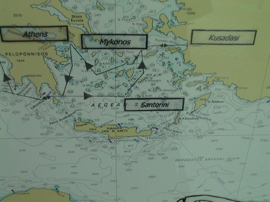 Santorini is one of about a thousand Greek Isles. This one
in particular, has some serious history behind it. It blew up. In the
process, it pretty much did in the Minoan civilization on Crete, about
60 miles away, and it's impact was felt over the entire region. Our
hike today was just about to ground zero.
Santorini is one of about a thousand Greek Isles. This one
in particular, has some serious history behind it. It blew up. In the
process, it pretty much did in the Minoan civilization on Crete, about
60 miles away, and it's impact was felt over the entire region. Our
hike today was just about to ground zero.
The island used to be a nearly circular volcanic island. After the
volcano blew, in about 1600 BC or so, the island virtually collapsed
into itself leaving an incomplete ring and a volcanic core in the
middle. Later, another volcanic island grew in the middle, this is the
active one that we visited.
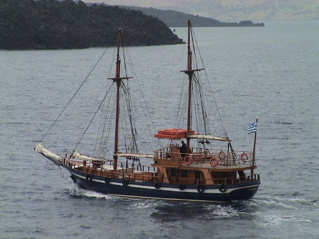 This is a tender port, but instead of using
the ship's tenders, the tour provided it's own. We were picked up from
the Grand Princess in this boat, the Captain Jannis. We were taken out
to Nea Kameni island (New Burnt Island). The hike was about a half hour
up, rising only 500 feet above sea level to the very top.
This is a tender port, but instead of using
the ship's tenders, the tour provided it's own. We were picked up from
the Grand Princess in this boat, the Captain Jannis. We were taken out
to Nea Kameni island (New Burnt Island). The hike was about a half hour
up, rising only 500 feet above sea level to the very top.
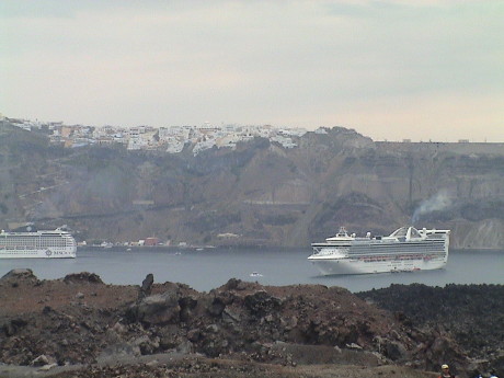 Partway up the trail, we got a good view of the island
of Santorini and part of the main town of Fira in the background past
our ship. Access to Fira is limited. There is a trail, seen as
switchbacks in the photo of 600+ steps that rises 900 feet to the level
of the town. One can either walk it or ride a donkey for €4.
However, the hot setup is the cable car which makes the trip in 2
minutes, also for €4 one way.
Partway up the trail, we got a good view of the island
of Santorini and part of the main town of Fira in the background past
our ship. Access to Fira is limited. There is a trail, seen as
switchbacks in the photo of 600+ steps that rises 900 feet to the level
of the town. One can either walk it or ride a donkey for €4.
However, the hot setup is the cable car which makes the trip in 2
minutes, also for €4 one way.
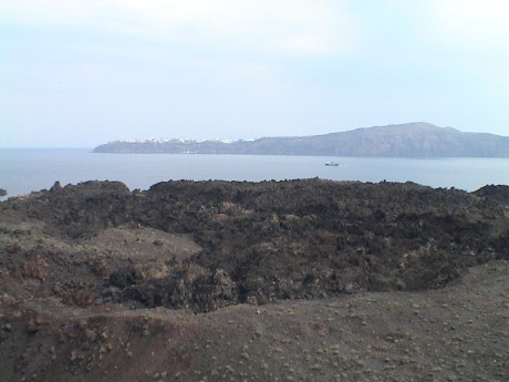 There are six craters on this island, this is one of them,
an inactive one.
There are six craters on this island, this is one of them,
an inactive one.
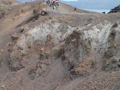 Near the top of the mountain, is the active crater. The
activity is just some fumaroles spilling steam and sulphur. The last
actual eruption from this crater was during 1940 and it threw some ash
and rocks around. However, the pressure is still there and this thing
could heat up again.
Near the top of the mountain, is the active crater. The
activity is just some fumaroles spilling steam and sulphur. The last
actual eruption from this crater was during 1940 and it threw some ash
and rocks around. However, the pressure is still there and this thing
could heat up again.
We finished the hike and took a boat ride back to the ship for
lunch. We then got on one of the port supplied tenders to a dock at the
base of the trail. There is another dock down the coast a ways where
there is road access so that tour busses can pick up passengers as
well. The guide told us that on some Thursdays, there can be as many as
10 cruise ships in port at once. The island is set up to handle this
many people. There are only 13,000 permanent residents, there can be
twice as many tourists on a busy day.
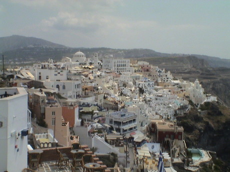 After checking
out the shops at the base of the cable car, we got on to ride to the
top, this is the view of part of the town from near the cable car
station. Many of the buildings are whitewashed to better reflect the
summer sun. Many of the structures are also built into the hillside.
The pumice stone that the whole island is built from is fairly easy to
carve into, is stable and helps control the summer heat and winter
cold.
After checking
out the shops at the base of the cable car, we got on to ride to the
top, this is the view of part of the town from near the cable car
station. Many of the buildings are whitewashed to better reflect the
summer sun. Many of the structures are also built into the hillside.
The pumice stone that the whole island is built from is fairly easy to
carve into, is stable and helps control the summer heat and winter
cold.
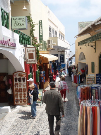 The pedestrian streets are narrow and wind
around a little. These streets are lined with shops selling just about
anything that a tourist would buy. There are also a wide variety of
bars and restaurants. Back from the front of the town, one can find the
side that the locals see, roads and car rental agencies. Even
backstage, the place was very clean with little litter or debris
scattered around. We found a small market where we bought some soda's
for €1.60 for TWO 1.5 liter bottles.
The pedestrian streets are narrow and wind
around a little. These streets are lined with shops selling just about
anything that a tourist would buy. There are also a wide variety of
bars and restaurants. Back from the front of the town, one can find the
side that the locals see, roads and car rental agencies. Even
backstage, the place was very clean with little litter or debris
scattered around. We found a small market where we bought some soda's
for €1.60 for TWO 1.5 liter bottles.
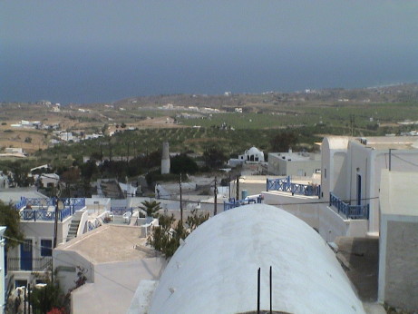 From the
backside of town, we could look over the countryside, which was quite
pretty. Much of the arable land on Santorini is used for vineyards as
wine is a high value product. Most food is imported. There are
virtually no trees on the island, there is too much wind. Even the
grape vines are grown down near the ground in "baskets" made of vines
or they would not survive the wind. However, today, the weather was
perfect, as it has been ever since we entered the Mediterranean.
From the
backside of town, we could look over the countryside, which was quite
pretty. Much of the arable land on Santorini is used for vineyards as
wine is a high value product. Most food is imported. There are
virtually no trees on the island, there is too much wind. Even the
grape vines are grown down near the ground in "baskets" made of vines
or they would not survive the wind. However, today, the weather was
perfect, as it has been ever since we entered the Mediterranean.
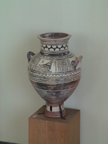 We were told that there was an
archeological museum in Fira. I was looking for it, but we didn't find
it until we were about ready to leave. I was just scanning around a
small courtyard near the cable car station and there it was. It
contains some of the artifacts that were extracted from the ruins at
Akrotiri, a town on the south part of the island that was buried in ash
during and eruption in about 700 BC. This pot is 2700 years old.
We were told that there was an
archeological museum in Fira. I was looking for it, but we didn't find
it until we were about ready to leave. I was just scanning around a
small courtyard near the cable car station and there it was. It
contains some of the artifacts that were extracted from the ruins at
Akrotiri, a town on the south part of the island that was buried in ash
during and eruption in about 700 BC. This pot is 2700 years old.
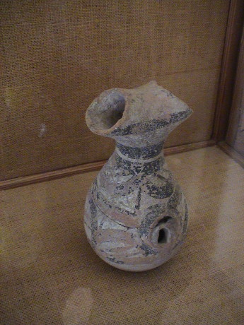 I'm not sure how the older stuff was found,
but this piece of pottery is described to be from the 20th century
BC.
I'm not sure how the older stuff was found,
but this piece of pottery is described to be from the 20th century
BC.
Thursday, May 8, 2008, Kusadasi, Turkey, about 1700 GMT+3
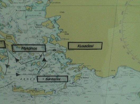 Today our stop is Kusadasi, Turkey. This is the 7th
continent that Sandy and I have visited since we retired just 8 months
ago. From the ship, we took a tour that dragged us all over. First we
stopped at Ephesus, a Greek-Roman town of some importance that is
currently under restoration. We went by the Archeological Museum to see
many of the better artifacts that were recovered from Ephesus. Then it
was off to the 6th century ruins of the Basilica of St. John, then to
lunch at, of all places, a steam locomotive museum. Then we drove up a
local mountain to the claimed home of Mary in the last part of her
life. When we got back to the ship we did some shopping in a local
bazaar.
Today our stop is Kusadasi, Turkey. This is the 7th
continent that Sandy and I have visited since we retired just 8 months
ago. From the ship, we took a tour that dragged us all over. First we
stopped at Ephesus, a Greek-Roman town of some importance that is
currently under restoration. We went by the Archeological Museum to see
many of the better artifacts that were recovered from Ephesus. Then it
was off to the 6th century ruins of the Basilica of St. John, then to
lunch at, of all places, a steam locomotive museum. Then we drove up a
local mountain to the claimed home of Mary in the last part of her
life. When we got back to the ship we did some shopping in a local
bazaar.
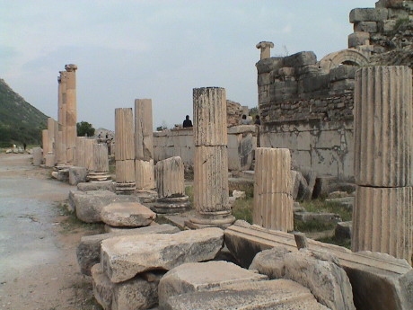 Ephesus was an important port town in the 1st
through 5th centuries. It was situated on a river at the coast.
However, as the river valley silted up, the sea receded further and
further to the point that the town faded away. However in its day, it
was the most important place around. These are the ruins of the forum
that was used by the leaders and upper class of Ephesus. From here,
there is a wide road, paved in marble, that went about half a mile down
toward the old port. The archeologists are trying to put the town back
together again, most of the material is original, some patching has
been done in concrete.
Ephesus was an important port town in the 1st
through 5th centuries. It was situated on a river at the coast.
However, as the river valley silted up, the sea receded further and
further to the point that the town faded away. However in its day, it
was the most important place around. These are the ruins of the forum
that was used by the leaders and upper class of Ephesus. From here,
there is a wide road, paved in marble, that went about half a mile down
toward the old port. The archeologists are trying to put the town back
together again, most of the material is original, some patching has
been done in concrete.
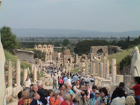 There were
about 60 tour busses scheduled to go through Ephesus today, not all at
the same time however. There were people in plenty though. It was hard
to find a spot to get a photo without people in the photo.
There were
about 60 tour busses scheduled to go through Ephesus today, not all at
the same time however. There were people in plenty though. It was hard
to find a spot to get a photo without people in the photo.
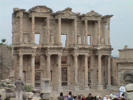 One of the structures that has had
significant restoration was the library. There were thousands of
scrolls stored here at one time, no one knows where they are now.
One of the structures that has had
significant restoration was the library. There were thousands of
scrolls stored here at one time, no one knows where they are now.
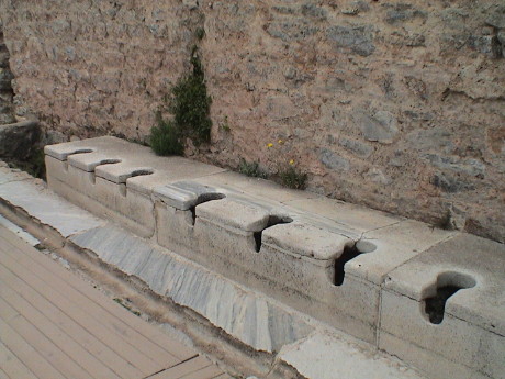 Across the street from the library is a public restroom.
This is one stretch of public toilets. The public bath is next door and
the overflow from the bath is flushed underneath the toilets, 48 in
all, and out into the sewers under the street. There wasn't much
expectation of privacy. The groove in front of the toilets was also
flushed with water so that patrons could used a wet sponge to clean up.
Imagine what it was like sitting on a marble slab on a cold
morning.
Across the street from the library is a public restroom.
This is one stretch of public toilets. The public bath is next door and
the overflow from the bath is flushed underneath the toilets, 48 in
all, and out into the sewers under the street. There wasn't much
expectation of privacy. The groove in front of the toilets was also
flushed with water so that patrons could used a wet sponge to clean up.
Imagine what it was like sitting on a marble slab on a cold
morning.
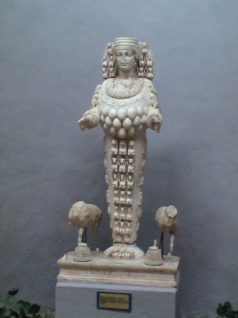 One of the gods of the era was Artemis, the goddess of
fertility. She was pretty important. All of her "features" were
intended to represent fertility. This is a 2nd century AD statue in the
Archeological Museum. There is an older, larger statue in the museum as
well as another one in the Vatican Museum in Rome.
One of the gods of the era was Artemis, the goddess of
fertility. She was pretty important. All of her "features" were
intended to represent fertility. This is a 2nd century AD statue in the
Archeological Museum. There is an older, larger statue in the museum as
well as another one in the Vatican Museum in Rome.
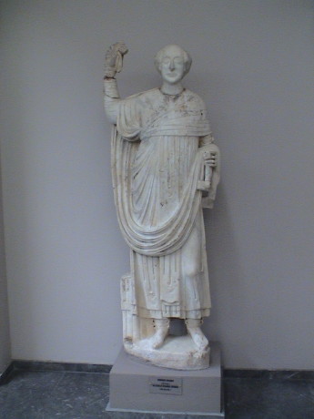 Another statue in the museum was one of a proconsul of
Ephesus. I included this photo because the head is detached from the
rest of the statue. This was fairly common so that in case when a new
emperor was crowned or some VIP came visiting, a new head could be
placed on a generic body in a hurry. This is sort of an ancient form of
photoshop.
Another statue in the museum was one of a proconsul of
Ephesus. I included this photo because the head is detached from the
rest of the statue. This was fairly common so that in case when a new
emperor was crowned or some VIP came visiting, a new head could be
placed on a generic body in a hurry. This is sort of an ancient form of
photoshop.
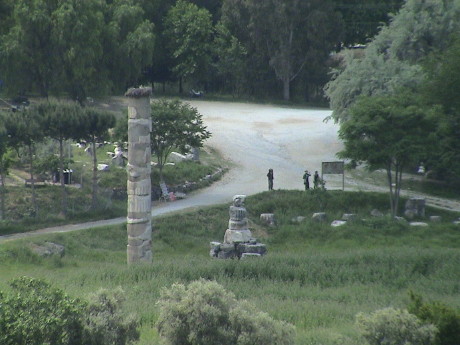 Artemis had her own temple in the flatland
near Ephesus. However, this one column of an original 127 is all that
remains. The rest of the ruins have been raided over the years, first
to build the Basilica of St. John in the 6th century and later to build
a mosque in the 13th century.
Artemis had her own temple in the flatland
near Ephesus. However, this one column of an original 127 is all that
remains. The rest of the ruins have been raided over the years, first
to build the Basilica of St. John in the 6th century and later to build
a mosque in the 13th century.
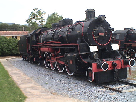 We we
were taken to a restaurant nearby for lunch and a local folklore show.
However, the site was apparently that of a Turkish Railways engine
house. There were a couple of dozen restored steam locomotives, a full
sized turntable, a couple of rotary snowplows, some passenger, freight,
and maintenance of way equipment.
We we
were taken to a restaurant nearby for lunch and a local folklore show.
However, the site was apparently that of a Turkish Railways engine
house. There were a couple of dozen restored steam locomotives, a full
sized turntable, a couple of rotary snowplows, some passenger, freight,
and maintenance of way equipment.
In the 15 minutes I had before it started to rain, I got photos of
about half of the locos. They came from all over, England, Germany,
France, Sweden and all of the major US builders, Lima, Baldwin, Alco,
and Vulcan. Apparently the Turkish National Railways bought their
equipment all over the world.
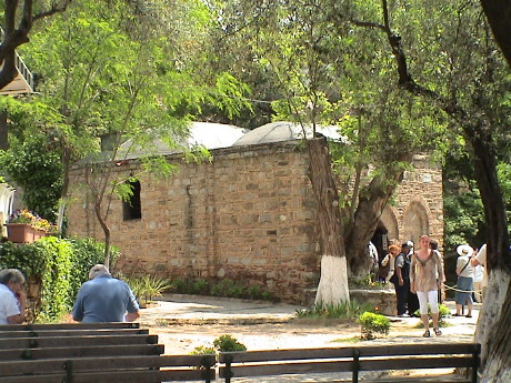 Mary apparently came to Ephesus with John
in the later years of her life. John was sent into exile and Mary had
to hide out. She is claimed to have lived and died in a house in the
mountains. This restored house was built on a 1st century foundation
that is claimed to be that house. It is part of a monastery and
photography is not allowed inside. There were lots of folks that wanted
to come here.
Mary apparently came to Ephesus with John
in the later years of her life. John was sent into exile and Mary had
to hide out. She is claimed to have lived and died in a house in the
mountains. This restored house was built on a 1st century foundation
that is claimed to be that house. It is part of a monastery and
photography is not allowed inside. There were lots of folks that wanted
to come here.
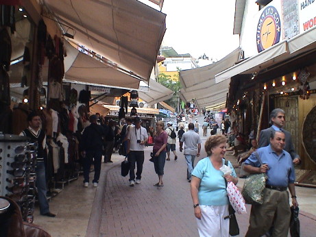 Back in Kusadasi, we had an hour to burn so
we found the local bazaar and looks around for more goodies. These
vendor stalls were much the same as others that we have seen except
that the streets were wider. Most items had prices marked in € but
negotiation was possible.
Back in Kusadasi, we had an hour to burn so
we found the local bazaar and looks around for more goodies. These
vendor stalls were much the same as others that we have seen except
that the streets were wider. Most items had prices marked in € but
negotiation was possible.
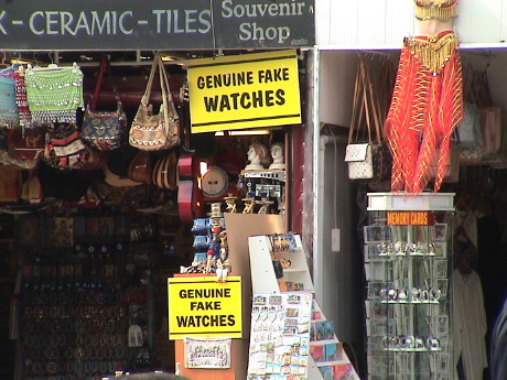 At least this vendor at Ephesus was up front
about what he was selling. Other vendors were selling "ancient" coins
that might have been minted yesterday, all manner of ceramic goodies
and cast resin statues.
At least this vendor at Ephesus was up front
about what he was selling. Other vendors were selling "ancient" coins
that might have been minted yesterday, all manner of ceramic goodies
and cast resin statues.
Friday, May 9, 2008, Mykonos, Greece, about 1300 GMT+3
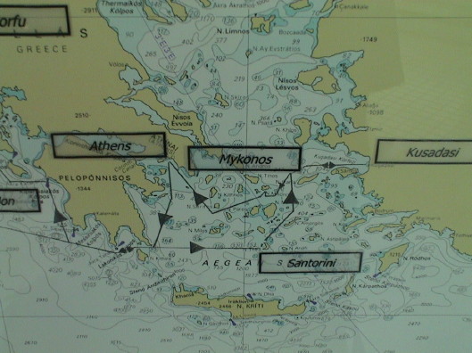 Mykonos is another of the many Greek isles. Today, the
weather was prefect, as it has been for most of the trip. I got rained
on just a little yesterday, but it cleared up in only a few minutes. We
don't have a formal tour scheduled for today, we just rode a shuttle
bus about a mile into town and walked up and around the narrow
streets.
Mykonos is another of the many Greek isles. Today, the
weather was prefect, as it has been for most of the trip. I got rained
on just a little yesterday, but it cleared up in only a few minutes. We
don't have a formal tour scheduled for today, we just rode a shuttle
bus about a mile into town and walked up and around the narrow
streets.
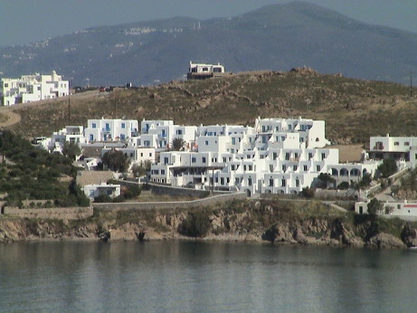 The houses on this island follow the style
used on most of the Greek isles. They are bunched together, all painted
white and conform to the hillside so that everybody gets some breeze
and a view.
The houses on this island follow the style
used on most of the Greek isles. They are bunched together, all painted
white and conform to the hillside so that everybody gets some breeze
and a view.
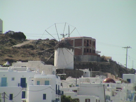 There are a few windmills here. When they
are in use, small triangular sails will be attached around the ring.
I'm not sure what they use the wind power for, probably pumping
water.
There are a few windmills here. When they
are in use, small triangular sails will be attached around the ring.
I'm not sure what they use the wind power for, probably pumping
water.
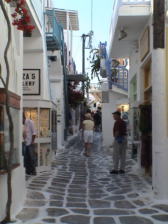 The streets
are typically narrow, and in the commercial section, are lined with
shops. The paving stones are typically outlined in white paint. It
lends a look of uniformity to all of the streets.
The streets
are typically narrow, and in the commercial section, are lined with
shops. The paving stones are typically outlined in white paint. It
lends a look of uniformity to all of the streets.
 If the street is just a little
wider, then there is vehicle traffic as well. I was walking down what
appeared to be a pedestrian street when I heard a car behind me. It was
a taxi that JUST fit.
If the street is just a little
wider, then there is vehicle traffic as well. I was walking down what
appeared to be a pedestrian street when I heard a car behind me. It was
a taxi that JUST fit.
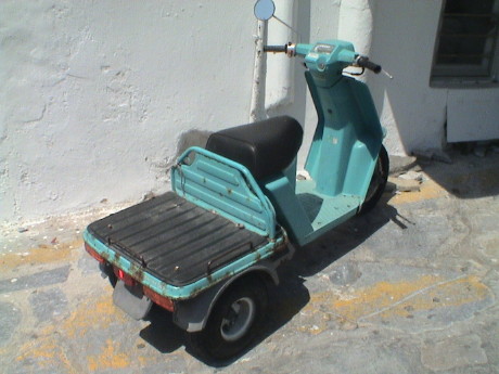 Since the
streets are so small, vehicles tend to be small as well. This appears
to be what passes for a pickup truck on this island. The front and back
parts rotate around a shaft on the centerline to allow it to traverse
uneven surfaces. There were also lots of conventional motorcycles,
motor scooters and mopeds.
Since the
streets are so small, vehicles tend to be small as well. This appears
to be what passes for a pickup truck on this island. The front and back
parts rotate around a shaft on the centerline to allow it to traverse
uneven surfaces. There were also lots of conventional motorcycles,
motor scooters and mopeds.
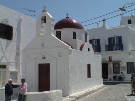 The churches
tended to be tiny too. We were told that there are over 800 churches on
this island. This makes sense as this one, which was typical of several
that we saw, could only hold maybe 10 people.
The churches
tended to be tiny too. We were told that there are over 800 churches on
this island. This makes sense as this one, which was typical of several
that we saw, could only hold maybe 10 people.
 Down near
the waterfront, we found a farmer's market. They were clearly there to
sell to the locals. There was a wide variety of produce for sale.
Down near
the waterfront, we found a farmer's market. They were clearly there to
sell to the locals. There was a wide variety of produce for sale.
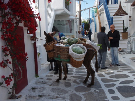 There
is also produce delivery in the form of an old lady leading a donkey.
The donkey was strapped with baskets with more than a dozen varieties
of fresh produce.
There
is also produce delivery in the form of an old lady leading a donkey.
The donkey was strapped with baskets with more than a dozen varieties
of fresh produce.
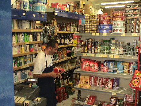 We stopped by
this "supermarket" to buy some soda to take back to the ship. This
picture encompasses about one third of the entire market. However, they
had some of practically everything. 1.5 liter bottles of Fanta were
€1.80.
We stopped by
this "supermarket" to buy some soda to take back to the ship. This
picture encompasses about one third of the entire market. However, they
had some of practically everything. 1.5 liter bottles of Fanta were
€1.80.
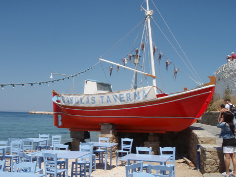 A cafe down by the waterfront was using this
boat as a sign. They specialized in dried octopus. This is how they dry
them, tided up to the rigging of the boat.
A cafe down by the waterfront was using this
boat as a sign. They specialized in dried octopus. This is how they dry
them, tided up to the rigging of the boat.
After our foot tour, we headed back to the ship for an afternoon of
relaxation. We have three more stops in Greece before we head for
Venice and the end of the cruise.
Saturday, May 10, 2008, Athens, Greece, about 1730 GMT+3
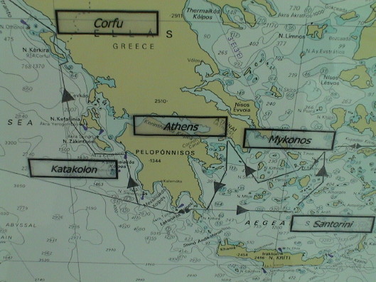 Our stop today was Athens and we had yet another tour
booked. So it was up early and onto a bus again. The tour was "the best
of Athens." We stopped at the National Archaeological Museum where I
went into sculpture overload in less than an hour. Then it was off to
the Acropolis, then lunch, then some "free" time in a shopping
district, then back to the ship. This took some 8 hours.
Our stop today was Athens and we had yet another tour
booked. So it was up early and onto a bus again. The tour was "the best
of Athens." We stopped at the National Archaeological Museum where I
went into sculpture overload in less than an hour. Then it was off to
the Acropolis, then lunch, then some "free" time in a shopping
district, then back to the ship. This took some 8 hours.
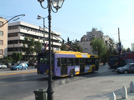 All the way from the port to the museum, we
had been following trolly bus lines. I always found trolly busses
fascinating and I don't remember these the last time we were here.
There was also a new streetcar system, put in for the 2004 Summer
Olympic Games and a fully developed subway system. It is pretty clear
that one can get around town pretty well on public transportation.
All the way from the port to the museum, we
had been following trolly bus lines. I always found trolly busses
fascinating and I don't remember these the last time we were here.
There was also a new streetcar system, put in for the 2004 Summer
Olympic Games and a fully developed subway system. It is pretty clear
that one can get around town pretty well on public transportation.
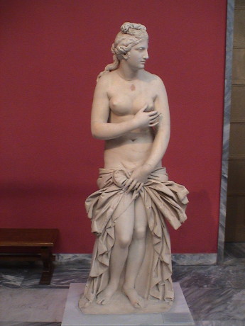 There are hundreds of statues in the museum,
at least in the part that we saw which wasn't nearly all of it. This is
Aphrodite, the goddess of love. Many of the statues were damaged in
some way, this one seemed to be mostly intact.
There are hundreds of statues in the museum,
at least in the part that we saw which wasn't nearly all of it. This is
Aphrodite, the goddess of love. Many of the statues were damaged in
some way, this one seemed to be mostly intact.
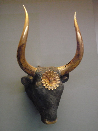 The minitor is the mythical half man, half
bull of Minoan legend. This is a minitor head. It is thousands of years
old.
The minitor is the mythical half man, half
bull of Minoan legend. This is a minitor head. It is thousands of years
old.
 There were many gold artifacts recovered
from a group of grave sites that somehow were not looted. The Mask of
Agamemnon is a particularly famous piece.
There were many gold artifacts recovered
from a group of grave sites that somehow were not looted. The Mask of
Agamemnon is a particularly famous piece.
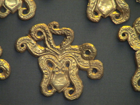 The period goldsmiths were obviously quite skilled.
This broach or pin was one of several on display, since each looked
identical, they must have been worn as a set in some fashion. The
actual size of the piece is less than an inch across.
The period goldsmiths were obviously quite skilled.
This broach or pin was one of several on display, since each looked
identical, they must have been worn as a set in some fashion. The
actual size of the piece is less than an inch across.
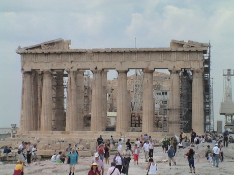 From the museum, we moved to the Acropolis.
After climbing the hill, we got to see that considerable progress has
been made in the seven years since the last time we were here. Then was
over 100°F on the Acropolis. This time, it was in the low 70's,
slightly cloudy so we didn't get hit by the direct sun and there was a
cool breeze.
From the museum, we moved to the Acropolis.
After climbing the hill, we got to see that considerable progress has
been made in the seven years since the last time we were here. Then was
over 100°F on the Acropolis. This time, it was in the low 70's,
slightly cloudy so we didn't get hit by the direct sun and there was a
cool breeze.
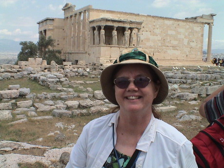 Sandy was still feeling pretty good, but later in
the day, she just wilted. During our shopping time after lunch, she was
so dazed that she couldn't shop. It became clear that she needed a rest
so I bought her a can of Coke and set her down in the shade to rest.
After about 15 minutes, she found some energy and managed to get what
she was looking for.
Sandy was still feeling pretty good, but later in
the day, she just wilted. During our shopping time after lunch, she was
so dazed that she couldn't shop. It became clear that she needed a rest
so I bought her a can of Coke and set her down in the shade to rest.
After about 15 minutes, she found some energy and managed to get what
she was looking for.
 We had lunch at a cafe in the Plaka District on our
way down the hill. It was a typical Greek meal, starting out with this
salad (tomato, cucumber, feta, onion and olives) with a yogurt and
cucumber dressing. This was so good that I just kept picking on it
until it was almost gone.
We had lunch at a cafe in the Plaka District on our
way down the hill. It was a typical Greek meal, starting out with this
salad (tomato, cucumber, feta, onion and olives) with a yogurt and
cucumber dressing. This was so good that I just kept picking on it
until it was almost gone.
Then we did the shopping thing along Pandrosuo street until it was
time to gather at the cathedral and meet the bus back to the ship.
Tomorrow, the ship stops at the port of Katakolon which the gateway
to Olympia and yet more ruins, this time of the original Olympic Games
sites. Our last stop in Greece is the following day at Corfu. Then we
have one more sea day before we arrive at Venice late at night. We
disembark early in the morning and then need to find our way to our
hotel.
Sunday, May 11, 2008, Katakolon, Greece, about 1600 GMT+3
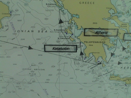 Today we tied up at the port of Katakolon. There really
isn't much here. The while town has about 300 residents. The port is
the access point for Olympia, which is just a small village in itself.
However, Olympia is the location of the ancient site of the Olympic
Games that were first held in 776 BC and continued for about 1100
years. The games were as much a religious event as a sporting event and
after the Roman Empire converted to Christianity, there was no room for
a pagan ritual. The games were stopped and the while site fell into
ruins. A pair of major earthquakes in the 6th century AD pretty much
finished the site off.
Today we tied up at the port of Katakolon. There really
isn't much here. The while town has about 300 residents. The port is
the access point for Olympia, which is just a small village in itself.
However, Olympia is the location of the ancient site of the Olympic
Games that were first held in 776 BC and continued for about 1100
years. The games were as much a religious event as a sporting event and
after the Roman Empire converted to Christianity, there was no room for
a pagan ritual. The games were stopped and the while site fell into
ruins. A pair of major earthquakes in the 6th century AD pretty much
finished the site off.
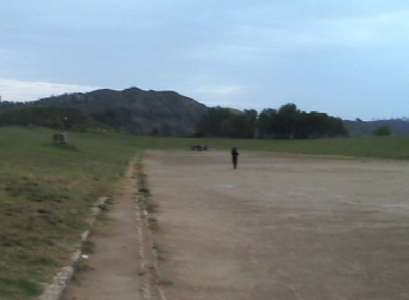 We took a bus tour out to the Olympic site
and museum. There is not much left but foundations so I am going to
describe the two most important places in the site.
We took a bus tour out to the Olympic site
and museum. There is not much left but foundations so I am going to
describe the two most important places in the site.
This is the stadium itself. The "field" is 200 meters from end to
end. Foot races were not run in laps around a track, the runners did
200 meters and turned around for the next lap. This continued for as
long as it took for the longer races. There was room for about 40,000
spectators (all male, females were not allowed to view the events)
seated on the slopes surrounding the field. Any male could view the
events, but only Greeks could compete.
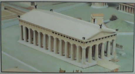 The
whole event was dedicated to Zeus, the leader of all the Greek gods. A
large temple was built in his honor. This is a model of what the temple
looked like based on the existing ruins and contemporary
descriptions.
The
whole event was dedicated to Zeus, the leader of all the Greek gods. A
large temple was built in his honor. This is a model of what the temple
looked like based on the existing ruins and contemporary
descriptions.
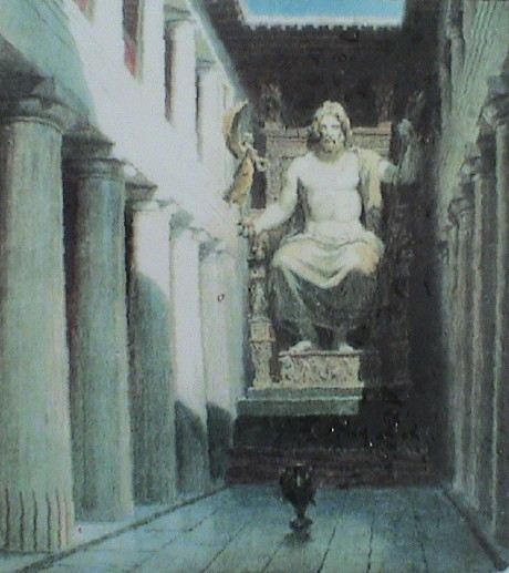 Inside was a seated statue of Zeus made of wood and
ivory. The statue was about 40 feet tall. The statue itself was
recovered from the site by the Greeks around 500 AD, but it burned in a
fire only a few years later, there is nothing left.
Inside was a seated statue of Zeus made of wood and
ivory. The statue was about 40 feet tall. The statue itself was
recovered from the site by the Greeks around 500 AD, but it burned in a
fire only a few years later, there is nothing left.
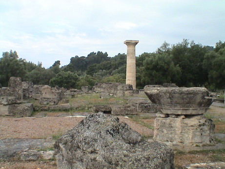 This is what is left of the entire
temple. The view is right in the entrance to the temple, Zeus would be
seated at the other end. One column has been restored and set
upright.
This is what is left of the entire
temple. The view is right in the entrance to the temple, Zeus would be
seated at the other end. One column has been restored and set
upright.
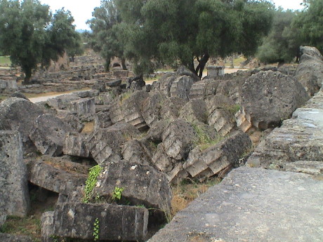 The rest of the columns are
in fragments surrounding the site. These columns were cut into fairly
squat segments, about a meter thick, and stacked. The earthquakes took
them down.
The rest of the columns are
in fragments surrounding the site. These columns were cut into fairly
squat segments, about a meter thick, and stacked. The earthquakes took
them down.
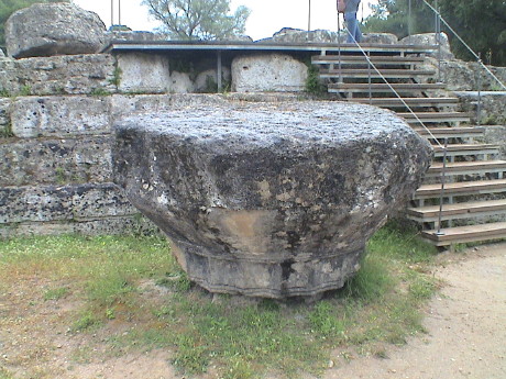 Each column
was topped with a final. This rock has to weigh at least a ton, but it
is still recognizable.
Each column
was topped with a final. This rock has to weigh at least a ton, but it
is still recognizable.
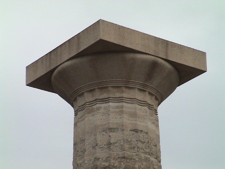 A restored final is on the top
of the single restored pillar.
A restored final is on the top
of the single restored pillar.
 Much of the
statuary that was on the site has been recovered and is displayed at
the Olympic Archaeological Museum. The best preserved statue is that of
Hermes, one of the major Greek gods. Most of the rest of them are
fragmentary or missing significant pieces as they were broken up in
falls during the earthquakes. However, at least there are pieces of
most of them there because the site was sort of forgotten and it was
never looted.
Much of the
statuary that was on the site has been recovered and is displayed at
the Olympic Archaeological Museum. The best preserved statue is that of
Hermes, one of the major Greek gods. Most of the rest of them are
fragmentary or missing significant pieces as they were broken up in
falls during the earthquakes. However, at least there are pieces of
most of them there because the site was sort of forgotten and it was
never looted.
 The museum also
has a collection of Greek artifacts that weren't directly related to
the Olympic site. Many of the bronze artifacts survived well. This
rather intricate piece was probably a pot handle.
The museum also
has a collection of Greek artifacts that weren't directly related to
the Olympic site. Many of the bronze artifacts survived well. This
rather intricate piece was probably a pot handle.
 They have a pretty good selection of bronze
helmets. These are in pretty good condition. Some were bashed in such a
way that, if the damage happened in battle, the wearer probably didn't
survive.
They have a pretty good selection of bronze
helmets. These are in pretty good condition. Some were bashed in such a
way that, if the damage happened in battle, the wearer probably didn't
survive.
 As we were leaving the site, we ran
across this turntable at the end of a railway line. There was a narrow
gauge railway that pretty much paralleled the road from Katakolon to
Olympia. From the size of this turntable, the equipment used must have
been pretty small. The rails on the rail line looked like that they
were still in service. Just behind the blue tank there was a more
recent station with people waiting on the platform, but we didn't see
any actual trains.
As we were leaving the site, we ran
across this turntable at the end of a railway line. There was a narrow
gauge railway that pretty much paralleled the road from Katakolon to
Olympia. From the size of this turntable, the equipment used must have
been pretty small. The rails on the rail line looked like that they
were still in service. Just behind the blue tank there was a more
recent station with people waiting on the platform, but we didn't see
any actual trains.
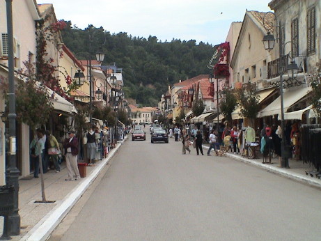 The tour was a half day affair, we got back
at about 1230 and got lunch on the ship. Then we walked back into
Katakolon. The whole commercial district was open on Sunday, this is
pretty much it. There was one other parallel walkway along the
waterfront that had mostly restaurants. A cruise ship coming into town
must be a pretty big deal for these folks. The prices were a little
higher than in Athens, most likely due to the sporadic nature of
tourist business here.
The tour was a half day affair, we got back
at about 1230 and got lunch on the ship. Then we walked back into
Katakolon. The whole commercial district was open on Sunday, this is
pretty much it. There was one other parallel walkway along the
waterfront that had mostly restaurants. A cruise ship coming into town
must be a pretty big deal for these folks. The prices were a little
higher than in Athens, most likely due to the sporadic nature of
tourist business here.
Monday, May 12, 2008, Corfu, Greece, about 1330 GMT+3
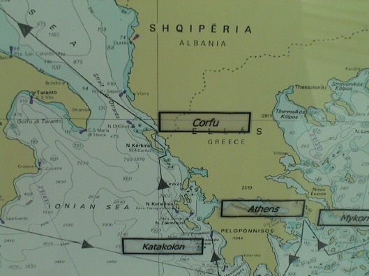 Corfu is our last port of call on this cruise before we
disembark in Venice. This is the largest of the Greek isles and it is
much different that the others that we have seen. First, it is lush as
it gets much more rain than the other islands. Also, it has been
heavily developed for longer. The other islands may have a much longer
history, but Corfu's history is more dense, especially during the last
600 years or so. The Venetians settled it early and built a large fort
and port. Later, it was taken over by the French (during Napoleon's
time) and then by the British (after Waterloo) and then the island
became part of Greece.
Corfu is our last port of call on this cruise before we
disembark in Venice. This is the largest of the Greek isles and it is
much different that the others that we have seen. First, it is lush as
it gets much more rain than the other islands. Also, it has been
heavily developed for longer. The other islands may have a much longer
history, but Corfu's history is more dense, especially during the last
600 years or so. The Venetians settled it early and built a large fort
and port. Later, it was taken over by the French (during Napoleon's
time) and then by the British (after Waterloo) and then the island
became part of Greece.
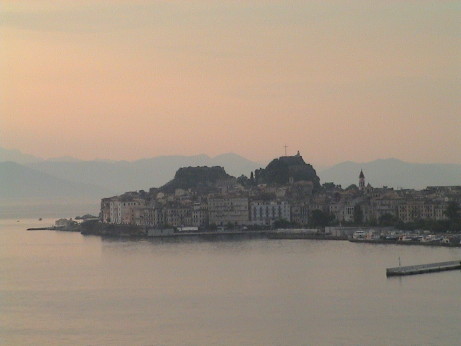 This is the old town of Corfu just after
sunrise as seen from our ship. The tallest point in the picture (with
the flag mast) is where we actually ended up later in the day. Our tour
took us by bus to the old fortress from where we took a guided walking
tour through Old Town Corfu before the town even started to awake.
This is the old town of Corfu just after
sunrise as seen from our ship. The tallest point in the picture (with
the flag mast) is where we actually ended up later in the day. Our tour
took us by bus to the old fortress from where we took a guided walking
tour through Old Town Corfu before the town even started to awake.
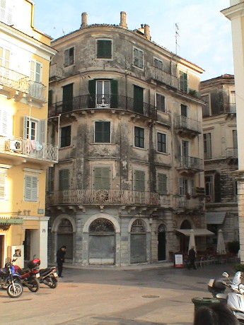 This is a Venetian style building in Corfu.
This one appears to date from those times. This is mix of Venetian,
French and Italian architecture throughout the old town.
This is a Venetian style building in Corfu.
This one appears to date from those times. This is mix of Venetian,
French and Italian architecture throughout the old town.
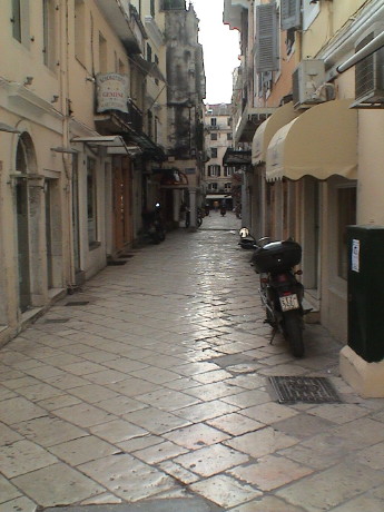 This is a quiet
back street in the old town before the shops that line this street
opened up. After about 0930, everything was open and the shop fronts
sprang out with goods and the streets filled with people.
This is a quiet
back street in the old town before the shops that line this street
opened up. After about 0930, everything was open and the shop fronts
sprang out with goods and the streets filled with people.
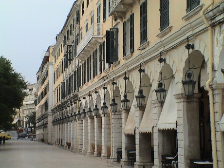 The French were
only in Corfu for about 10 years but they did build this row of arches
to look exactly like a street in Paris. Later, the locals built
apartments on top of the arches. This row is almost solid cafes once
the businesses started up.
The French were
only in Corfu for about 10 years but they did build this row of arches
to look exactly like a street in Paris. Later, the locals built
apartments on top of the arches. This row is almost solid cafes once
the businesses started up.
Our tour was about an hour during the guided part, then they cut is
free to explore on our own for nearly three hours. We elected to browse
the shops (that were then mostly open) and then to visit the fortress
that guards the harbor.
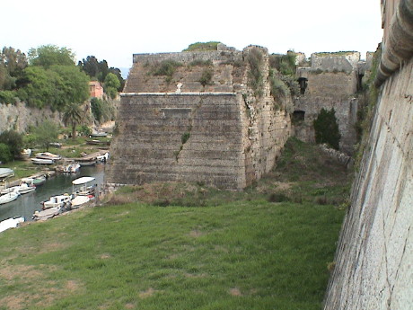 The Venetians
build a large fortress on a hill behind the old town and started on
another one on a peninsula that overlooks the harbor. Later the British
expanded on the harbor fort. This is the entrance to that fort. There
is one small bridge crossing a "moat" that is really just a canal cut
at the base of the peninsula. However, to storm the fort, one would
have to cross that moat under the fire of cannon and then scale the
walls that were about 40 ft high.
The Venetians
build a large fortress on a hill behind the old town and started on
another one on a peninsula that overlooks the harbor. Later the British
expanded on the harbor fort. This is the entrance to that fort. There
is one small bridge crossing a "moat" that is really just a canal cut
at the base of the peninsula. However, to storm the fort, one would
have to cross that moat under the fire of cannon and then scale the
walls that were about 40 ft high.
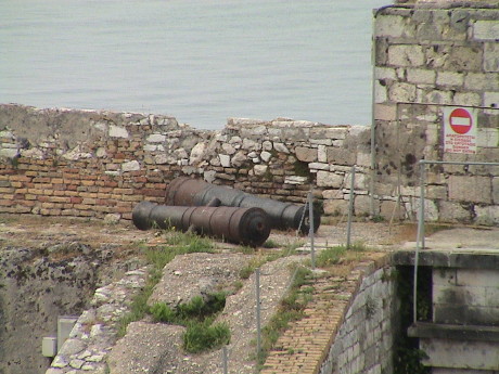 There were dismounted cannon all over the
place. They appeared to be British because of a royal seal cast into
some of them.
There were dismounted cannon all over the
place. They appeared to be British because of a royal seal cast into
some of them.
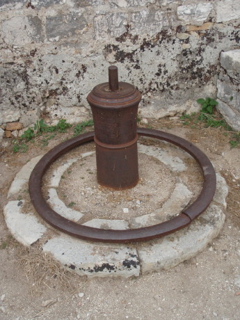 Some of the cannon were upended and used
for posts. There were maybe a dozen in use this way.
Some of the cannon were upended and used
for posts. There were maybe a dozen in use this way.
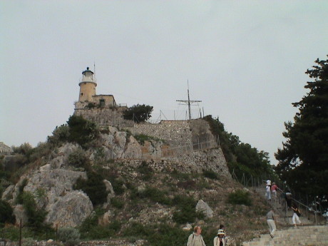 We climbed all the way up to the lighthouse
on the "land" fort. The fortress is actually built on two hills, the
one nearest the sea is called the "sea" fort. It was fenced off, there
was no access to that side. The taller hill is the land fort, this has
the flag standard and lighthouse on it.
We climbed all the way up to the lighthouse
on the "land" fort. The fortress is actually built on two hills, the
one nearest the sea is called the "sea" fort. It was fenced off, there
was no access to that side. The taller hill is the land fort, this has
the flag standard and lighthouse on it.
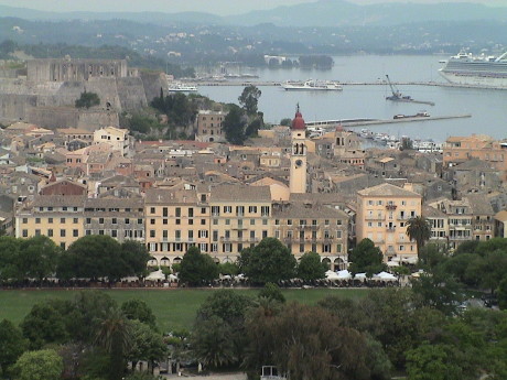 From there, we got a very good view of the old
town with part of the Venetian fort in the background. The area around
the bell tower is the district that we toured on foot.
From there, we got a very good view of the old
town with part of the Venetian fort in the background. The area around
the bell tower is the district that we toured on foot.
 The tour guide recommended that we try some
locally brewed ginger beer. This is a non-alcoholic beverage made from
lemon juice, ginger root and a little sugar. It is highly carbonated. I
bought this small bottle and the shopkeeper gave me detailed
instructions on how to open it. If one just twists off the cap, the
whole bottle will erupt and dump it's contents. It has to be just
barely cracked open and allowed to vent slowly, then poured carefully.
Even then, it takes on quite a head. I didn't like it much but Sandy
thought it was good.
The tour guide recommended that we try some
locally brewed ginger beer. This is a non-alcoholic beverage made from
lemon juice, ginger root and a little sugar. It is highly carbonated. I
bought this small bottle and the shopkeeper gave me detailed
instructions on how to open it. If one just twists off the cap, the
whole bottle will erupt and dump it's contents. It has to be just
barely cracked open and allowed to vent slowly, then poured carefully.
Even then, it takes on quite a head. I didn't like it much but Sandy
thought it was good.
Then it was time to board the bus back to the ship for lunch. Sandy
simply passed out, she is softly snoring in our cabin. We each walked
over 10,000 steps today, or about 4.5 miles, and this just wiped her
out.
Tuesday, May 13, 2008, At Sea, about 1000 GMT+2
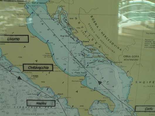 We've been moving westward and have slipped back one time
zone. Today is our last full day on the ship. We are sailing up the
Adriatic Sea toward Venice. We are due to pull in at about 2200
tonight. According to our disembarkation instructions, we will leave he
ship by 0800 tomorrow. We purchased a transfer to the Piazzale Roma
station. We have instructions that will allow us to find our way from
there to our hotel on the mainland.
We've been moving westward and have slipped back one time
zone. Today is our last full day on the ship. We are sailing up the
Adriatic Sea toward Venice. We are due to pull in at about 2200
tonight. According to our disembarkation instructions, we will leave he
ship by 0800 tomorrow. We purchased a transfer to the Piazzale Roma
station. We have instructions that will allow us to find our way from
there to our hotel on the mainland.
Today will be primarily dedicated to recovery from the rather
frantic pace if the last 10 days and preparation for the rather frantic
next several days as we travel home. We have to pack and put our
checked luggage out in the hallway by this evening. We'll gather it
back up in the terminal tomorrow.
The plan is to find our hotel tomorrow morning, and then do some
kind of tour, either of Venice proper or of the area inland. The next
day will also be dedicated to tourist stuff. The following day we need
to make our way to the airport to catch a flight to Dublin, then on to
LAX.
This is a good spot to recap some of the more general observations
concerning this cruise.
First, the food. It was generally competent, but not outstanding.
The food was more bland than we've experienced on cruises in the past
and there seemed to be less variety. This may be a Princess thing as
the buffet on Holland-America seemed to provide more ethnic variety at
every meal. The Princess chefs couldn't seem to figure out how to cook
salmon, it was overdone every time so I started avoiding it. There was
no grapefruit at all, but at least there was lots of pineapple. I had
pineapple with nearly every meal, I figure that I ate about one whole
pineapple every day. I found that the meals served in the dining rooms
was not remarkable enough to spend the time there very often. We ate
mostly in the buffet as the variety was generally better and the
quality was about the same.
The sea conditions on this cruise were the mildest that we have
experienced with the exception of the cruise to the Baltic. We had no
heavy weather at all. Most often, any sort of pitch or roll was not
detectable.
It was warm and humid in the tropical part of the cruise, bordering
on hot during our tour to Marrakech, but generally very nice the rest
of the time. We got a little rain on the morning of Devil's Island but
that didn't matter much because the swell, which didn't impact the ship
much but did impact the tenders, prevented us from going ashore. We
also got some rain during our tour to Olympia. The rest of the time, it
was shirtsleeve weather. I managed to avoid any sunburn at all without
the use of sunblock. We also didn't encounter any insects so that
repellant was not necessary either.
As far as misfortunes go, we've had only a few. I usually come back
from vacations in worse shape than I left, but unless something bad
happens in the next few days, that'll make three cruises in a row
without a disaster. Sandy did sprain her ankle in Orlando, but it
didn't prevent her from getting around although stairs were a problem.
I got a case of Norovirus that took me out of service for a couple of
days, but I recovered from that too. Sandy's main camera crapped out on
the first morning in Orlando and I had a power brick for a USB hub burn
up, but we worked around both of those failures. At this point, we
haven't left anything behind anywhere but we still have ample
opportunity to lose luggage and other stuff before we get home.
After we leave the ship, internet access may become spotty so the
next update might occur from home.
Wednesday, May 14, 2008, Mestre, Italy, about 1330 GMT+2
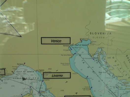 The last stop on our cruise is Venice, Italy. It is a
little unusual to arrive late at night, we got in at about 2200, and
then get off the ship the next morning. However, some people
disembarked as early as 0400 to catch early flights from Marco Polo
Airport. Our flight out isn't until late Friday. We've made it to the
hotel in Mestre Italy (just on the mainland from Venice) and are safely
ensconced in our room.
The last stop on our cruise is Venice, Italy. It is a
little unusual to arrive late at night, we got in at about 2200, and
then get off the ship the next morning. However, some people
disembarked as early as 0400 to catch early flights from Marco Polo
Airport. Our flight out isn't until late Friday. We've made it to the
hotel in Mestre Italy (just on the mainland from Venice) and are safely
ensconced in our room.
 Yesterday, I took a backstage tour in the Princess
Theatre. These were three of the costumes used in the production show
the previous night. The blue one is somewhat unique in that it is wired
for lights. There is a battery pack in the back and dozens of white
LEDs sewn into the dress. When a dancer hits the hidden switch, the
dresses light up with a very good effect.
Yesterday, I took a backstage tour in the Princess
Theatre. These were three of the costumes used in the production show
the previous night. The blue one is somewhat unique in that it is wired
for lights. There is a battery pack in the back and dozens of white
LEDs sewn into the dress. When a dancer hits the hidden switch, the
dresses light up with a very good effect.
The stage in this ship is huge. The lowest part of the stage is on
deck 5. This is were the orchestra pit and stage elevators go. The
stage itself is on deck 6 and the overhead goes all the way up to deck
9. All the lighting is automatic and can be pointed and can change
color by remote control. Each production is time keyed to the
soundtrack and the lights are pre-programmed for each production.
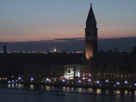 We pulled
into Venice harbor just at sunset last night and sailed past St. Mark's
Square, the location of the clock tower, Doge's palace and the
cathedral as it was getting dark.
We pulled
into Venice harbor just at sunset last night and sailed past St. Mark's
Square, the location of the clock tower, Doge's palace and the
cathedral as it was getting dark.
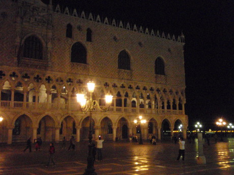 The ship
offered a water taxi ride from the berth to St. Mark's Square for
$15/head. We rode over to see St. Mark's at night.
The ship
offered a water taxi ride from the berth to St. Mark's Square for
$15/head. We rode over to see St. Mark's at night.
This is part of the Doge's Palace. Venice was called a republic, but
in fact, a Doge ran the show. There were elected representatives but
the real power was in the hands of the Doge and a supporting council.
There was also a "council of 10" who could basically try anybody for a
crime without the accused being present and there was no appeal. The
sentences were final.
During the day, the square is full of pigeons, at night there were
none. The square was dimly lit and most of my pictures didn't turn out
well. It was well past midnight by the time that we returned to the
ship, and even though I was dead tired from lack of sleep the previous
night, I didn't sleep much after we returned. Then it was up at 0630 to
get ready to actually leave the ship.
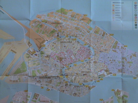 Venice is a collection of low lying islands
interconnected by short bridges. The Grand Princess was moored at the
left edge of this map. St. Mark's square is the white patch at the
lower right, near the lower end of the serpentine Grand Canal.
Venice is a collection of low lying islands
interconnected by short bridges. The Grand Princess was moored at the
left edge of this map. St. Mark's square is the white patch at the
lower right, near the lower end of the serpentine Grand Canal.
We purchased a transfer ticket to get from the berth to the the
Piazzale Roma bus terminal for $24/head. The train station is just one
bridge away from the bus terminal. It was maybe a one mile ride but at
least we didn't get lost. We could have taken a cab directly from the
ship to the hotel for less than the transfer cost us. Piazzale Roma is
a white splotch on the map at the end of the road leading in from the
upper left. From the terminal, we bought a couple of €1.10 bus
tickets. The bus dropped us off a half block from our hotel.
Internet access in the hotel is very expensive, about €20 for
one day. There are a couple of terminals in the lobby that are free but
there is no FTP facility to do web page uploads. We wandered out to
find lunch and an internet cafe. We found three different internet
shops, but none of them would allow the use of my own computer so they
were useless. We were also looking for a sandwich shop but we didn't
find one in several blocks. We did find a supermarket and we bought
some sodas and I got an olive focaccia loaf which was outstanding. Then
we turned the other way to the train station (across the street from
the hotel) to the McDonalds. There was a McDonalds there, but there was
also the exact kind of sandwich shop that we were looking for. We got a
couple of excellent prosciutto and mozzarella sandwiches and headed
back to the hotel for an outstanding lunch and then a nap.
Thursday, May 15, 2008, Mestre, Italy, about 1530 GMT+2
 This is our
hotel in Mestre. It is dead across the street from the Mestre train
station, one stop away from the end of the line in Venice.
This is our
hotel in Mestre. It is dead across the street from the Mestre train
station, one stop away from the end of the line in Venice.
 While we
were strolling up the street yesterday, we found this vending machine
right on the street. They are selling condoms. This wouldn't go over
too well in the US, but in Italy, a lot more goes without comment.
While we
were strolling up the street yesterday, we found this vending machine
right on the street. They are selling condoms. This wouldn't go over
too well in the US, but in Italy, a lot more goes without comment.
The plan today was to see something besides Venice. We sort of threw
a dart at the map to find a place to ride the train to. Virtually
everyplace is steeped in history here, there is something interesting
everywhere. We chose Padua, or Padova to the locals, which is about 30
minutes by train from Mestre. Padova is a moderately sized city with
history going back to Roman times at least. Trains are a good way to
travel to these places because they are usually inexpensive and you end
up right down town. In Italy, the trains are subsidized, our fare was
€9.40 both ways for both of us.
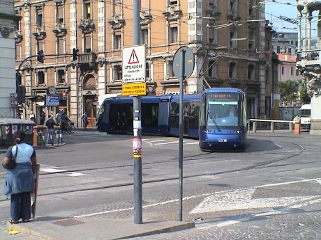 One of the first things that I noticed
outside the Padova train station was this streetcar. What was odd is
that it runs on ONE rail. The rail is a guide rail and electric current
return, the car actually runs on rubber tires. However, at the other
end of the line, there is no overhead wire. The cars apparently run on
batteries as well and recharge when they are under wire. We did walk by
the stop where the wire ended. The driver dropped the pantograph and
the train trundled away with no engine sound.
One of the first things that I noticed
outside the Padova train station was this streetcar. What was odd is
that it runs on ONE rail. The rail is a guide rail and electric current
return, the car actually runs on rubber tires. However, at the other
end of the line, there is no overhead wire. The cars apparently run on
batteries as well and recharge when they are under wire. We did walk by
the stop where the wire ended. The driver dropped the pantograph and
the train trundled away with no engine sound.
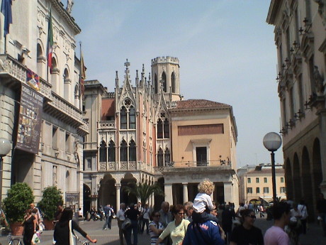 We mostly walked down one street from the
station to a large plaza toward the south. The street was sometimes two
way vehicle traffic, sometimes with the streetcar line on one side and
vehicles on the other and sometimes pedestrian only. It changed names
four or five times in the two miles or so that we walked.
We mostly walked down one street from the
station to a large plaza toward the south. The street was sometimes two
way vehicle traffic, sometimes with the streetcar line on one side and
vehicles on the other and sometimes pedestrian only. It changed names
four or five times in the two miles or so that we walked.
 In one
square, an artist was working on a mural which he had taped down to the
street. His work was pretty good.
In one
square, an artist was working on a mural which he had taped down to the
street. His work was pretty good.
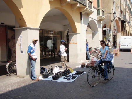 In other parts, there were other
artists, but of a different kind. This Nigerian vendors are illegal
here. They are artists at not getting busted. They usually operate in
groups with lookouts up and down the street. As soon as a police
officer is spotted, these guys will quickly wrap up their wares in the
sheet and run off. They are all over the place in Venice too.
In other parts, there were other
artists, but of a different kind. This Nigerian vendors are illegal
here. They are artists at not getting busted. They usually operate in
groups with lookouts up and down the street. As soon as a police
officer is spotted, these guys will quickly wrap up their wares in the
sheet and run off. They are all over the place in Venice too.
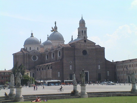 The Italians are really big on their
churches. This is the St. Giustina Basilica. We didn't actually walk
all the way there, we had gone far enough and elected to turn back at
this point. From a distance, it also appeared to be closed. Italian
business and churches tend to close up between noon and 1500 hours for
siesta. Further, photography is typically not allowed within the
churches.
The Italians are really big on their
churches. This is the St. Giustina Basilica. We didn't actually walk
all the way there, we had gone far enough and elected to turn back at
this point. From a distance, it also appeared to be closed. Italian
business and churches tend to close up between noon and 1500 hours for
siesta. Further, photography is typically not allowed within the
churches.
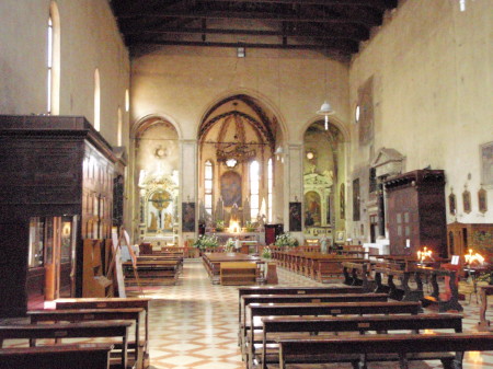 However, we got
to the Church of Santa Marie dei Servi just before noon and it was open
and did allow photography. It wasn't as ornate or nearly as large as
the St. Giustina Basilica but it was still pretty impressive. We did go
into another large church, St. Anthony's Basilica (which did not allow
photography) and it was huge. There were at least a dozen minor alters
and chapels in addition to the main alter.
However, we got
to the Church of Santa Marie dei Servi just before noon and it was open
and did allow photography. It wasn't as ornate or nearly as large as
the St. Giustina Basilica but it was still pretty impressive. We did go
into another large church, St. Anthony's Basilica (which did not allow
photography) and it was huge. There were at least a dozen minor alters
and chapels in addition to the main alter.
 We stopped at a
cafe on the way back for some sandwiches. They were pretty good, but
they charged us €4 for a can of lemon soda which we saw in a
market earlier for €0.37.
We stopped at a
cafe on the way back for some sandwiches. They were pretty good, but
they charged us €4 for a can of lemon soda which we saw in a
market earlier for €0.37.
Further along we found an Italian gelato shop. Gelato is an Italian
form of sorbet. Real gelato is REALLY good. I've never found anything
better anywhere. Sandy appears to agree.
We then trudged back to the train station and a train back to Mestre
was just getting ready to leave so we hopped on. This was a non-stop
between Padova and Mestre and it took less than 20 minutes to get
back.
Friday, May 16, 2008, Marco Polo Airport, Venice, Italy, about 1630
GMT+2
 After
seeing what a stiff walking tour did to Sandy yesterday, I figured that
it would be better if we arranged a low impact tour of Venice. It
turned out that the solution sort of fell into our laps. When we went
to buy the bus tickets to Venice, we found that we could get a combo
bus/boat ticket for €14 each which was good for 12 hours from the
time that we got on the bus. So we elected for a low impact boat tour
on the Grand Canal.
After
seeing what a stiff walking tour did to Sandy yesterday, I figured that
it would be better if we arranged a low impact tour of Venice. It
turned out that the solution sort of fell into our laps. When we went
to buy the bus tickets to Venice, we found that we could get a combo
bus/boat ticket for €14 each which was good for 12 hours from the
time that we got on the bus. So we elected for a low impact boat tour
on the Grand Canal.
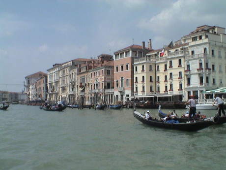 There are
numerous kinds of water taxis, gondolas and water busses plying the
canals. The ticket was for a water bus that followed a scheduled route,
just like a regular bus. We got on the number 1 boat which started at
the Piazzale Roma and went all the way through the Grand Canal and out
to the Lido (an sandbar island that forms the outer edge of the Venice
lagoon). It then turns around and comes back the other way. Since we
got on at the first stop of the run, the boat was empty and we got good
seats by an open window. From the second stop on, the boat was SRO.
There are
numerous kinds of water taxis, gondolas and water busses plying the
canals. The ticket was for a water bus that followed a scheduled route,
just like a regular bus. We got on the number 1 boat which started at
the Piazzale Roma and went all the way through the Grand Canal and out
to the Lido (an sandbar island that forms the outer edge of the Venice
lagoon). It then turns around and comes back the other way. Since we
got on at the first stop of the run, the boat was empty and we got good
seats by an open window. From the second stop on, the boat was SRO.
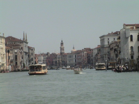 At the end of
the line, we had to get off the boat and get right back on the next
boat into the same seats we had on the first boat. Both of these
pictures are typical of the Grand Canal. The buildings are built right
to the water's edge and the high water line is often somewhat higher
than the door jams on the first floor. In these buildings, I assume
that something has been done to prevent the ingress of water or perhaps
the ground floor is simply abandoned. The whole island is built on
wooden piles driven into the silt and it is slowly sinking under it's
own weight. Rising sea levels are not helping either. The highest water
is during the winter, during that time even St. Marks square partially
floods.
At the end of
the line, we had to get off the boat and get right back on the next
boat into the same seats we had on the first boat. Both of these
pictures are typical of the Grand Canal. The buildings are built right
to the water's edge and the high water line is often somewhat higher
than the door jams on the first floor. In these buildings, I assume
that something has been done to prevent the ingress of water or perhaps
the ground floor is simply abandoned. The whole island is built on
wooden piles driven into the silt and it is slowly sinking under it's
own weight. Rising sea levels are not helping either. The highest water
is during the winter, during that time even St. Marks square partially
floods.
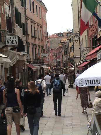 We got off the
boat on the second to last stop on the way back, the train station
stop. There we found a many sandwich shops and we bought some food and
drinks and then wandered down some pretty heavily used streets for
awhile before turning back.
We got off the
boat on the second to last stop on the way back, the train station
stop. There we found a many sandwich shops and we bought some food and
drinks and then wandered down some pretty heavily used streets for
awhile before turning back.
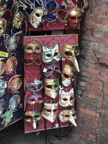 Most of the vendors sell pretty much the same stuff.
Decorative masks like these are big in Venice.
Most of the vendors sell pretty much the same stuff.
Decorative masks like these are big in Venice.
We walked back to the Piazzale Roma and caught the #2 bus back to
our hotel where we had left our luggage when we checked out in the
morning. We then walked about a block to the FlyBus station and caught
a €3 ride to the Marco Polo airport where we are now. Our flight
doesn't leave for 4 hours and we can't even check in yet but at least
we are here.
Update, Friday, May 16, 2008, Dublin, Ireland, about 2330
GMT+1
We got to the Dublin airport for our layover and were routed right
out of the terminal. So instead of trying to get some sleep inside the
airport, we booked a room at the Bewleys Hotel, Dublin Airport. We are
there now and they actually have free internet. We'll be here just to
crash, it's back on an airplane tomorrow morning.
Saturday, May 17, 2008, North Atlantic, about 0540 PDT GMT-7
We in the air somewhere between Iceland and Greenland. They've just
served a marginal lunch but at least it was food. On the flight from
Venice to Dublin, it was food for purchase and it was very expensive
for not much food. I made do on munchies that I had with me.
The hotel was ok, at least that have a 24 hour shuttle to the
airport every 20 min. Some drunk pounded on our door or one nearby at
about 0500 Dublin time and woke me up. I didn't get back to sleep but I
did get about 5 hours and that will have to do. Sandy and I have a 4
seat row to ourselves, but 3 seats are not quite enough for me to lay
down in and sleep so it looks like it's either sleep sitting up or none
at all. We should get into LAX at about 1330.
Sunday, May 18, 2008, Torrance, CA, about 0820 PDT GMT-7
The flight into LAX was uneventful but long. However, we got to
bypass immigration at LAX as there was a US immigration check at the
Dublin airport by CBP officers. We took a cab home and got there at
about 1430. We spent the rest of the day getting reoriented, backing up
data, cleaning up a little bit and otherwise trying to get back to a
normal life.
Even though I ate much more than I should have, I gained only a pound over the whole trip.
This page has been accessed times since Feb 14, 2008
© 2008 George Schreyer
Created Feb 14, 2008
Last Updated May 18, 2008